MyTopo
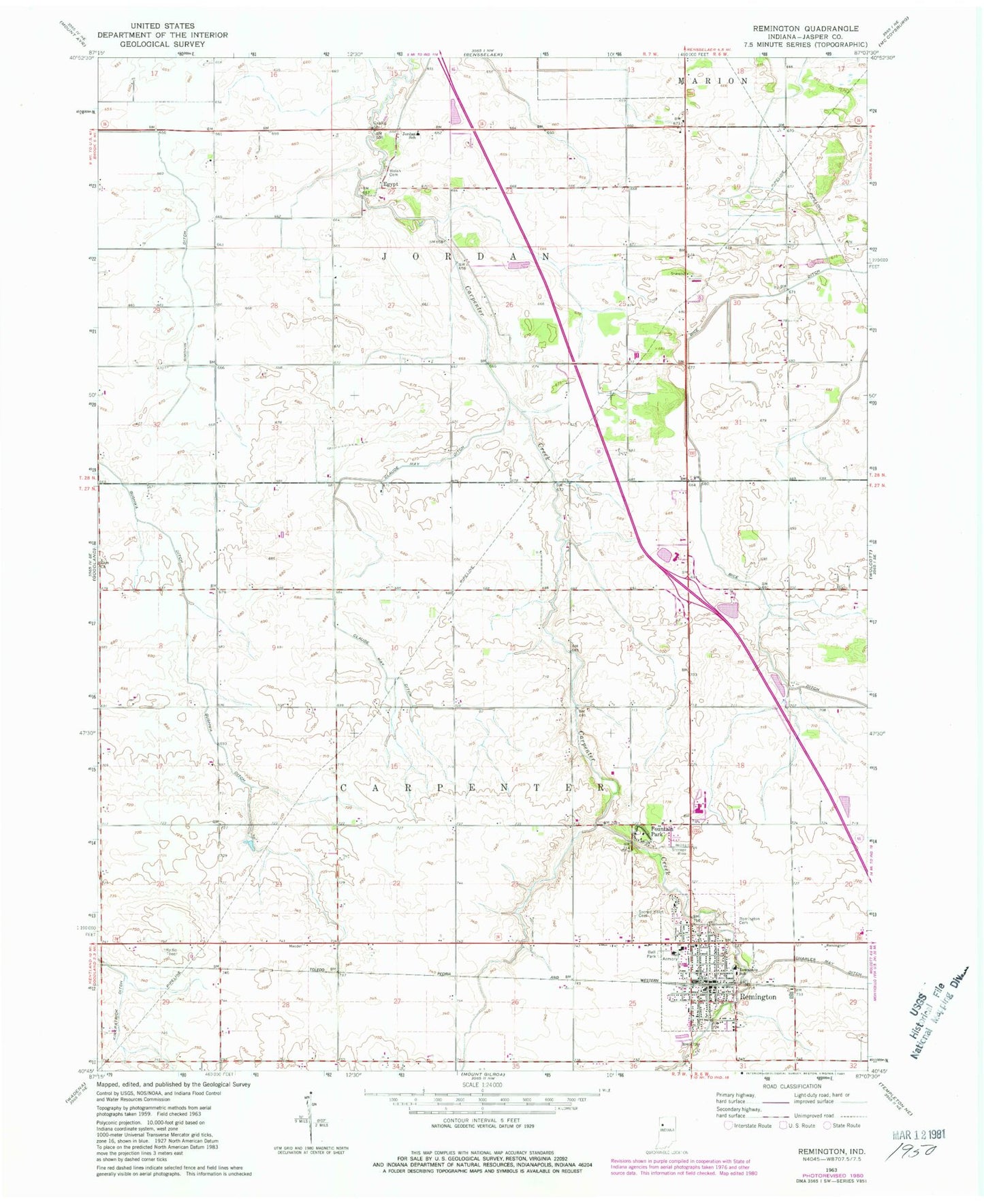
Classic USGS Remington Indiana 7.5'x7.5' Topo Map
Couldn't load pickup availability
Historical USGS topographic quad map of Remington in the state of Indiana. Map scale may vary for some years, but is generally around 1:24,000. Print size is approximately 24" x 27"
This quadrangle is in the following counties: Jasper.
The map contains contour lines, roads, rivers, towns, and lakes. Printed on high-quality waterproof paper with UV fade-resistant inks, and shipped rolled.
Contains the following named places: Bice Ditch, Charles May Ditch, Claude May Ditch, Egypt, Fountain Park, Foxhill Hog Farm, Gushwa Ditch, Jordan School, Kirkpatrick Ditch, Remington, Remington Cemetery, Remington City Fire Department, Remington Police Department, Remington Post Office, Sacred Heart Cemetery, Simonin Ditch, Southern Jasper County Ambulance Service, Town of Remington, Township of Carpenter, Township of Jordan, Tri-County West Elementary School, Welsh Cemetery, ZIP Code: 47977