MyTopo
Classic USGS Remlap Alabama 7.5'x7.5' Topo Map
Couldn't load pickup availability
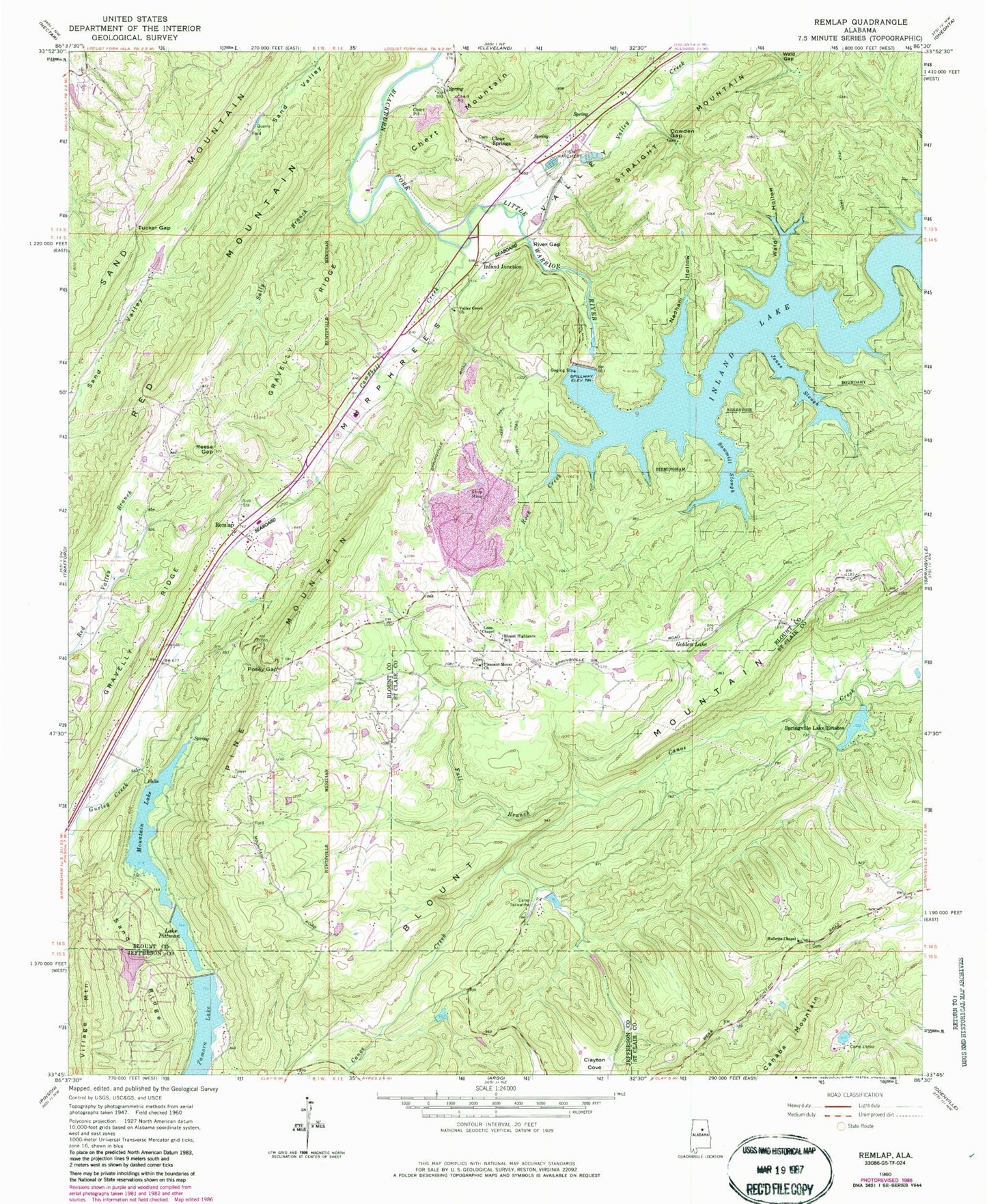
Historical USGS topographic quad map of Remlap in the state of Alabama. Typical map scale is 1:24,000, but may vary for certain years, if available. Print size: 24" x 27"
This quadrangle is in the following counties: Blount, Jefferson, St. Clair.
The map contains contour lines, roads, rivers, towns, and lakes. Printed on high-quality waterproof paper with UV fade-resistant inks, and shipped rolled.
Contains the following named places: Blount Highlands School, Campbell Creek, Clayton Cove, Cowden Gap, Gravelly Ridge, Jones Slough, Lees Chapel, Mountain Lake, Nedham Hollow, Posey Gap, Reese Gap, Remlap, River Gap, Rock Creek, Sally Branch, Sand Ridge, Sawmill Slough, Tucker Gap, Valley Creek, Valley Grove Church, Village Mountain, Wald Hollow, Zamora Lake Dam, Woodhaven Lake Dam, Pittman Lakes Dam Number 2, Mountain Lake Dam, Rocking H Ranch Lake, Adams Lake, Adams Lake Dam, Inland Lake, Clear Springs United Methodist Church, Clear Springs School (historical), Cowden Gap Mine, Inland Lake Dam, Pine Mountain, Red Valley Church, Remlap Church, Swansea (historical), Woodhaven Lake, Watseka (historical), Johnson Gap, Waid Gap, Inland Lake, Pine Mountain, Lake Pittman, Zamora Lake, Clear Springs, Inland Junction, Southeastern Elementary School, Camp Tekawitha, Camp Utopia, Fall Branch, Golden Lake, Hulletts Chapel, Pleasant Mountain Baptist Church, Springville Lake Estates, Tekawitha Dam, Tekawitha Lake, Springville Estate Dam, Golden Dam, Bear Mountain, Bear Mountain Branch, Springville Lake, Saint Clair Mountain, Viola (historical), Remlap Post Office, Viola Post Office (historical), Clear Springs Cemetery, Remlap Volunteer Fire Department Station 1, Pine Mountain Volunteer Fire and Emergency Medical Services Station 1, Pine Mountain Volunteer Fire and Emergency Medical Services District, Remlap Census Designated Place