MyTopo
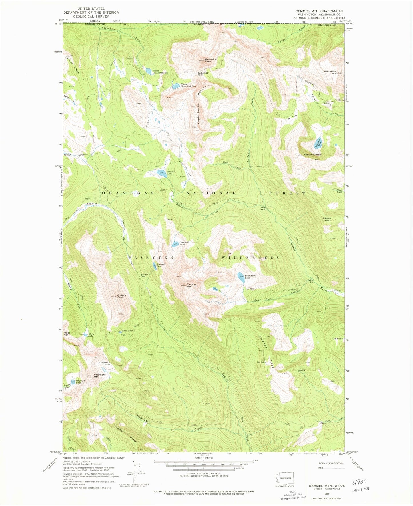
Classic USGS Remmel Mountain Washington 7.5'x7.5' Topo Map
Couldn't load pickup availability
Historical USGS topographic quad map of Remmel Mountain in the state of Washington. Typical map scale is 1:24,000, but may vary for certain years, if available. Print size: 24" x 27"
This quadrangle is in the following counties: Okanogan.
The map contains contour lines, roads, rivers, towns, and lakes. Printed on high-quality waterproof paper with UV fade-resistant inks, and shipped rolled.
Contains the following named places: Airview Lake, Amphitheater Mountain, Andrew Pass, Andrew Peak, Apex Mountain, Apex Pass, Border Ridge, Cal Peak, Cathedral Creek, Cathedral Pass, Cathedral Peak, Coleman Ridge, Cornwell Lake, Crazy Man Pass, Four Point Creek, Four Point Lake, Glory Lake, Hazel Creek, Lower Cathedral Lake, Peepsight Creek, Peepsight Lake, Peepsight Mountain, Remmel Creek, Remmel Lake, Remmel Mountain, Rock Lake, Saddle Peak, Tungsten Lake, Upper Cathedral Lake, Wolframite Mountain, Cathedral Lakes