MyTopo
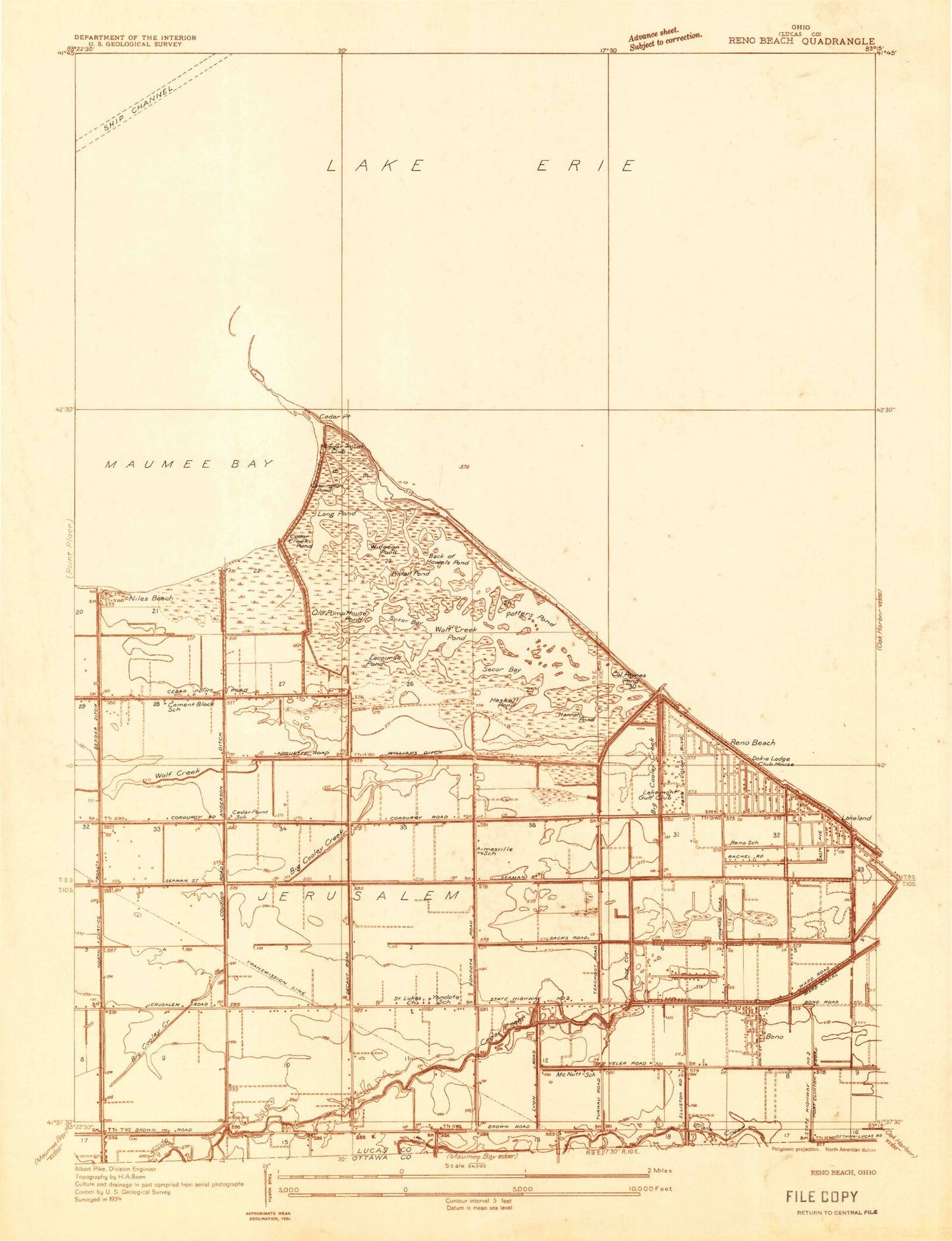
Classic USGS Reno Beach Ohio 7.5'x7.5' Topo Map
Couldn't load pickup availability
Historical USGS topographic quad map of Reno Beach in the state of Ohio. Map scale may vary for some years, but is generally around 1:24,000. Print size is approximately 24" x 27"
This quadrangle is in the following counties: Lucas.
The map contains contour lines, roads, rivers, towns, and lakes. Printed on high-quality waterproof paper with UV fade-resistant inks, and shipped rolled.
Contains the following named places: Anchor Point Marina, Back of Howells Pond, Berger Road Ditch, Bono, Bono Post Office, Carrington Pond, Cedar Creek, Cedar Creek Pond, Cedar Point, Cedar Point Clubhouse, Cedar Point Marsh, Cedar Point National Wildlife Refuge, Eisenhower Intermediate School, Goose Pond, Hannah Pond, Haskell Pond, Jerusalem Township Fire Department, Lacourse Pond, Lakeland, Lakemont Landing, Lamb Beach, Long Pond, Mallard Club Marsh, Mallard Club Marsh State Wildlife Area, New Jerusalem, Niles Beach, Niles Pond, Oregon City Filtration Plant, Our Lady of Mount Carmel Church, Outlet Pond, Paynes Pond, Pintail Pond, Potters Pond, Reno Beach, Reno Beach Census Designated Place, Reno Side Cut, Saint Lukes Church, Sautter Ditch, Scottish Links Golf Course, Secor Bay, Suzar Bay, Wards Canal, WDHO Radio Tower, Widgeon Pond, Williams Ditch, WNWO-TV (Toledo), Wolf Creek, Wolf Creek Pond, Yondota, Yondota Post Office, ZIP Code: 43412