MyTopo
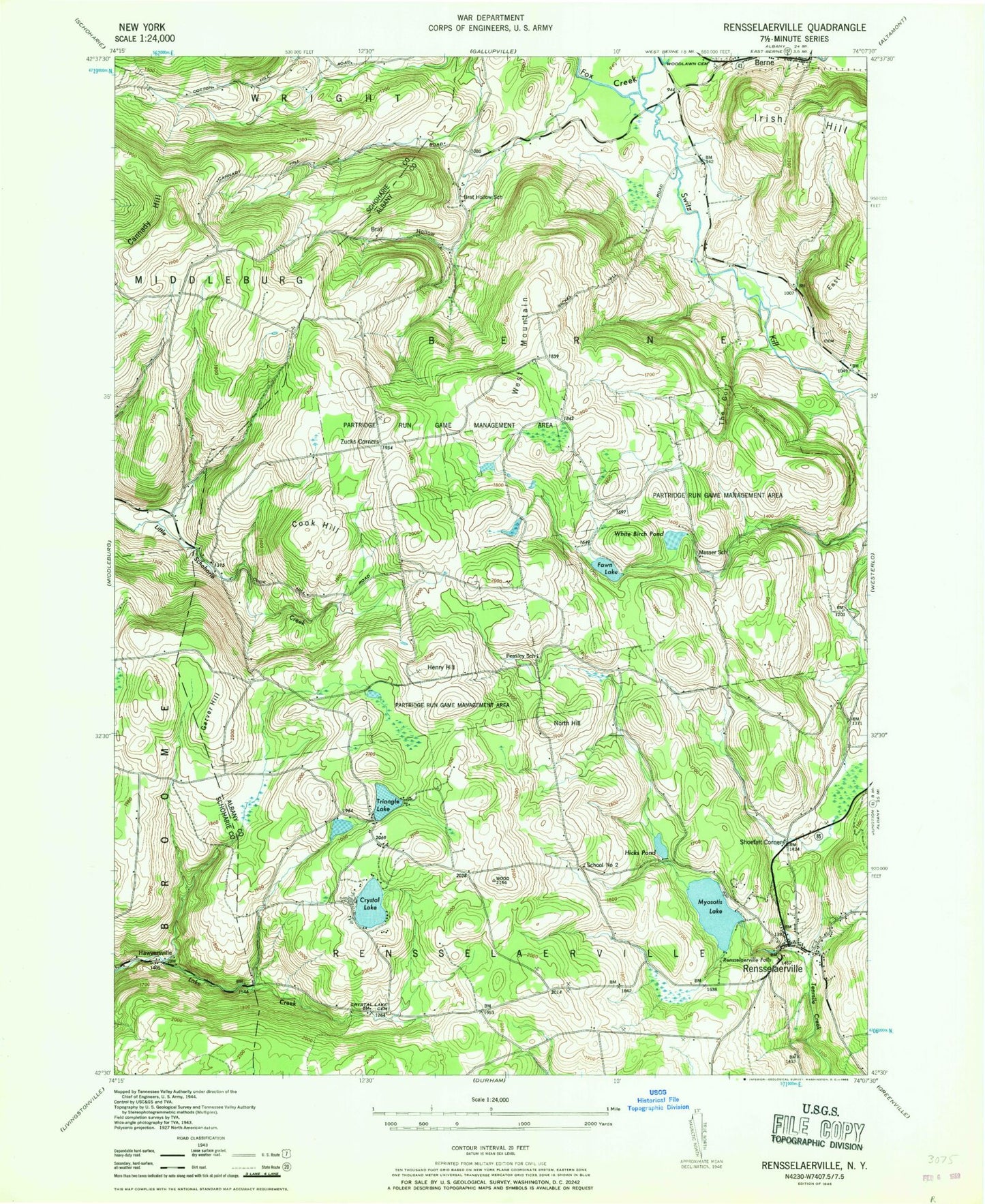
Classic USGS Rensselaerville New York 7.5'x7.5' Topo Map
Couldn't load pickup availability
Historical USGS topographic quad map of Rensselaerville in the state of New York. Typical map scale is 1:24,000, but may vary for certain years, if available. Print size: 24" x 27"
This quadrangle is in the following counties: Albany, Schoharie.
The map contains contour lines, roads, rivers, towns, and lakes. Printed on high-quality waterproof paper with UV fade-resistant inks, and shipped rolled.
Contains the following named places: Brat Hollow, Brat Hollow School (historical), Cannady Hill, Cook Hill, Crystal Lake, Crystal Lake Cemetery, East Hill, Fawn Lake, Garver Hill, Hawversville, Henry Hill, Hicks Pond, Messer School, Myosotis Lake, North Hill, Partridge Run Game Management Area, Peasley School, Rensselaerville, Rensselaerville Falls, Shoefelt Corners, Switz Kill, The Gulf, Triangle Lake, West Mountain, White Birch Pond, Zucks Corners, School Number 2 (historical), Gifford Hollow Burial Ground, Huntersland Christian Cemetery, Rensselaerville Volunteer Fire Department, Berne Volunteer Fire Department, Rensselaerville Post Office