MyTopo
Classic USGS Republic SW Michigan 7.5'x7.5' Topo Map
Couldn't load pickup availability
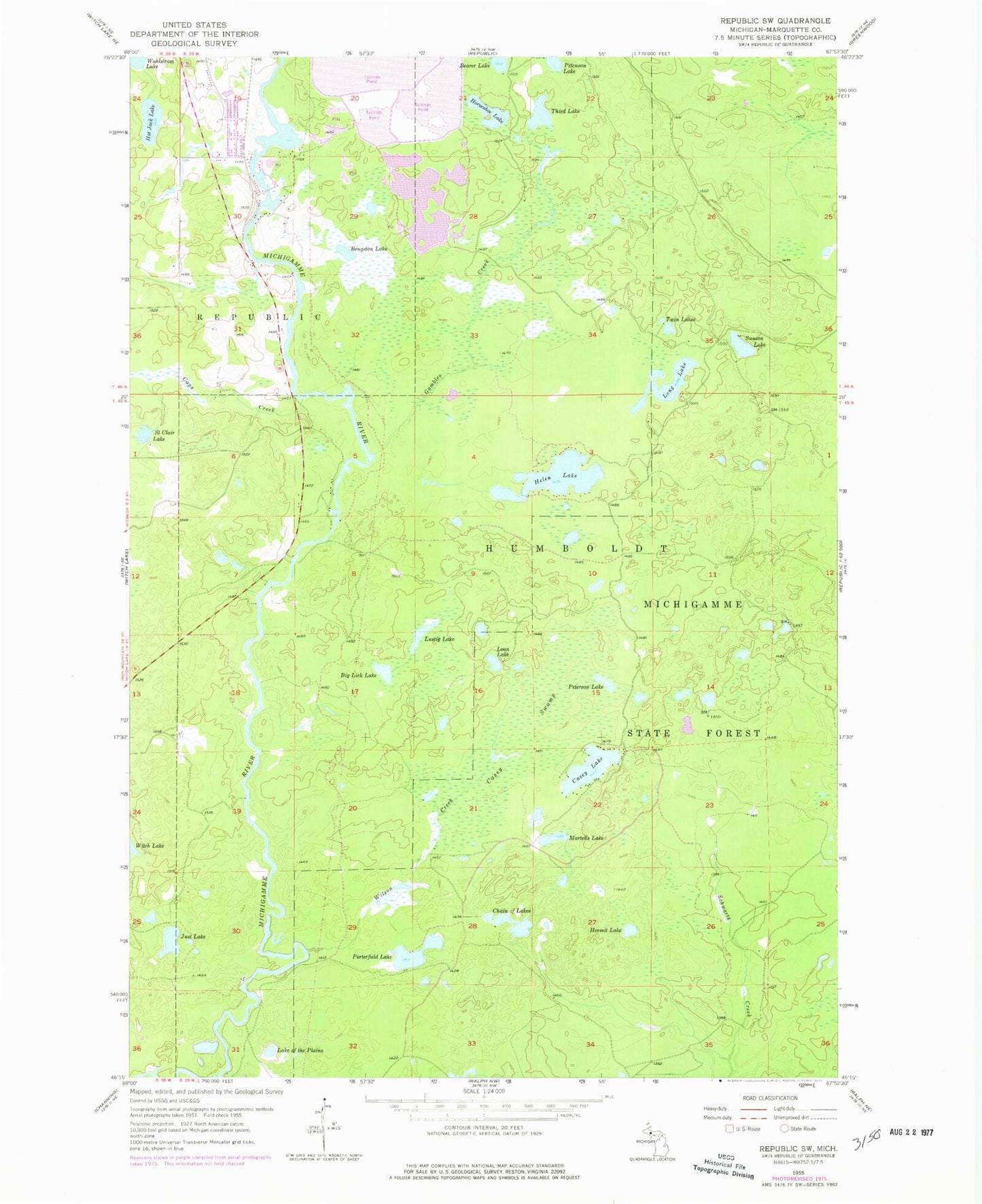
Historical USGS topographic quad map of Republic SW in the state of Michigan. Map scale may vary for some years, but is generally around 1:24,000. Print size is approximately 24" x 27"
This quadrangle is in the following counties: Marquette.
The map contains contour lines, roads, rivers, towns, and lakes. Printed on high-quality waterproof paper with UV fade-resistant inks, and shipped rolled.
Contains the following named places: Beaver Lake, Bell Medical Family Practice, Bengston Lake, Bethany Lutheran Church, Big Lick Lake, Caps Creek, Casey Lake, Casey Swamp, Chain of Lakes, Donaldson Lake, First Baptist Church, Gambles Creek, Helen Lake, Hermit Lake, Hot Jack Lake, Just Lake, Lake of The Plains, Long Lake, Loon Lake, Lustig Lake, Martells Lake, Petcuson Lake, Peterson Lake, Porterfield Lake, Republic Michigamme Public Library, Republic Michigamme School, Saint Clair Lake, Sunson Lake, Third Lake, Twin Lakes, Wahlstrom Lake, Wilson Creek, Witbeck Rapids Campground