MyTopo
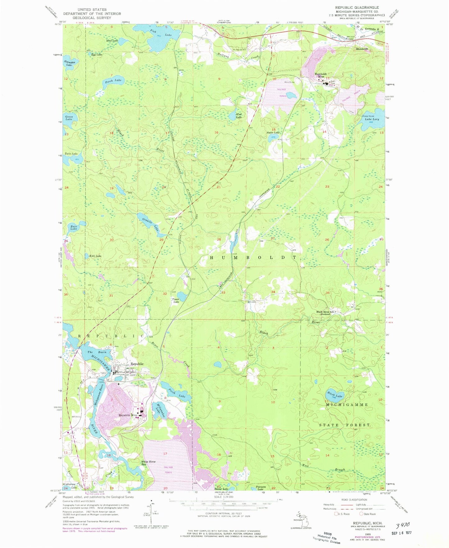
Classic USGS Republic Michigan 7.5'x7.5' Topo Map
Couldn't load pickup availability
Historical USGS topographic quad map of Republic in the state of Michigan. Map scale may vary for some years, but is generally around 1:24,000. Print size is approximately 24" x 27"
This quadrangle is in the following counties: Marquette.
The map contains contour lines, roads, rivers, towns, and lakes. Printed on high-quality waterproof paper with UV fade-resistant inks, and shipped rolled.
Contains the following named places: Autio Lake, Birch Lake, Black River School, Bruce Creek, Buto Lake, Egg Lake, Fish Lake, Granite Lake, Horseshoe Lake, Humboldt, Humboldt Cemetery, Humboldt Mine, Humboldt Post Office, Humboldt Station, Kirk Lake, Lake Lory, Michigamme Basin, Michigamme State Forest, Milwaukee Lake, Mud Lake, Perch Lake, Republic, Republic Cemetery, Republic Census Designated Place, Republic Mine, Republic Police Department, Republic Post Office, Republic Station, Republic Township Ambulance, Republic Township Fire Department, Republic United Methodist Church, Saint Augustine Catholic Church, The Basin, Tower Lake, Township of Humboldt, Trout Falls Creek, Twin Lake, White Horse Bay