MyTopo
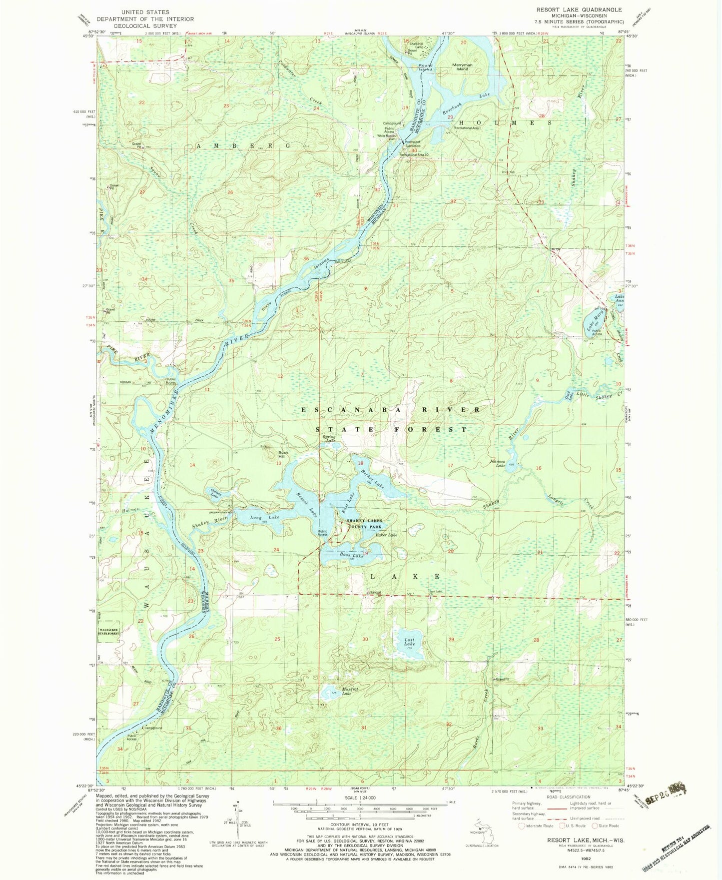
Classic USGS Resort Lake Michigan 7.5'x7.5' Topo Map
Couldn't load pickup availability
Historical USGS topographic quad map of Resort Lake in the states of Michigan, Wisconsin. Typical map scale is 1:24,000, but may vary for certain years, if available. Print size: 24" x 27"
This quadrangle is in the following counties: Marinette, Menominee.
The map contains contour lines, roads, rivers, towns, and lakes. Printed on high-quality waterproof paper with UV fade-resistant inks, and shipped rolled.
Contains the following named places: Lake Ann, Baker Lake, Bass Lake, Becher Lake, Buck Hill, Duck Lake, East Lake, Johnson Lake, Little Shakey Creek, Long Lake, Longrie Creek, Lost Lake, Lost Lake Church, Lake Mary, Merryman Island, Muskrat Lake, Osborn Lake, Resort Lake, Rosebush Creek, Rosebush Lake, Shakey Lakes, Shakey River, Spring Lake, White Rapids Dam, Township of Lake, Shakey Lakes County Park, Lost Lake Cemetery, Chalk Hill Camp, Coldwater Creek, Holmes Creek, Pike River, Round Island, Sixty Islands, Squaw Creek, White Rapids Dam, Squaw Creek 2WP1486 Dam, 10 Reservoir, Wausaukee State Forest, Pike River School (historical), Lazy River Airport