MyTopo
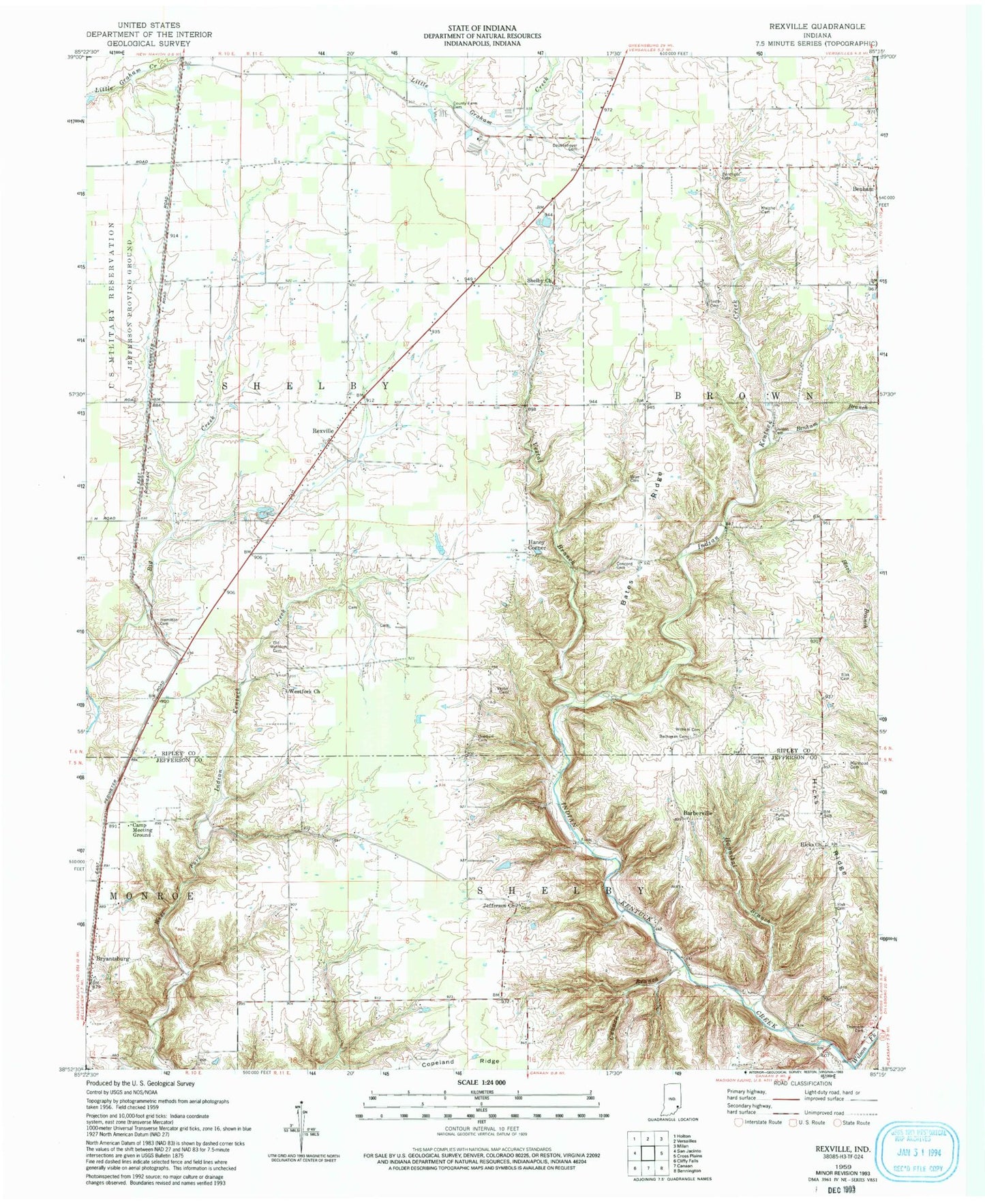
Classic USGS Rexville Indiana 7.5'x7.5' Topo Map
Couldn't load pickup availability
Historical USGS topographic quad map of Rexville in the state of Indiana. Map scale may vary for some years, but is generally around 1:24,000. Print size is approximately 24" x 27"
This quadrangle is in the following counties: Jefferson, Ripley.
The map contains contour lines, roads, rivers, towns, and lakes. Printed on high-quality waterproof paper with UV fade-resistant inks, and shipped rolled.
Contains the following named places: Barbersville, Bates Ridge, Benham, Benham Branch, Bryantsburg, Buchanan Cemetery, Camp Meeting Ground, Canaan Branch, Concord Cemetery, Conner Cemetery, County Farm Cemetery, Daubenheyer Cemetery, Derringer Cemetery, Gordon Cemetery, Hamilton Cemetery, Haney Corner, Haneys Corner Post Office, Hannibal Branch, Hicks Baptist Church, Hicks Ridge, Hyatt Cemetery, Jefferson Church, Jefferson Proving Ground, Jolleyville, Klotzsche Family Cemetery, Mermoud Cemetery, New Carrollton, Old Ditch Cemetery, Old Westfork Cemetery, Overturf Cemetery, Pullum Cemetery, Raccoon Creek, Rexville, Risk Cemetery, Shelby Cemetery, Shelby Church, Thornton Cemetery, Titusville Post Office, Township of Shelby, Vestal Branch, Westfork Church, Whitham Cemetery, Wilson Fork, Wise Cemetery