MyTopo
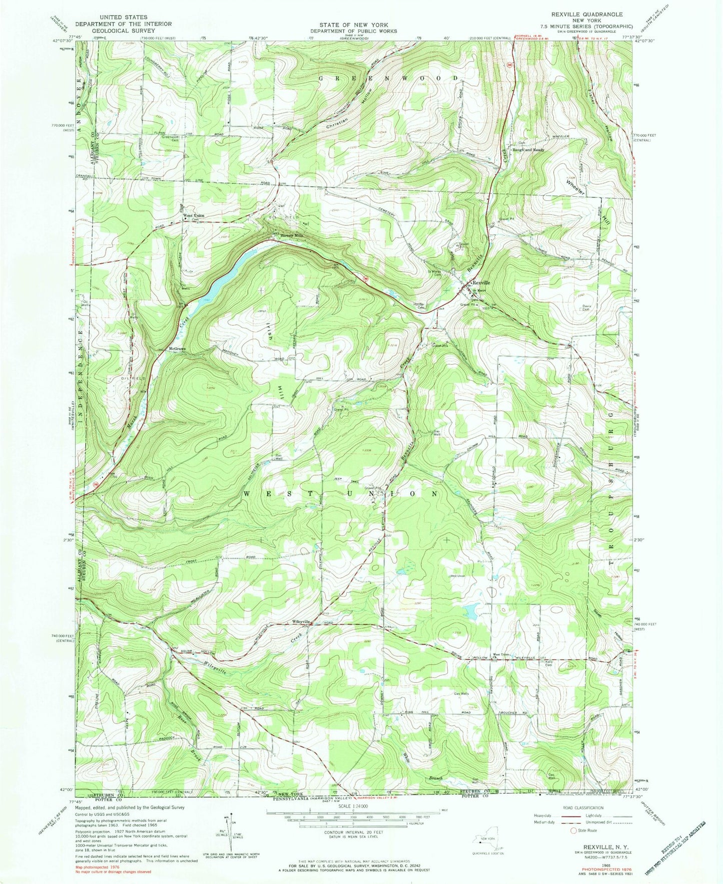
Classic USGS Rexville New York 7.5'x7.5' Topo Map
Couldn't load pickup availability
Historical USGS topographic quad map of Rexville in the state of New York. Map scale may vary for some years, but is generally around 1:24,000. Print size is approximately 24" x 27"
This quadrangle is in the following counties: Allegany, Steuben.
The map contains contour lines, roads, rivers, towns, and lakes. Printed on high-quality waterproof paper with UV fade-resistant inks, and shipped rolled.
Contains the following named places: A C Rochester Engineering Center Heliport, Barney Mills, Catholic Church School, Davis Cemetery, Gilbert Hill School, Greenwood Cemetery, Hauber Cemetery, Irish Hill, Irish Hill School, Kelly Cemetery, King Hill School, McGraw School, McGraws, Rexville, Rexville Post Office, Rose Brook, Rose School, Rough and Ready, Rough And Ready Cemetery, Saint Marys Cemetery, Saint Marys Church, Saint Marys New Catholic Cemetery, Saunders School, Town of West Union, West Union, West Union Cemetery, West Union Church, West Union Grange Hall, West Union Volunteer Fire Department, Wheeler Hill, Wileyville, ZIP Codes: 14839, 14877