MyTopo
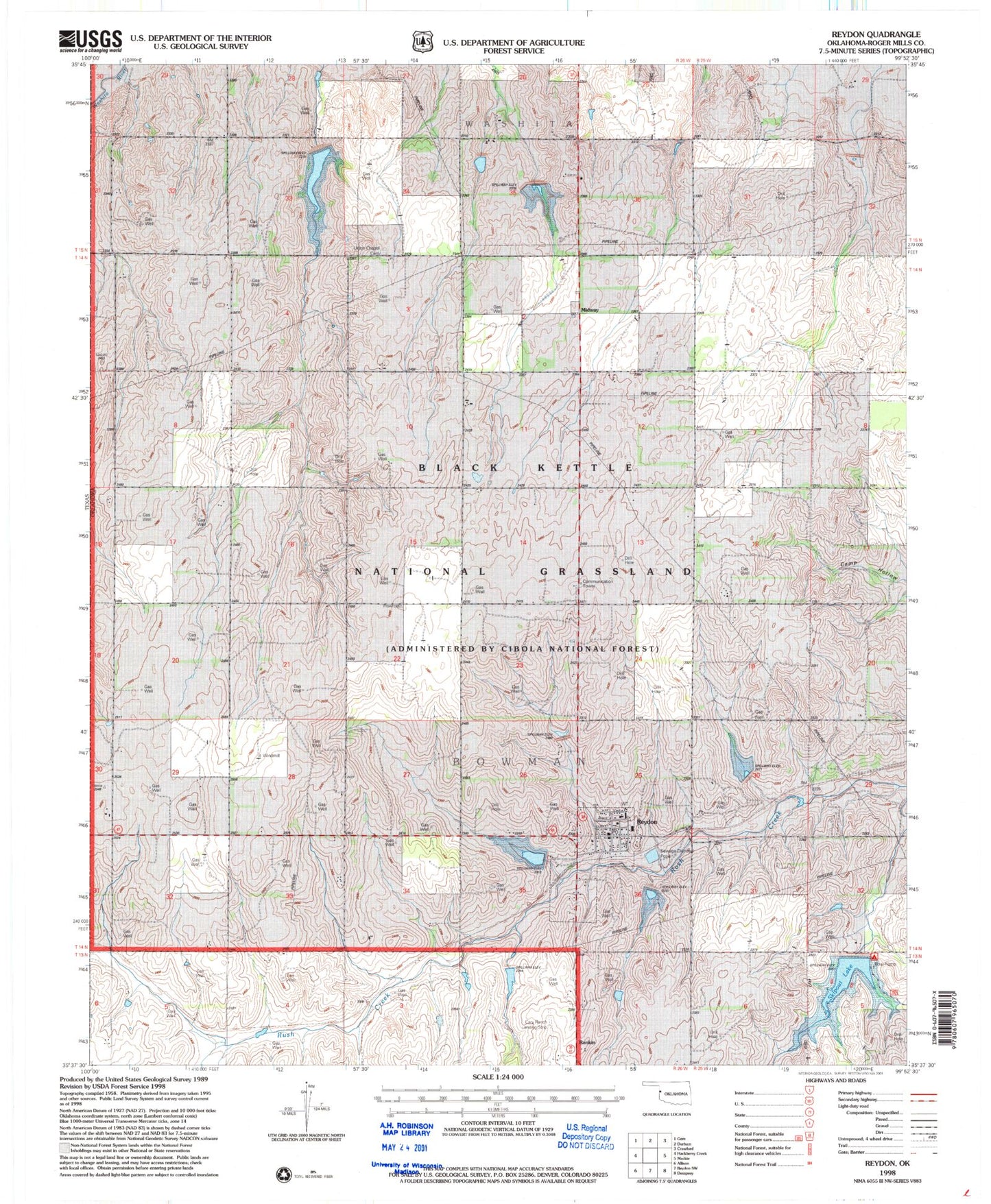
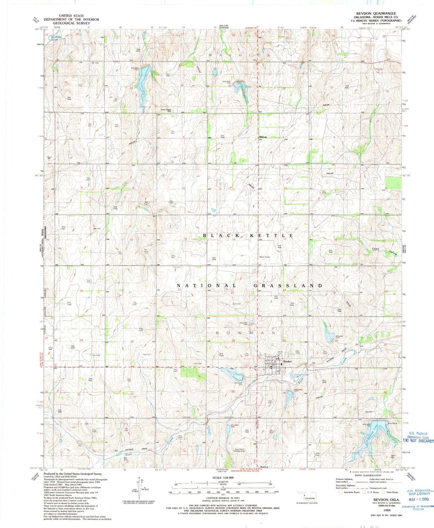
Classic USGS Reydon Oklahoma 7.5'x7.5' Topo Map
Couldn't load pickup availability
Historical USGS topographic quad map of Reydon in the state of Oklahoma. Map scale may vary for some years, but is generally around 1:24,000. Print size is approximately 24" x 27"
This quadrangle is in the following counties: Roger Mills.
The map contains contour lines, roads, rivers, towns, and lakes. Printed on high-quality waterproof paper with UV fade-resistant inks, and shipped rolled.
Contains the following named places: Cary Ranch Airport, Midway, Reydon, Reydon Elementary School, Reydon High School, Reydon Post Office, Reydon Volunteer Fire Department, Roger Mills County Emergency Medical Service, Skipout Campground, Skipout Lake, Town of Reydon, Township of Bowman, Union Chapel Cemetery, Upper Washita River Site 101 Dam, Upper Washita River Site 49 Dam, Upper Washita River Site 49 Reservoir, Upper Washita River Site 50 Dam, Upper Washita River Site 50 Reservoir, Upper Washita Site 101 Reservoir, Upper Washita Site 35 Dam, Upper Washita Site 35 Reservoir, Upper Washita Site 36 Dam, Upper Washita Site 36 Reservoir, Upper Washita Site 41 Dam, Upper Washita Site 41 Reservoir, Upper Washita Site 48 Dam, Upper Washita Site 48 Reservoir, Upper Washita Site 51 Dam, Upper Washita Site 51 Reservoir, Upper Washita Site 52 Dam, Upper Washita Site 52 Reservoir, Upper Washita Site 53 Dam, Upper Washita Site 56 Dam, Upper Washita Site 56 Reservoir