MyTopo
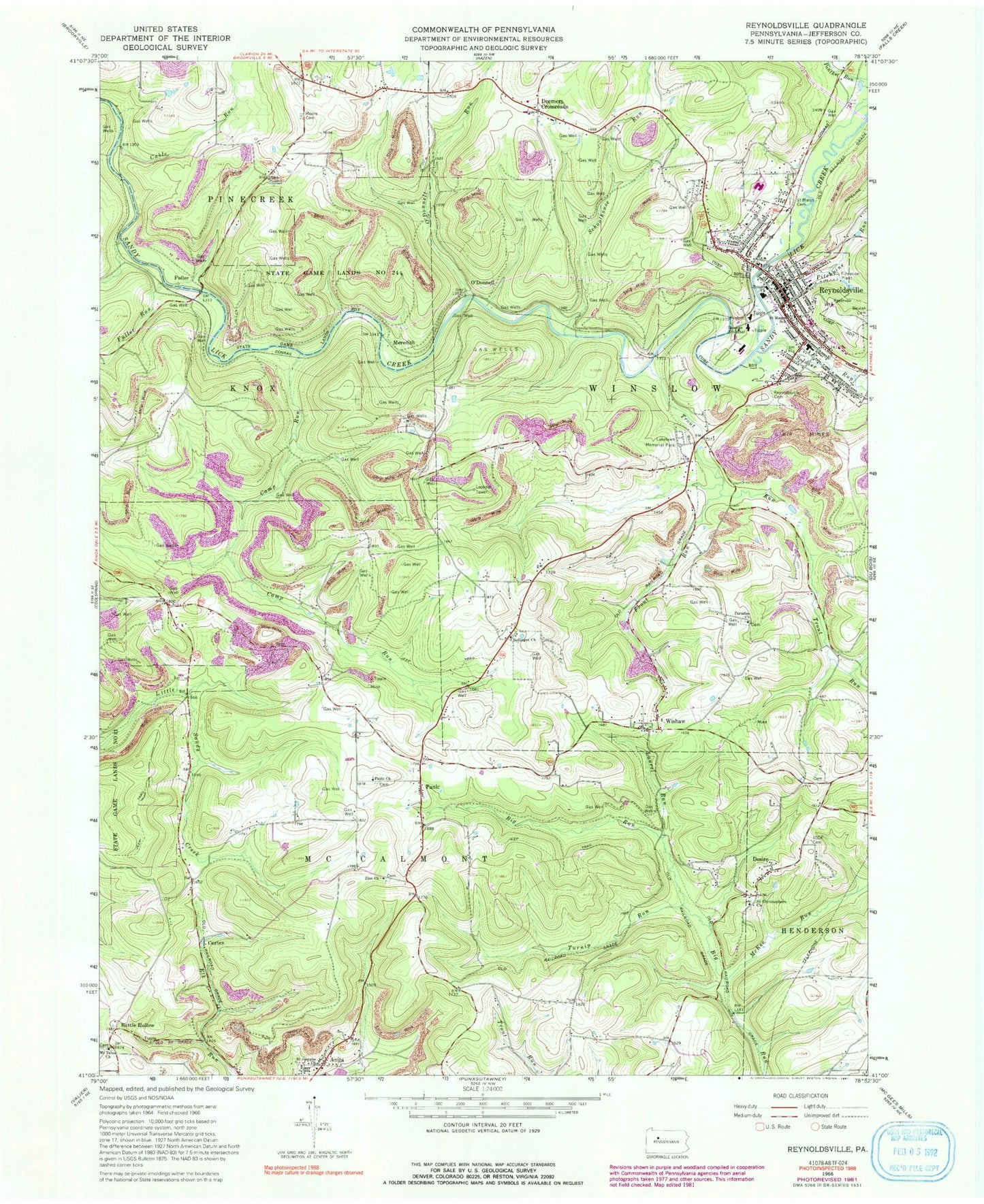
Classic USGS Reynoldsville Pennsylvania 7.5'x7.5' Topo Map
Couldn't load pickup availability
Historical USGS topographic quad map of Reynoldsville in the state of Pennsylvania. Map scale may vary for some years, but is generally around 1:24,000. Print size is approximately 24" x 27"
This quadrangle is in the following counties: Jefferson.
The map contains contour lines, roads, rivers, towns, and lakes. Printed on high-quality waterproof paper with UV fade-resistant inks, and shipped rolled.
Contains the following named places: Anita, Anita Station, Battle Hollow, Battle Hollow School, Baum School, Bolinger School, Bollinger Church, Borough of Reynoldsville, Cable Run, Camp Run, Cortez, Cortez School, Deemers Crossroads, Desire, Desire Cemetery, Eleanor, Eleanor Post Office, Front Run, Fuller, Fuller Run, Hemlock School, High Florence School, Jenks School, Johnson Elementary School, Lakelawn Memorial Park and Mausoleum, Laurel Run, Mary School, McKee Run, Meredith, Milliron Cemetery, Moore Cemetery, Mount Tabor Church, Mount Tabor United Methodist Church Cemetery, O'Donnell, O'Donnell Run, Panic, Panic Church, Paradise Church, Phillippi School, Pifer Cemetery, Pifer School, Pitchpine Run, Reynoldsville, Reynoldsville Area Ambulance Service Station 60, Reynoldsville Cemetery, Reynoldsville Fire Tower, Reynoldsville Post Office, Reynoldsville Volunteer Fire Department Station 6, Saint Christophers Church, Saint Jacobs Union Cemetery, Saint Josephs Church, Saint Mary's Immaculate Conception Cemetery, Schoolhouse Run, Soldier Run, State Game Lands Number 244, Syphrit Cemetery, Township of McCalmont, Township of Winslow, Trinity Church, Trout Run, Turnip Run, United Brethren Cemetery, Wayne School, Wishaw, Zion Church, Zion Presbyterian Cemetery, ZIP Codes: 15711, 15851


