MyTopo
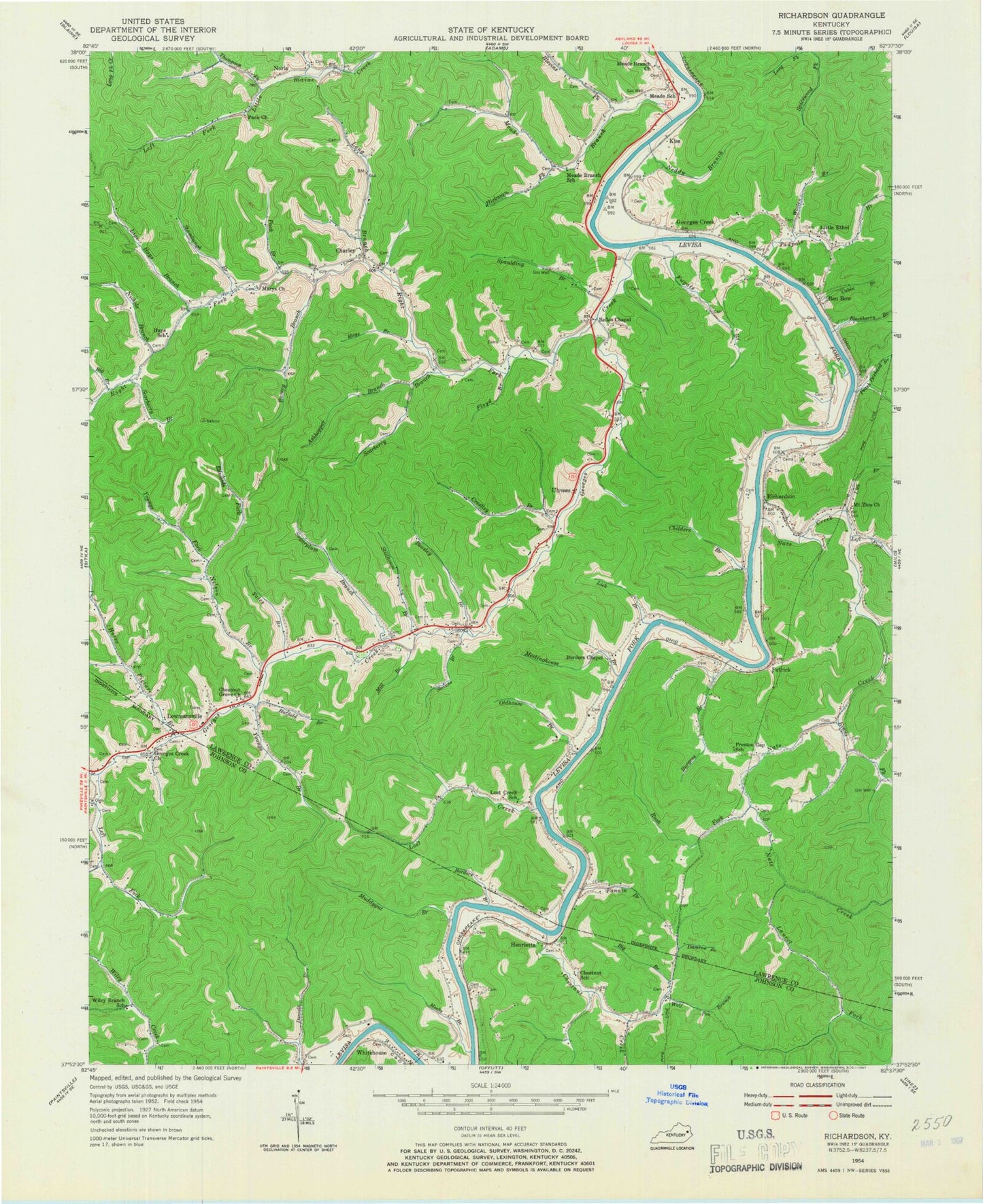
Classic USGS Richardson Kentucky 7.5'x7.5' Topo Map
Couldn't load pickup availability
Historical USGS topographic quad map of Richardson in the state of Kentucky. Map scale may vary for some years, but is generally around 1:24,000. Print size is approximately 24" x 27"
This quadrangle is in the following counties: Johnson, Lawrence, Martin.
The map contains contour lines, roads, rivers, towns, and lakes. Printed on high-quality waterproof paper with UV fade-resistant inks, and shipped rolled.
Contains the following named places: Adams Division, Amos Thompson Branch, Ashhopper Branch, Beasley Branch, Bells Chapel, Ben Bow, Ben Bow Railroad Station, Big Branch, Blackberry Branch, Blevins Fork, Borders Branch, Borders Chapel United Methodist Church, Borders Store Post Office, Brows Defeat, Burgess Branch, Cabin Branch, Charley, Charley Freewill Baptist Church, Charley Post Office, Charley School, Chestnut, Chestnut Creek, Chestnut Grove Church, Childers Branch, Chrestley School, Crestley Branch, Damron Branch, Edwards Fork, Elmwood School, Emmanuel Baptist Church, Ervin Scarberry Branch, Evans Fork, Fannin Branch, Floyd Branch, Forshas Branch, Freewill Baptist Church, Fugate Branch, Georges Creek, Georges Creek Post Office, Georges Creek Railroad Station, Georges Creek School, Georges Creek United Baptist Church, Hatfield Branch, Hayes School, Hays Branch, Henrietta Railroad Station, Hickman Fork, Home Fork, Horse Picture Branch, Kise, Kise Railroad Stop, Laurel Fork, Left Fork Nats Creek, Lick Branch, Lick Log School, Lige Hays Branch, Little Blaine United Baptist Church, Little Ethel Church, Long Branch, Lost Creek, Lost Creek School, Lowmansville, Lowmansville Post Office, Lowmansville School, Lowmansville Volunteer Fire Department, Mary Branch, Marys United Baptist Church, Meadd School, Meade Branch, Meade Branch Church, Meade School, Meades Branch, Meades Branch School, Meeks Branch, Meetinghouse Branch, Mill Branch, Miller Hollow, Mount Zion United Baptist Church, Muddygut Branch, Nats Creek, Neddy Branch, Nelson Branch, New Belles Chapel, Nichols Branch, Noris, Noris Post Office, Noris School, Oldhouse Branch, Pack Branch, Patrick, Patrick Post Office, Patrick Railroad Station, Peach Orchard Branch, Phil Hill, Preston Gap School, Ramey Branch, Ray, Richardson, Richardson Chapel, Richardson Missionary Baptist Church, Richardson Post Office, Richardson Railroad Station, Richardson School, Right Fork Georges Creek, Rush Fork, Scarberry Branch, Son Butcher Cemetery, Spaulding Branch, Stambaugh Branch, Stevens Branch, Stillhouse Branch, Sugarplum Branch, Tadpole Branch, Thompson Fork, Ulysses, Ulysses Post Office, Walnut Grove Freewill Baptist Church, Walnut Grove School, Wolf Pen Branch, Wooten Branch, Yates Branch, Youngs Branch, Youngs Fork, ZIP Codes: 41232, 41254, 41264