
MyTopo
Classic USGS Richey Mississippi 7.5'x7.5' Topo Map
Couldn't load pickup availability
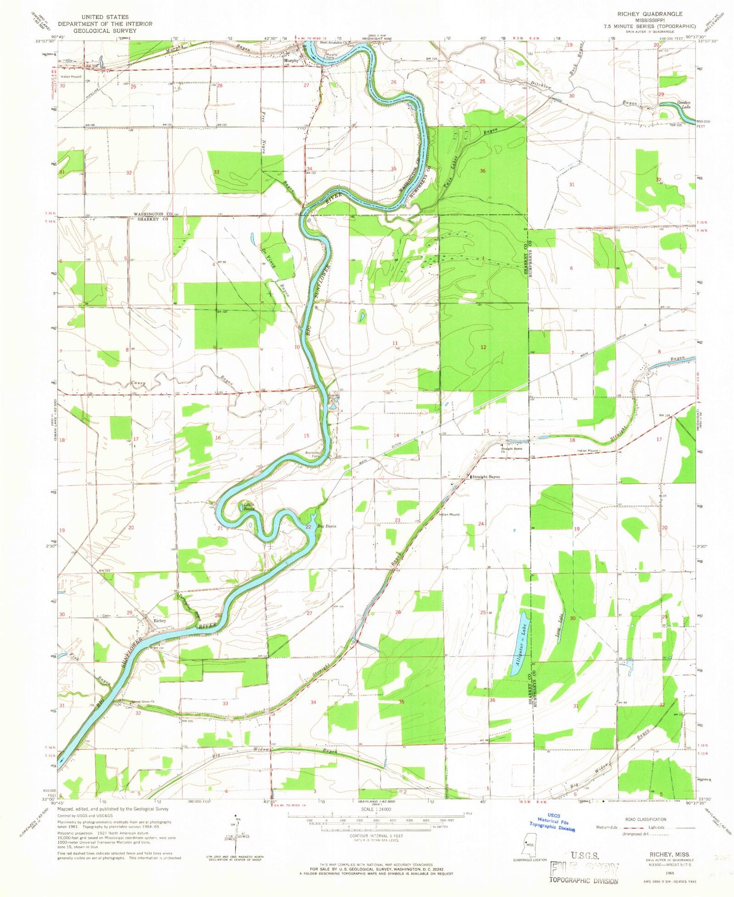
Historical USGS topographic quad map of Richey in the state of Mississippi. Map scale may vary for some years, but is generally around 1:24,000. Print size is approximately 24" x 27"
This quadrangle is in the following counties: Humphreys, Sharkey, Washington.
The map contains contour lines, roads, rivers, towns, and lakes. Printed on high-quality waterproof paper with UV fade-resistant inks, and shipped rolled.
Contains the following named places: Alligator Lake, Auter, B G Janous Pond Dam, Big Basin, Bommers, Bommers Ferry, Buck Bayou, Caney Bayou, De Viney Bayou, Ditchlow Bayou, Fish Bayou, Free Negro Bayou, Hughey Point, Kongo, Little Basin, Locust Grove Church, Long Lake, Murphy, Murphy Bayou, Murphy Ferry, Rattler Bayou, Richey, Short Jerusalem Church, Straight Bayou, Straight Bayou Church, Turkeyfoot Bayou, Twin Lakes Bayou, Whatley Lake Dam


