
MyTopo
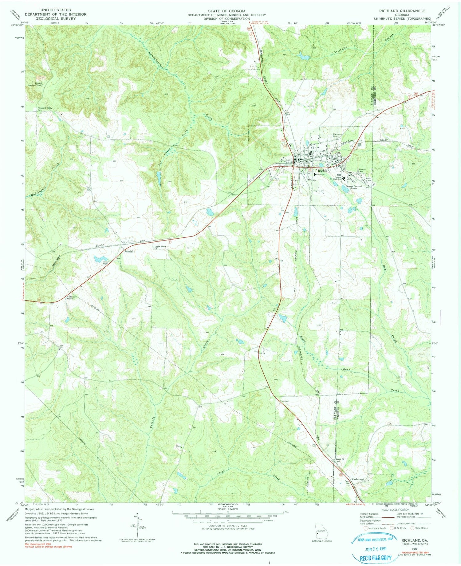
Classic USGS Richland Georgia 7.5'x7.5' Topo Map
Couldn't load pickup availability
Historical USGS topographic quad map of Richland in the state of Georgia. Map scale may vary for some years, but is generally around 1:24,000. Print size is approximately 24" x 27"
This quadrangle is in the following counties: Stewart, Webster.
The map contains contour lines, roads, rivers, towns, and lakes. Printed on high-quality waterproof paper with UV fade-resistant inks, and shipped rolled.
Contains the following named places: Allen Chapel, Alston Mill, Ben Owens Creek, Bethel Church, Beulah Church, Bryants Cemetery, City of Richland, Harmony Cemetery, Hesters School, Horton School, Independence Church, Jackson Trail Monument, Kimbrough, Little Bear Creek, Mount Zion Church, Parish Lake, Parish Lake Dam, Parish Lake South, Parish Lake South Dam, Perkins Lake, Perkins Lake Dam, Pleasant Valley Cemetery, Raju Airport, Randall, Richland, Richland Division, Richland Elementary School, Richland Historic District, Richland Police Department, Richland Post Office, Richland Volunteer Fire Department, Sardis Church, Stewart Lookout Tower, Stewart Webster Hospital, Union Church, Upper Sardis Church, Westbrook Airport, Whitt Cemetery, Williams Lake, Williams Lake Dam, ZIP Code: 31825


