MyTopo
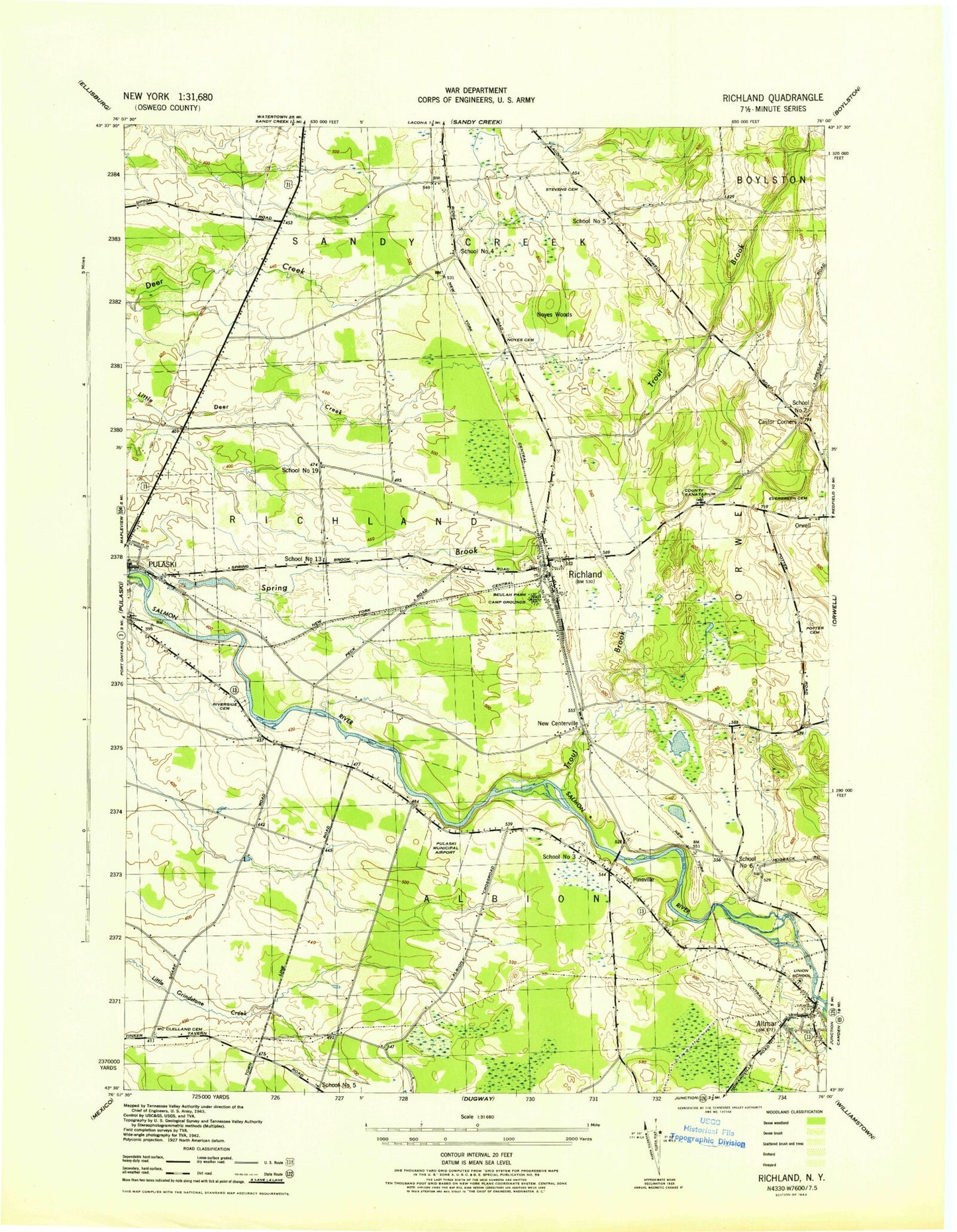
Classic USGS Richland New York 7.5'x7.5' Topo Map
Couldn't load pickup availability
Historical USGS topographic quad map of Richland in the state of New York. Typical map scale is 1:24,000, but may vary for certain years, if available. Print size: 24" x 27"
This quadrangle is in the following counties: Oswego.
The map contains contour lines, roads, rivers, towns, and lakes. Printed on high-quality waterproof paper with UV fade-resistant inks, and shipped rolled.
Contains the following named places: Altmar, Beulah Park Campground, Castor Corners, Centerville, Evergreen Cemetery, McClelland Cemetery, Pekin Brook, Potter Cemetery, Richland, Riverside Cemetery, Spring Brook, Stevens Cemetery, Trout Brook, Union School, Orwell Creek, Pineville, Pulaski Airport (historical), Oswego County at Pulaski Heliport, Richland Airpark, Noyes Cemetery, School Number 2 (historical), School Number 3 (historical), School Number 4 (historical), School Number 5 (historical), School Number 5 (historical), School Number 6 (historical), School Number 13 (historical), School Number 19 (historical), Noyes Woods, Village of Altmar (historical), Grindstone Farm, Richland Village Cemetery, Salmon River Cemetery, Castor Cemetery, Blue Springs Cemetery, Pulaski Village Cemetery, Altmar Fire Department, Altmar Post Office, Richland Post Office, Pulaski Junior - Senior High School, Greater Victory Fellowship Church, Pulaski Calvary Baptist Church, Richland Christian Church, The Church of Jesus Christ of Latter Day Saints, Salmon River Bridge, Stoney's Pineville Campground, Streamside Golf Course and Country Club, Adirondack Manor Assisted Living Facility, Northern Oswego County Ambulance Service, Richland Volunteer Fire Department, Altmar Census Designated Place