MyTopo
Classic USGS Richmond North Kentucky 7.5'x7.5' Topo Map
Couldn't load pickup availability
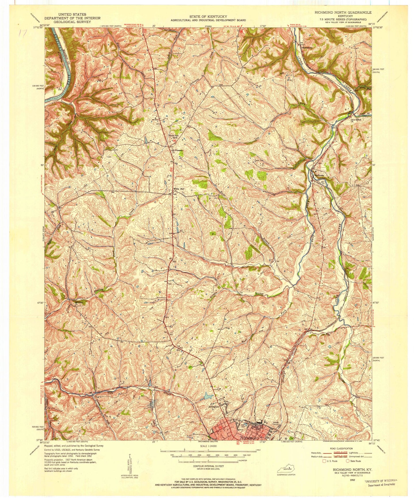
Historical USGS topographic quad map of Richmond North in the state of Kentucky. Map scale may vary for some years, but is generally around 1:24,000. Print size is approximately 24" x 27"
This quadrangle is in the following counties: Fayette, Madison.
The map contains contour lines, roads, rivers, towns, and lakes. Printed on high-quality waterproof paper with UV fade-resistant inks, and shipped rolled.
Contains the following named places: Arlington, Bellevue School, Blue Grass, Blue Grass Post Office, Boonesborough-White Hall Division, Crews Ferry, Daniel Boone School, Dreaming Creek, East Fork Otter Creek, Finney Fork, Greenwood Farm, Hicks Branch, Hillcrest, Irvine Lick, Jacks Creek, Jerry Clay Hill, John Tanner Station, Kit Carson School, Lost Fork, Madison Country Club, Madison County Emergency Medical Services, Madison County Fire Department Station 1, Madison County Regional Fire Training Center, Madison High School, Mount Nebo Church, Mount Nebo School, Mount Pleasant Church, Ophelia Railroad Station, Otter Creek Church, Redhouse, Redhouse Elementary School, Redhouse High School, Redhouse Post Office, Redhouse Railroad Station, Richmond Fire Department Station 4, Rosedale, Stony Run, Sunnyside Farm, Tribble Branch, WCBR-AM (Richmond), West Fork Otter Creek, White Hall, White Hall Post Office, White Hall School, White Hall State Shrine, White Hall Volunteer Fire Department, William Hoys Station, WMCQ-FM (Richmond), ZIP Code: 40475