MyTopo
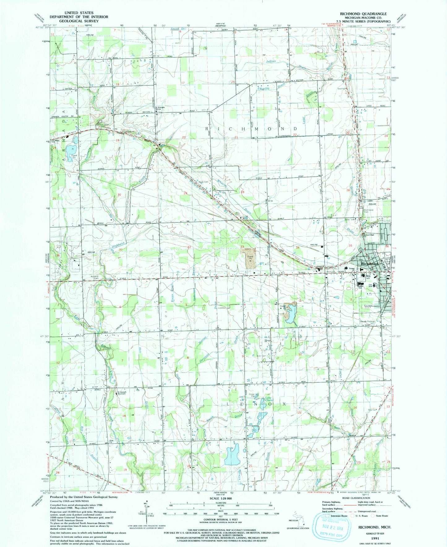
Classic USGS Richmond Michigan 7.5'x7.5' Topo Map
Couldn't load pickup availability
Historical USGS topographic quad map of Richmond in the state of Michigan. Map scale may vary for some years, but is generally around 1:24,000. Print size is approximately 24" x 27"
This quadrangle is in the following counties: Macomb.
The map contains contour lines, roads, rivers, towns, and lakes. Printed on high-quality waterproof paper with UV fade-resistant inks, and shipped rolled.
Contains the following named places: Anderson Drain, Bailey Park, Bates Cemetery, Beebe Street Memorial Park, Boss Lake, Cemetery Creek, City of Richmond, Community Baptist Church, Community of Christ Church, Dixon Drain, First United Church of Christ, First United Methodist Church, Fistler Drain, Harrison Drain, Highbank Creek, Hill Drain, Independent Church, Jeffrey Drain, Jehovah's Witnesses Kingdom Hall, Lake Chalet, Lee School, Lenox Centre Burial Grounds, Lenox Township Fire Department Station 2, Logg Drain, Norton Drain, Richards Cemetery, Richmond, Richmond - Lenox Emergency Medical Services Ambulance Authority House 2, Richmond / Lenox Emergency Medical Services Ambulance Station 1 Headquarters, Richmond Cemetery, Richmond Center for the Performing Arts Historical Marker, Richmond Community High School, Richmond Fire Department, Richmond Middle School, Richmond Place Mobile Home Estates, Richmond Station, Richmond Volunteer Fire Department, Ryall Drain, Saint Joseph Novitiate, Saint Joseph's Academy, Saint Joseph's Seminary Cemetery, Saint Mary Church, Sanford Stone Historical Marker, Smith Drain, Timberwood Golf Club, Township of Lenox, Township of Richmond, Trinity Lutheran Church, Weller House Historical Marker, Wheeler Drain, Will L Lee School, Willow Grove Cemetery, ZIP Codes: 48050, 48062