MyTopo
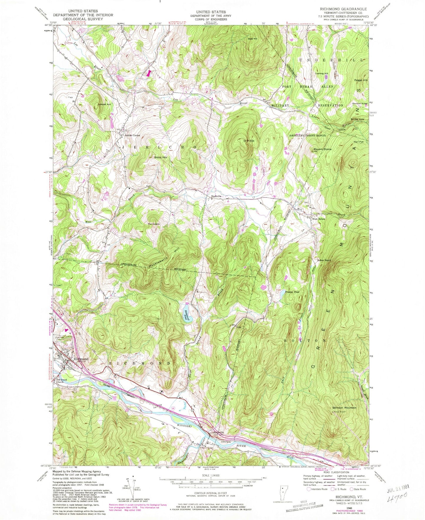
Classic USGS Richmond Vermont 7.5'x7.5' Topo Map
Couldn't load pickup availability
Historical USGS topographic quad map of Richmond in the state of Vermont. Typical map scale is 1:24,000, but may vary for certain years, if available. Print size: 24" x 27"
This quadrangle is in the following counties: Chittenden.
The map contains contour lines, roads, rivers, towns, and lakes. Printed on high-quality waterproof paper with UV fade-resistant inks, and shipped rolled.
Contains the following named places: Bald Hill, Birch Hill, Birnies Nose, Bolton Notch, Camp Underhill, Cushing Hill, Duck Brook, Edmond Bridge, Huckleberry Hill, Jericho Center, Jonesville, Laisdell Hill, Marr Flat, Mayers Dome, Nashville, O P Hill, Old Round Church, Preston Brook, Preston Pond, Richmond, Richmond Pond, River View Cemetery, Snipe Island Brook, Starbird Ridge, Stimson Mountain, Talbot Hollow, The Cobble, Vermont Research Forest Agriculture Experiment StatiON, West Bolton, Huntington River, Town of Bolton, Town of Jericho, Town of Richmond, Camels Hump Middle School, Champlain Council Campfire Girls Camp, Cochran Ski Center, Jericho Center Post Office, Jonesville Academy, Jonesville Post Office, Machine Gun School (historical), Mount Mansfield Union High School, Richmond Village Cemetery, Richmond Congregational Church, Richmond Elementary School, Richmond Post Office, Saint Marys Cemetery, West Bolton Cemetery, West Bolton Golf Course, Richmond Fire Department, Underhill - Jericho Fire Department, Meadow Airport, Training Site Ethan Allen Range, Richmond Rescue Squad, Richmond Census Designated Place, Richmond Police Department