MyTopo
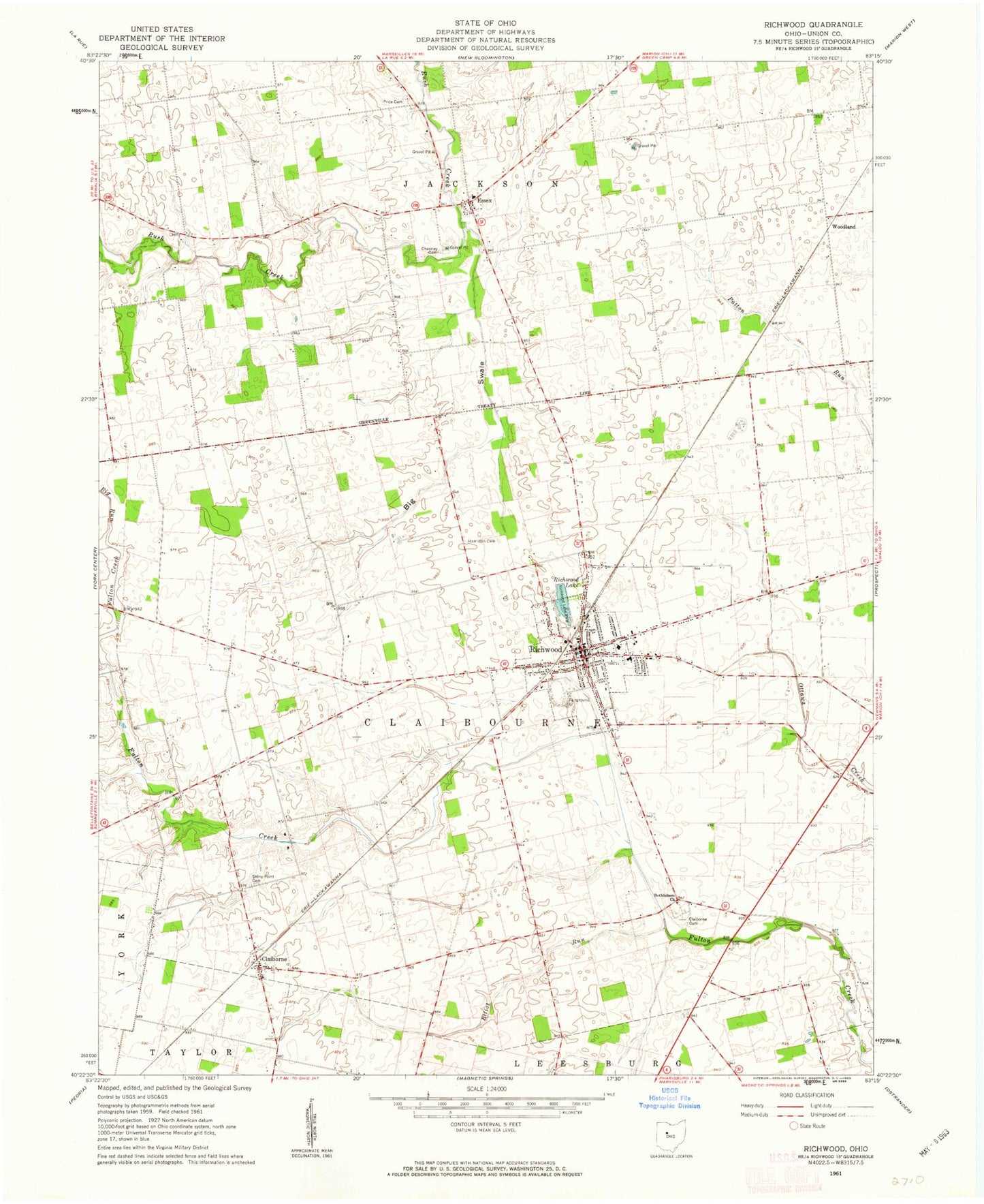
Classic USGS Richwood Ohio 7.5'x7.5' Topo Map
Couldn't load pickup availability
Historical USGS topographic quad map of Richwood in the state of Ohio. Map scale may vary for some years, but is generally around 1:24,000. Print size is approximately 24" x 27"
This quadrangle is in the following counties: Union.
The map contains contour lines, roads, rivers, towns, and lakes. Printed on high-quality waterproof paper with UV fade-resistant inks, and shipped rolled.
Contains the following named places: Adams School, Baldwin School, Benedict School, Bethlehem Church, Big Run, Big Swale, Big Swale Creek, Big Swale School, Bigelow School, Boundary School, Cahill School, Carter School, Central United Methodist Church, Chaney School, Cheney Cemetery, Claiborne, Claiborne Cemetery, Claiborne Post Office, Claibourne-Richwood Elementary School, Deadwood School, Elliot Run, Essex, Essex United Methodist Church, First Baptist Church, First United Methodist Church, Hamilton Cemetery, Jackson Elementary School, North Union High School, Northern Union County Fire Department and Emergency Medical Services, Peacock Run, Price Cemetery, Richwood, Richwood Fairgrounds, Richwood Lake, Richwood Lake Park, Richwood North Union Public Library, Richwood Police Department, Richwood Post Office, Richwood Village Hall, Stony Point Cemetery, Stony Point School, Styre School, Sunnyside School, Tawa Estates, Tawa School, Tenery School, Township of Claibourne, Township of Jackson, Village of Richwood, Willey School, Woodland, ZIP Code: 43344