MyTopo
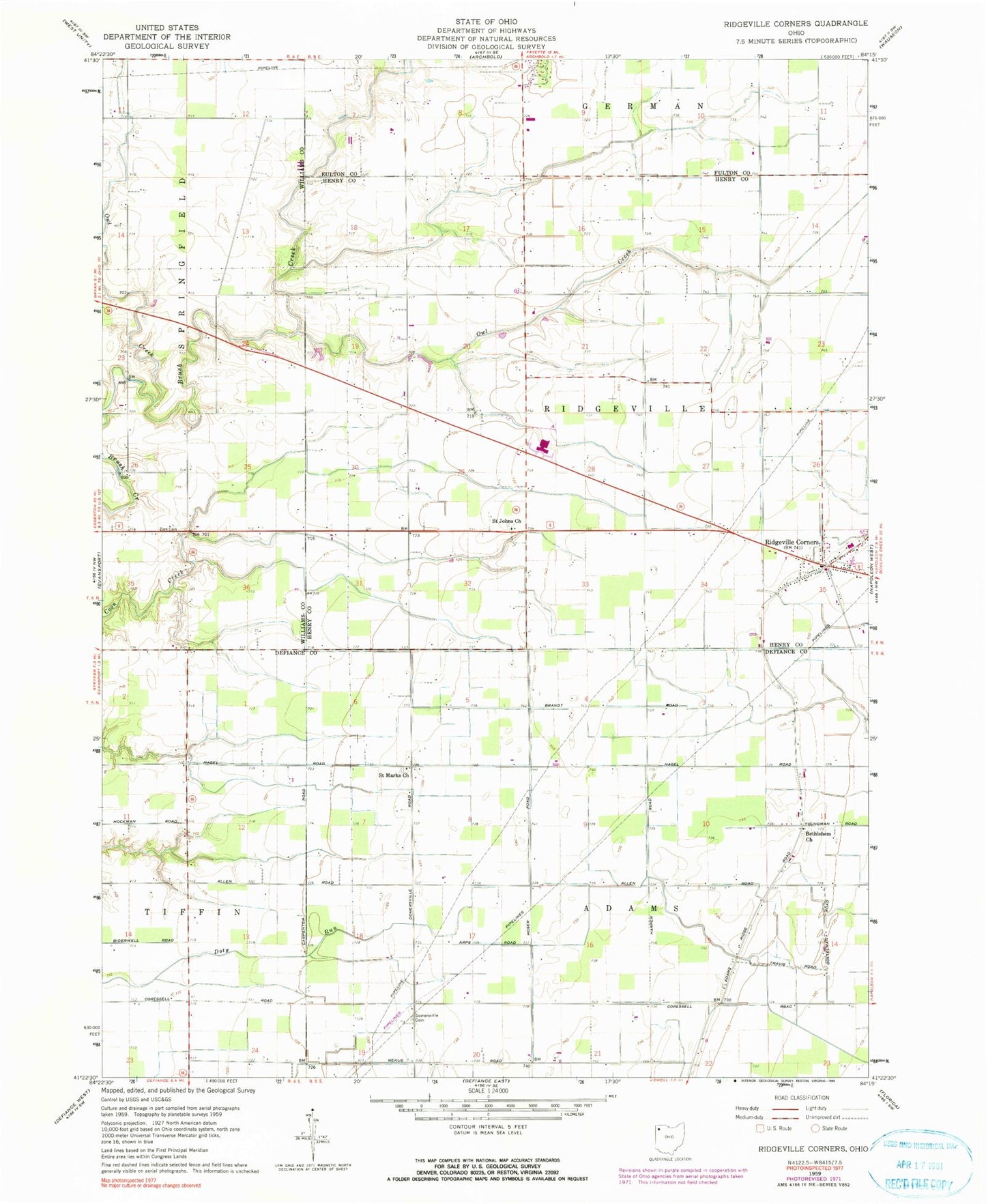
Classic USGS Ridgeville Corners Ohio 7.5'x7.5' Topo Map
Couldn't load pickup availability
Historical USGS topographic quad map of Ridgeville Corners in the state of Ohio. Map scale may vary for some years, but is generally around 1:24,000. Print size is approximately 24" x 27"
This quadrangle is in the following counties: Defiance, Fulton, Henry, Williams.
The map contains contour lines, roads, rivers, towns, and lakes. Printed on high-quality waterproof paper with UV fade-resistant inks, and shipped rolled.
Contains the following named places: Adams Ridge, Adams Ridge Post Office, Archbold Middle School, Bethlehem Lutheran Cemetery, Bethlehem Lutheran Church, Buehrer Farms, Corrections Center of Northwest Ohio, Domersville Cemetery, Domerville, Domerville Post Office, Four County Joint Vocational School, Fox Chase, Hickory Hills, Locust Cemetery, Northwest Technical College, Owl Creek, Plants Plus Nursery, Ridgeville Corners, Ridgeville Corners Census Designated Place, Ridgeville Corners Post Office, Ridgeville Township Volunteer Fire Department, Roselawn Farm, Saint John Lutheran Church, Saint Johns Cemetery, Saint Johns Church, Saint Marks Lutheran Cemetery, Saint Mark's Lutheran Church, Saint Peter Cemetery, Saint Peter Church, Township of Adams, Township of Ridgeville, Zion Cemetery, Zion Church, ZIP Code: 43555