MyTopo
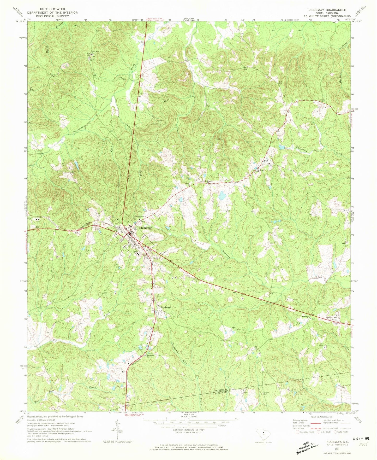
Classic USGS Ridgeway South Carolina 7.5'x7.5' Topo Map
Couldn't load pickup availability
Historical USGS topographic quad map of Ridgeway in the state of South Carolina. Map scale may vary for some years, but is generally around 1:24,000. Print size is approximately 24" x 27"
This quadrangle is in the following counties: Fairfield, Richland.
The map contains contour lines, roads, rivers, towns, and lakes. Printed on high-quality waterproof paper with UV fade-resistant inks, and shipped rolled.
Contains the following named places: Aimwell Cemetery, Brown Pond Dam D-1591, Cedar Fork, Fairfield County Fire Department Ridgeway, Geiger School, Good Hope Church, Lots Fork, Macedonia Church, Mount Pisgah Church, Oak Grove Church, Oak Grove School, Rehoboth Church, Ridgeway, Ridgeway Division, Ridgeway Historic District, Ridgeway Police Department, Rulis Chapel, Saint Stephens Cemetery, Saint Stephens Church, Sawneys Creek Cemetery, Sawneys Creek Church, Smallwood, South Carolina Noname 20023 D-0533 Dam, Town of Ridgeway, ZIP Code: 29130