MyTopo
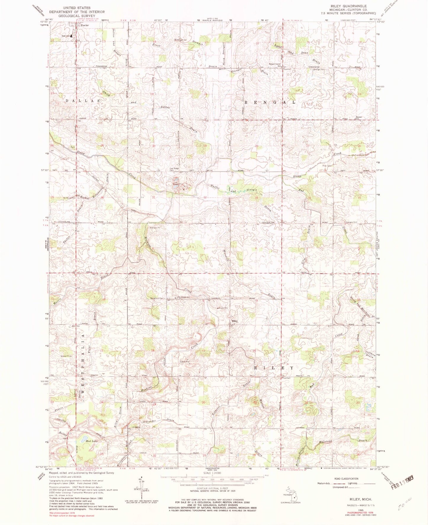
Classic USGS Riley Michigan 7.5'x7.5' Topo Map
Couldn't load pickup availability
Historical USGS topographic quad map of Riley in the state of Michigan. Map scale may vary for some years, but is generally around 1:24,000. Print size is approximately 24" x 27"
This quadrangle is in the following counties: Clinton.
The map contains contour lines, roads, rivers, towns, and lakes. Printed on high-quality waterproof paper with UV fade-resistant inks, and shipped rolled.
Contains the following named places: Anne Char Farms, Bad Creek, Bengal Center School, Bengal Post Office, Boughton Cemetery, Bray Cemetery, Circle K Farm and Ranch, Cloverbrook Farm, Double M Farm, Evert and Stewart Drain, Feneis Drain, Flegler Farms, Forest Hill Airport, Fowler High School, Georgia Cemetery, Granger Drain, Halstead Drain, Harper School, Jacob Drain, Jason Corners Farm, Kelley Drain, Lyon and Dean Drain, M M Farms, Mud Lake, Muskrat Creek, Nuffer and Sturgis Drain, Oak Ridge Cemetery, Oral Post Office, Riley, Riley Elementary School, Riley Post Office, Rochol Extension Drain, Rock N Oak Dairy, Saint Paul's Cemetery, Saint Peter Lutheran Church, Saint Peter's Lutheran Cemetery, Saint Peters School, Schneider Dairy Farm, Schrader Dairy, Schrader Farm, Schroeder Drain, Silm Drain, Smith and Sutton Drain, Sweetgrass Farm, Thelen Drain, Tibbetts Drain, Township of Bengal, Township of Riley, Trent Drain, Vacottage Heliport, Wandeil Drain, Watson Drain, Westphalia and Riley Drain