MyTopo
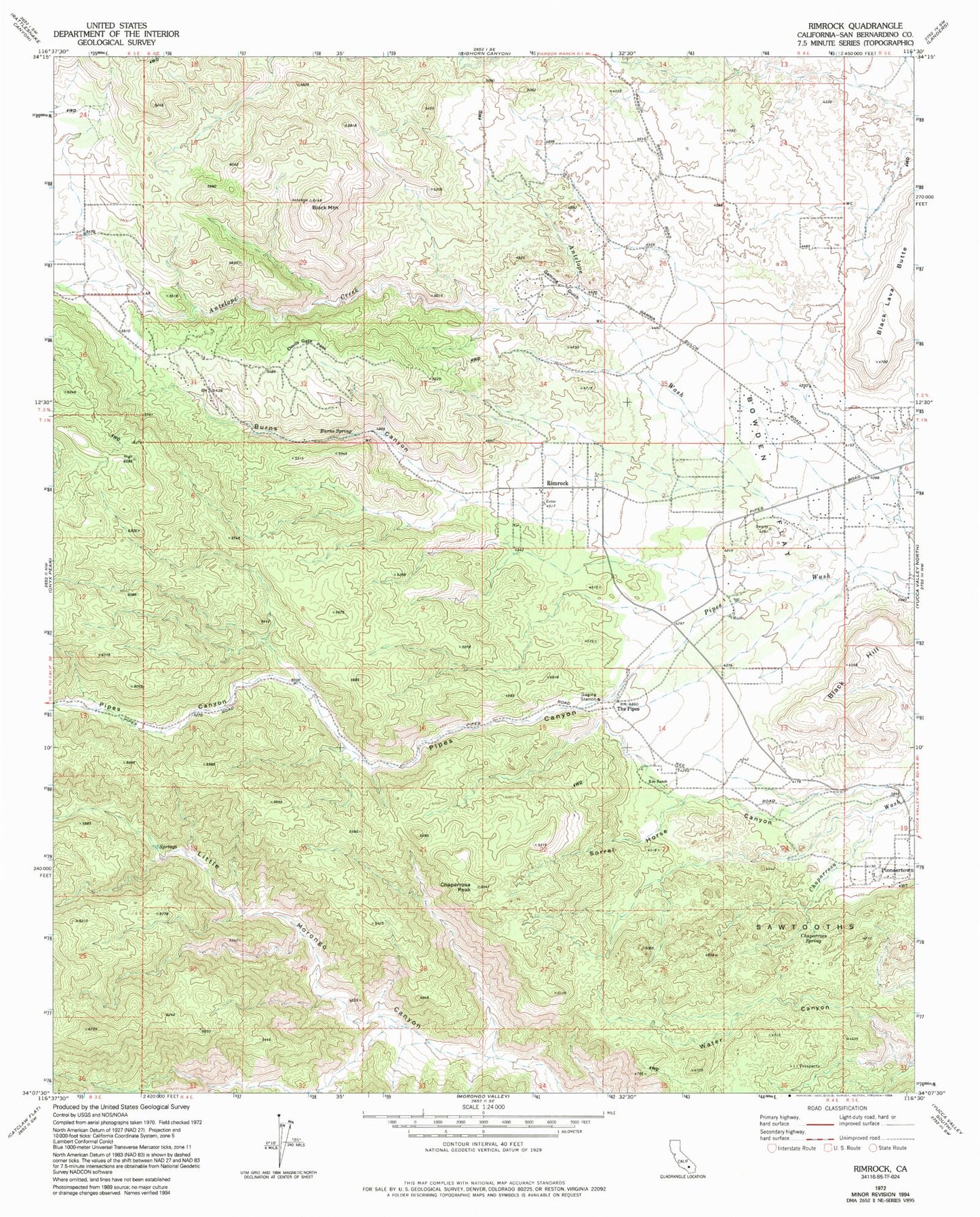
Classic USGS Rimrock California 7.5'x7.5' Topo Map
Couldn't load pickup availability
Historical USGS topographic quad map of Rimrock in the state of California. Typical map scale is 1:24,000, but may vary for certain years, if available. Print size: 24" x 27"
This quadrangle is in the following counties: San Bernardino.
The map contains contour lines, roads, rivers, towns, and lakes. Printed on high-quality waterproof paper with UV fade-resistant inks, and shipped rolled.
Contains the following named places: Antelope Wash, Black Lava Butte, Black Mountain, Bowden Flat, Burns Canyon, Burns Spring, Chaparrosa Peak, Chaparrosa Spring, Devils Gate Pass, Gamma Gulch, Kee Ranch, Sorrel Horse Canyon, The Pipes, Antelope Creek, Pipes Canyon, Rimrock, Sawtooths, Bobo Springs Reservoir (historical), The Pipes Ranch, San Bernardino County Fire Department Station 38 Pioneertown