MyTopo
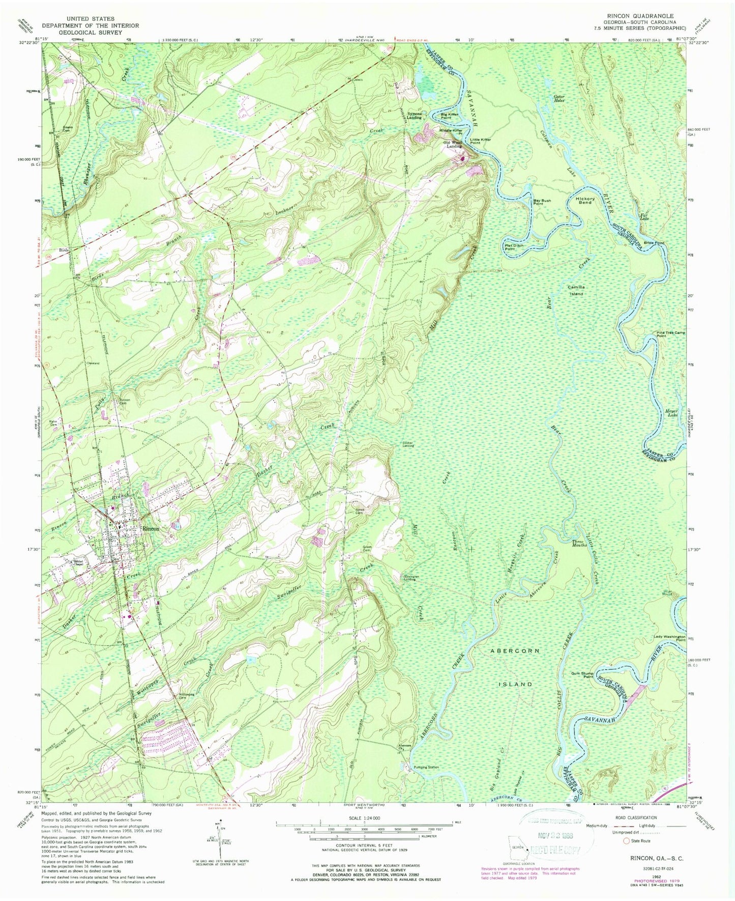
Classic USGS Rincon Georgia 7.5'x7.5' Topo Map
Couldn't load pickup availability
Historical USGS topographic quad map of Rincon in the states of Georgia, South Carolina. Map scale may vary for some years, but is generally around 1:24,000. Print size is approximately 24" x 27"
This quadrangle is in the following counties: Effingham, Jasper.
The map contains contour lines, roads, rivers, towns, and lakes. Printed on high-quality waterproof paper with UV fade-resistant inks, and shipped rolled.
Contains the following named places: Abercorn Church, Bay Bush Point, Bear Creek, Becks Ferry, Bethel Chapel, Big Collis Creek, Big Gayland Creek, Big Kiffer Point, Big Patten Landing, Birds, Birds Branch, Blandford Elementary School, Church of God, City of Rincon, Coleman Lake, Coleman Run, Dasha Landing, Dasher Creek, Ebenezer Elementary School, Ebenezer Middle School, Flat Ditch Point, Forks Lake, Fox Lake, Gator Holes, Glovers Point, Gnann Cemetery, Goshen Villa, Green Cemetery, Gum Stump Point, Jones Cemetery, Lady Washington Point, Little Abercorn Creek, Little Collis Creek, Little Gayland Creek, Little Kiffer Point, Lockner Creek, Meyer Lake, Middle Kiffer Point, Mill Creek, Mosquito Creek, Newington Landing, Northside Church, Old Wood Landing, Pine Tree Camp Point, Polly Creek, Raccoon Creek, Rahn Cemetery, Rincon, Rincon Branch, Rincon Cemetery, Rincon Church, Rincon Elementary School, Rincon Fire Department Station 1, Rincon Fire Department Station 2, Rincon Police Department, Rincon Post Office, Rincon South Shopping Center, Rincon Town Hall, Savannah Water Works, Silverwood Plantation, Sweigoffer Creek, Symons Landing, Willowpeg, Willowpeg Cemetery, Willowpeg Creek, ZIP Code: 31326