MyTopo
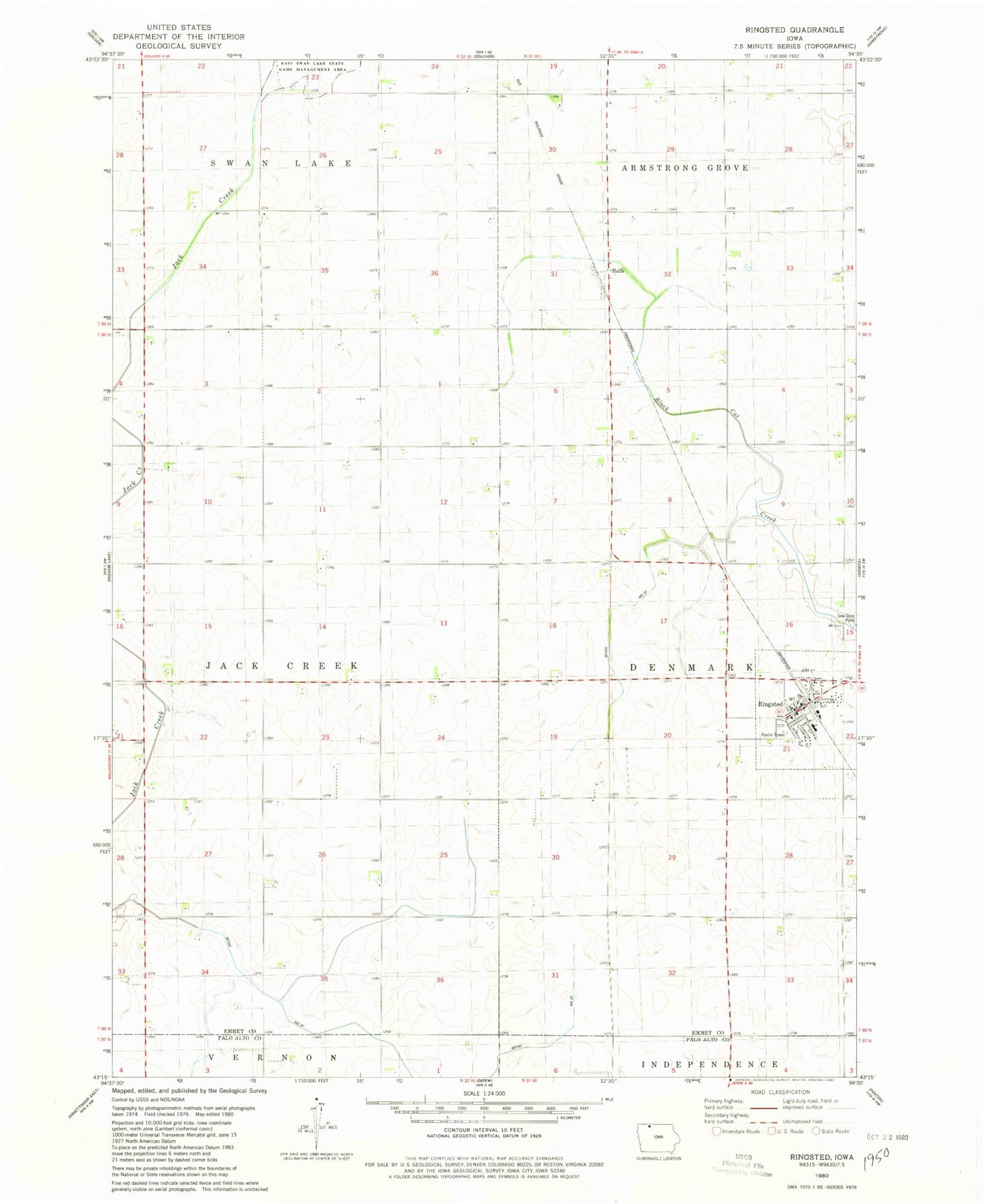
Classic USGS Ringsted Iowa 7.5'x7.5' Topo Map
Couldn't load pickup availability
Historical USGS topographic quad map of Ringsted in the state of Iowa. Map scale may vary for some years, but is generally around 1:24,000. Print size is approximately 24" x 27"
This quadrangle is in the following counties: Emmet, Palo Alto.
The map contains contour lines, roads, rivers, towns, and lakes. Printed on high-quality waterproof paper with UV fade-resistant inks, and shipped rolled.
Contains the following named places: Armstrong - Ringsted Elementary School, City of Ringsted, Co-op Grain and Product Company Elevator, Ditch Number 21, Ditch Number 37, Halfa, Halfa Post Office, Hoprig, Hoprig Post Office, J and N Farm, Luke Farm, M and R Farms, Peltz Field, Presbyterian Church, Ringsted, Ringsted City Hall, Ringsted Fire Department, Ringsted Post Office, Ringsted Public Library, Saint Pauls Lutheran Church, State Line Co-op Elevator, State Line Cooperative Elevator, Township of Denmark, Township of Jack Creek, ZIP Code: 50578