MyTopo
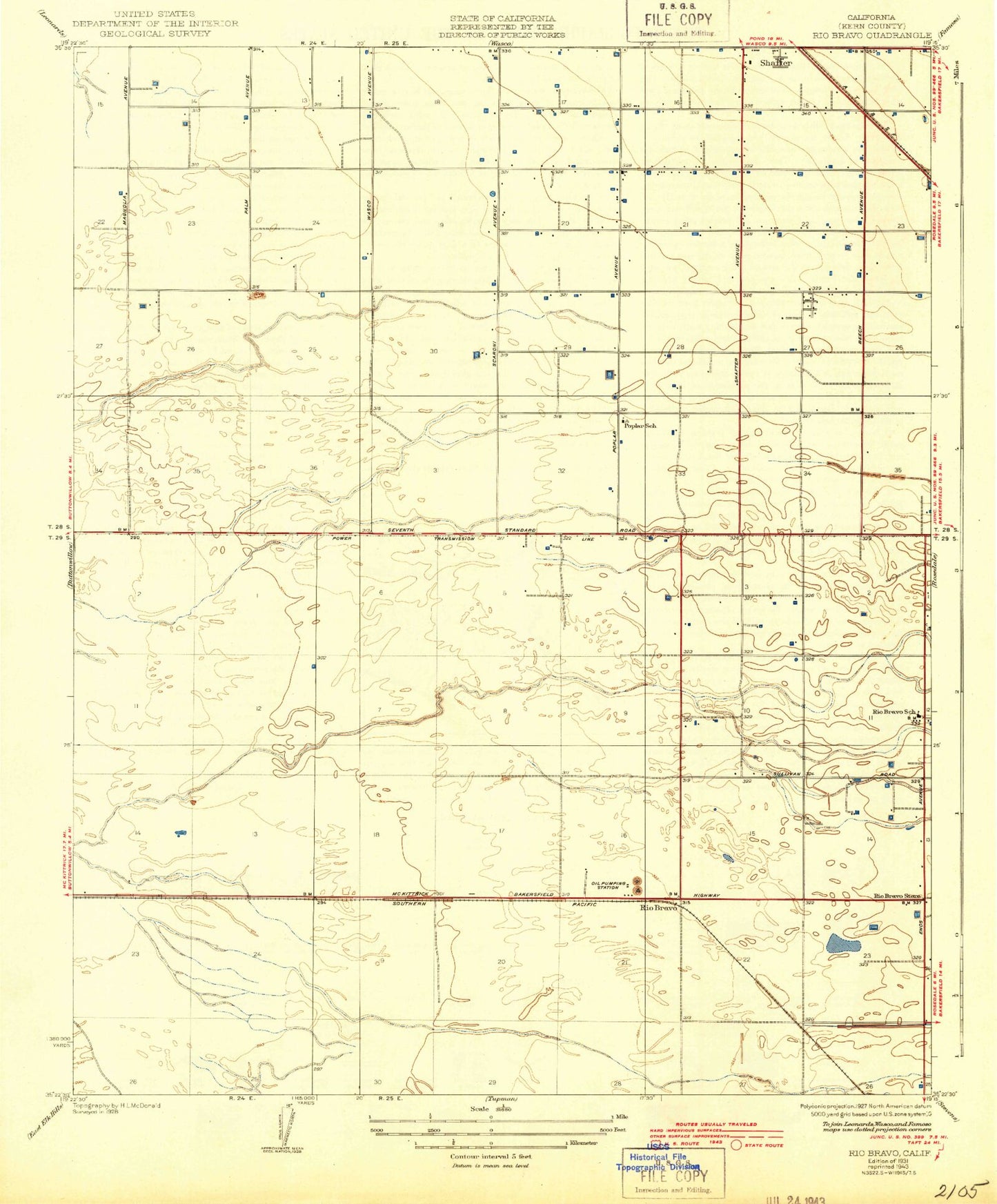
Classic USGS Rio Bravo California 7.5'x7.5' Topo Map
Couldn't load pickup availability
Historical USGS topographic quad map of Rio Bravo in the state of California. Map scale may vary for some years, but is generally around 1:24,000. Print size is approximately 24" x 27"
This quadrangle is in the following counties: Kern.
The map contains contour lines, roads, rivers, towns, and lakes. Printed on high-quality waterproof paper with UV fade-resistant inks, and shipped rolled.
Contains the following named places: Apostolic Assembly Church, Aukeman Dairy, Calders Corner, Cherokee Strip, Cherokee Strip Census Designated Place, First Mexican Baptist Church, Iglesia Evangelica Encuento, Kern Junior Academy, Kirchenmann Park, Mexican Colony, Mexican Colony Census Designated Place, Oasis Holsteins Dairy, Poplar School, Richland Park, Richland Primary School, Rio Bravo, Rio Bravo Oil Field, Rio Bravo-Greeley Elementary School, Rodriguez Park, Shafter Division, Shafter Modified Community Correctional Facility, Shafter Pentecostal Church of God, Smith Corner, Smith Corner Census Designated Place, Stebbins, Stebbins Census Designated Place, Thomas Lane, Tjaarda Dairy, ZIP Code: 93263