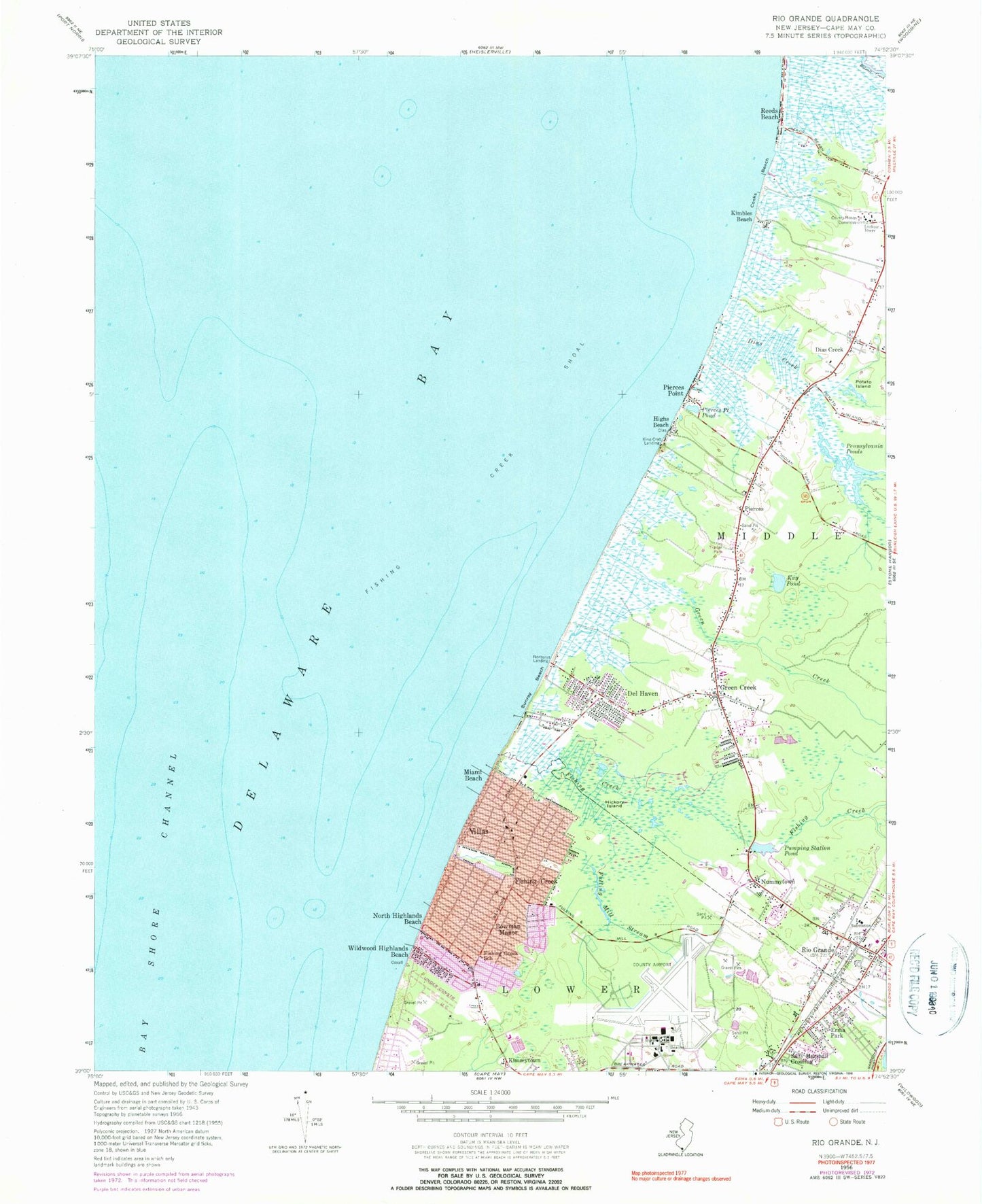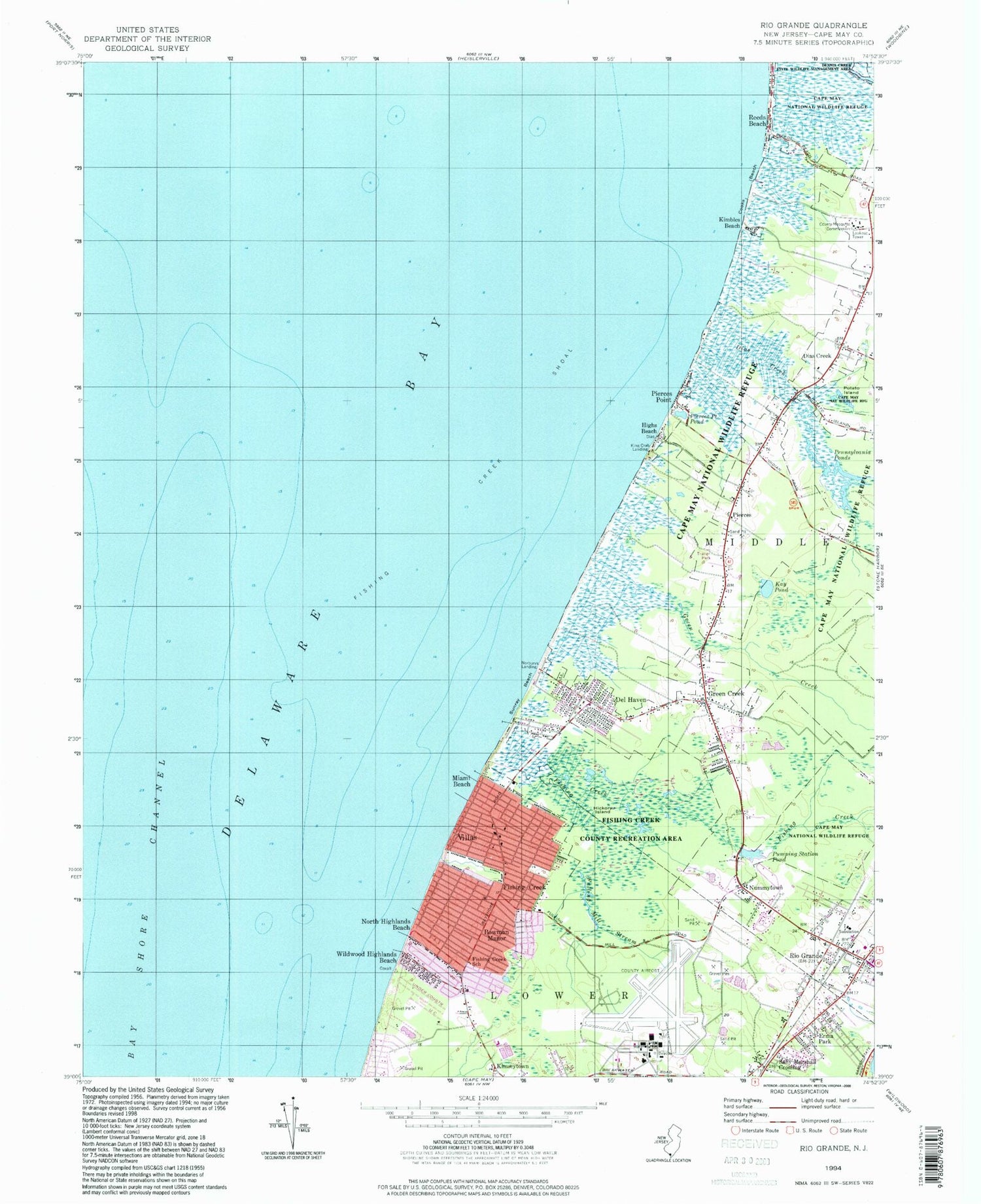

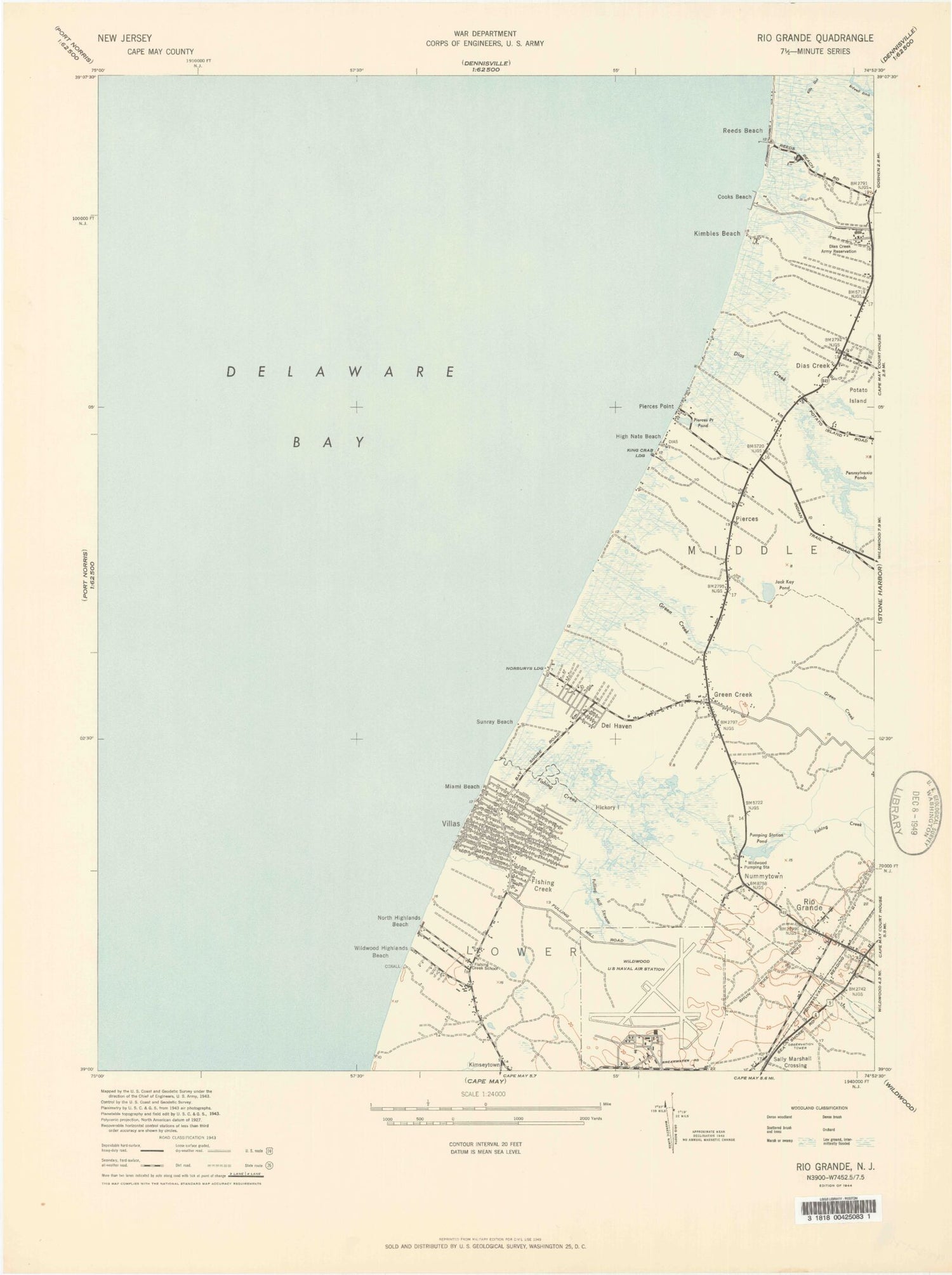
MyTopo
Classic USGS Rio Grande New Jersey 7.5'x7.5' Topo Map
Couldn't load pickup availability
Historical USGS topographic quad map of Rio Grande in the state of New Jersey. Map scale may vary for some years, but is generally around 1:24,000. Print size is approximately 24" x 27"
This quadrangle is in the following counties: Cape May.
The map contains contour lines, roads, rivers, towns, and lakes. Printed on high-quality waterproof paper with UV fade-resistant inks, and shipped rolled.
Contains the following named places: Bowman Manor, Cape May County Airport, Cooks Beach, Del Haven, Dias Creek, Erma Park, Erma Volunteer Fire Company, Fishing Creek, Fishing Creek School, Fishing Creek Shoal, Fulling Mill Stream, Green Creek, Green Creek Post Office, Green Creek Volunteer Fire Company 3, Hickory Island, Highs Beach, Kay Pond, Kimbles Beach, Kimseytown, King Crab Landing, Lower Township Bureau of Fire Safety, Lower Township Police Department, Lower Township Rescue Squad, Marcy Landing, Memorial Elementary School, Miami Beach, Naval Air Station Wildwood, Norburys Landing, North Highlands Beach, Nummytown, Paramount Air Airport, Pennsylvania Ponds, Pierces, Pierces Point, Pierces Point Pond, Potato Island, Pumping Station Pond, Reeds Beach, Rio Grand Volunteer Fire Station 72, Rio Grande, Rio Grande Census Designated Place, Rio Grande Post Office, Saint Raymond Regional Elementary School, Sally Marshall Crossing, Sunray Beach, Villas, Villas Census Designated Place, Villas Post Office, Villas Volunteer Fire Company, Wildwood Highlands Beach, Wuerkers New Acres Farm Heliport, ZIP Codes: 08242, 08251