MyTopo
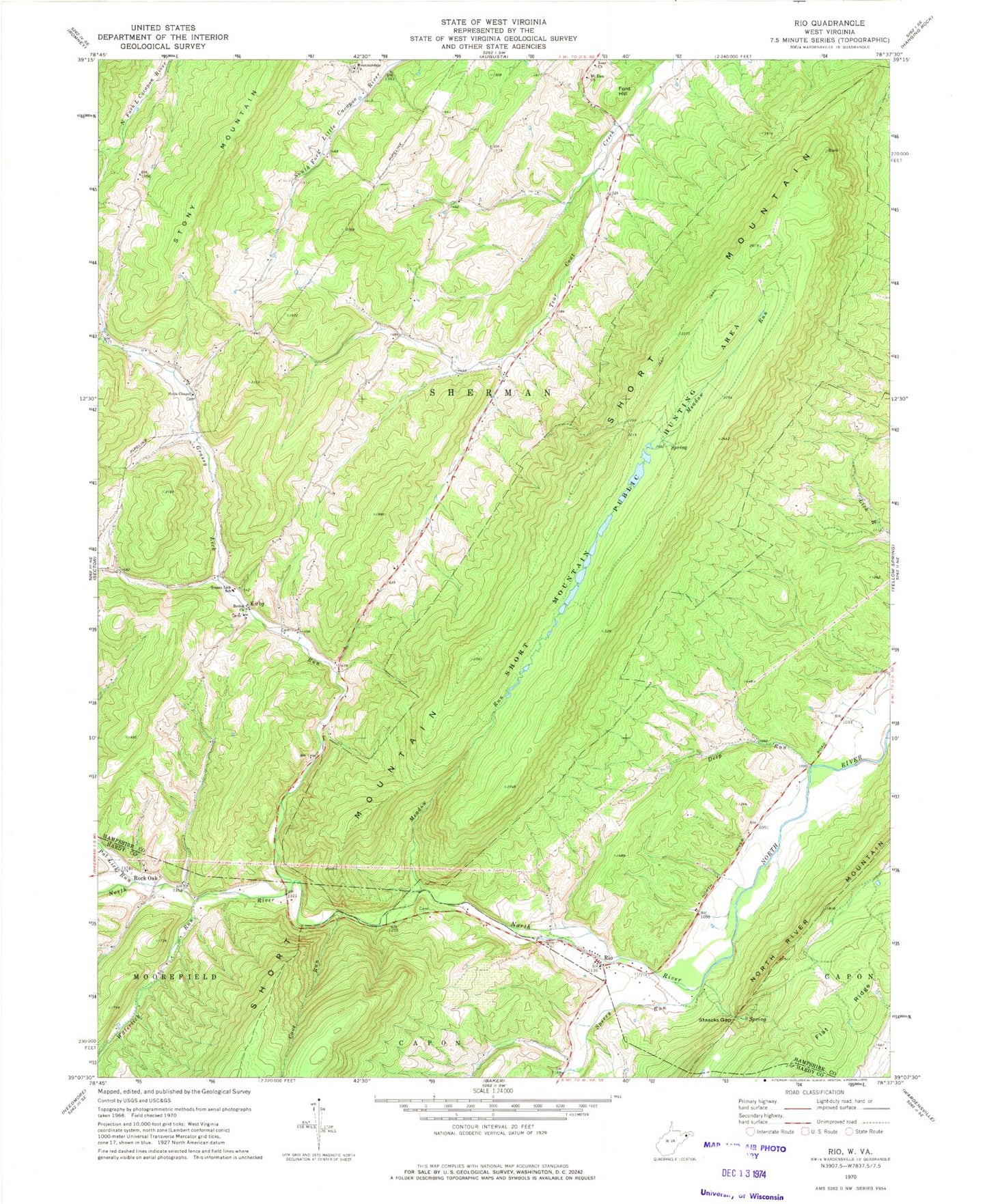
Classic USGS Rio West Virginia 7.5'x7.5' Topo Map
Couldn't load pickup availability
Historical USGS topographic quad map of Rio in the states of West Virginia, Maryland. Typical map scale is 1:24,000, but may vary for certain years, if available. Print size: 24" x 27"
This quadrangle is in the following counties: Hampshire, Hardy.
The map contains contour lines, roads, rivers, towns, and lakes. Printed on high-quality waterproof paper with UV fade-resistant inks, and shipped rolled.
Contains the following named places: Kirby Bethel Baptist Church, Deep Run, Grassy Lick Run, Grassy Lick Elementary School (historical), Hotts Chapel, Meadow Run, Mount Zion Church, Mountaindale Church, Pot Lick Run, Rio, Staacks Gap, Zoar Church, Cove Run, Flat Ridge, Short Mountain Wildlife Management Area, Sperry Run, Waterlick Run, Ford Hill, Kirby, Rock Oak, Deep Run School (historical), Denver School (historical), Ruckman, Sugar Grove School (historical), Watson School (historical), Marshall School (historical), Gap Run Spring, Meadow Spring, Raymond Hawse Spring, Bethel Schoolhouse (historical), Heare Cemetery, Hotts Chapel Cemetery, Kirby Post Office, Mountaindale Cemetery, Rio Elementary School (historical), Rio Post Office, Sherman District, North River Valley Volunteer Fire Company, Jerry Staggs Memorial Bridge, Bethel Baptist Church Cemetery, Grassy Lick Cemetery, Lutheran Ebenezer Cemetery, South Mountain