MyTopo
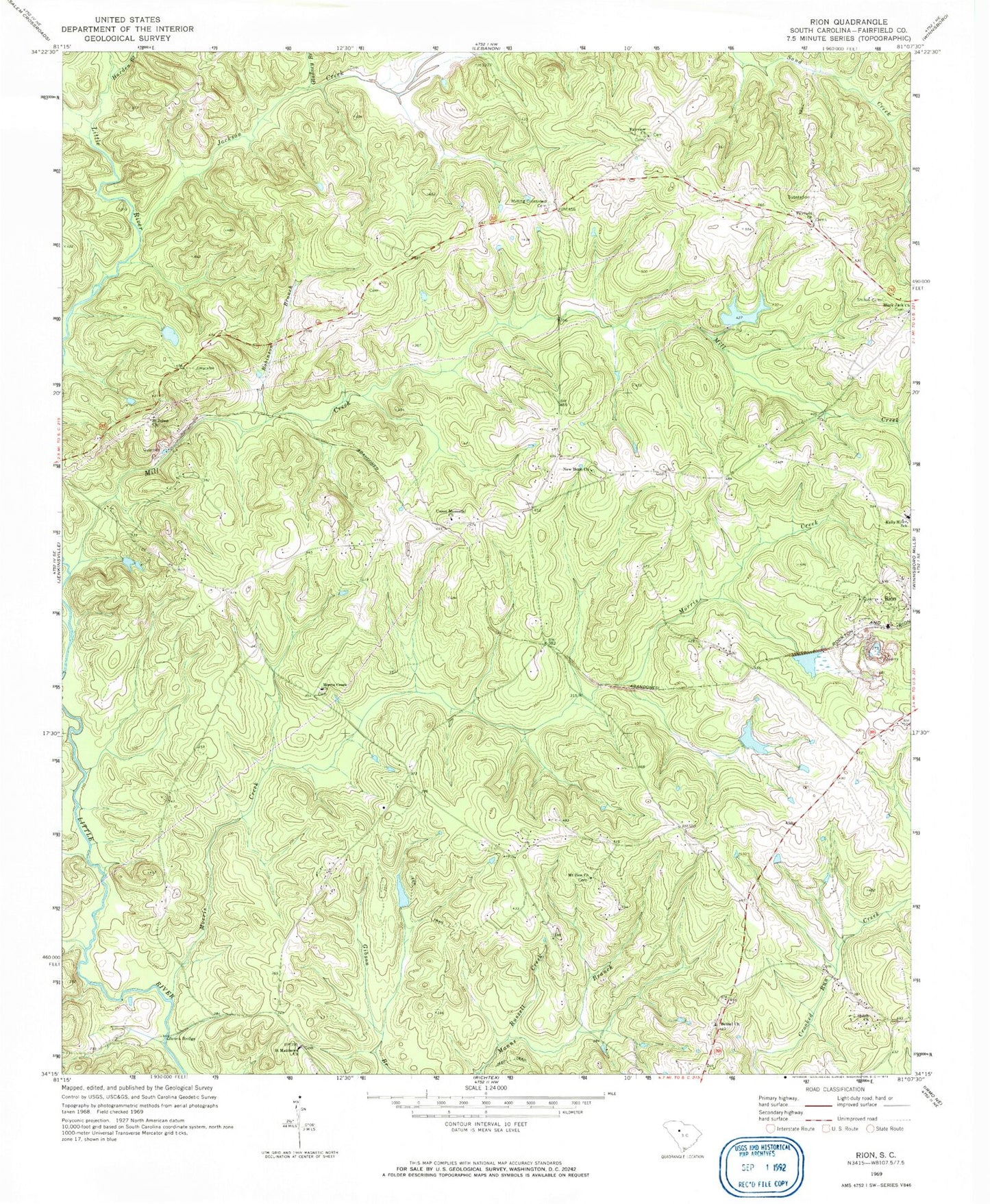
Classic USGS Rion South Carolina 7.5'x7.5' Topo Map
Couldn't load pickup availability
Historical USGS topographic quad map of Rion in the state of South Carolina. Map scale may vary for some years, but is generally around 1:24,000. Print size is approximately 24" x 27"
This quadrangle is in the following counties: Fairfield.
The map contains contour lines, roads, rivers, towns, and lakes. Printed on high-quality waterproof paper with UV fade-resistant inks, and shipped rolled.
Contains the following named places: Anderson Quarry, Bells Mill, Bethel Cemetery, Bethel Church, Bethel School, Black Jack Church, Black Jack School, Fairfield Cemetery, Fairfield Church, Fairview Church, Fairview School, Gladney Branch, Gladney Cemetery, Glenns Bridge, Harden Branch, Jackson Creek, Jackson Mill Creek Watershed Structure Number One, Jackson Mill Creek Watershed Structure Number Two, Jackson Mill Creek WCD Dam D-0523, Jackson Mill Creek WCD Dam Two D-0521, Kelly Miller School, Kincaids Mill, Macfie Pond D-1568 Dam, Mill Creek, Milling Crossroad Cemetery, Molly Alston Cemetery, Morris Creek, Morris Creek Church, Mount Zion Church, Mount Zion School, Neckleys Creek, New Hope Church, New Hope School, Rion, Robinson Branch, Russell Creek, Saint Johns Church, Saint Matthews Church, Saint Matthews School, Shiloh Cemetery, Shiloh Church, Shiloh School, South Carolina Noname 20008 D-0525 Dam, South Carolina Noname 20021 D-0438 Dam, Union Cemetery, Union Memorial Church, Union School, Winnsboro Reservoir, Winnsboro Reservoir Dam D-0522, Winnsboro South Division, Yarborough Cemetery