MyTopo
Classic USGS Ripley Alabama 7.5'x7.5' Topo Map
Couldn't load pickup availability
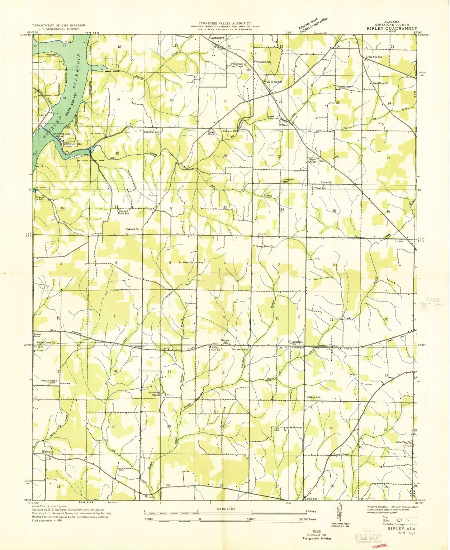
Historical USGS topographic quad map of Ripley in the state of Alabama. Map scale may vary for some years, but is generally around 1:24,000. Print size is approximately 24" x 27"
This quadrangle is in the following counties: Limestone.
The map contains contour lines, roads, rivers, towns, and lakes. Printed on high-quality waterproof paper with UV fade-resistant inks, and shipped rolled.
Contains the following named places: Angela Memorial Chapel, Baker Hill, Beacon Church, Beauchamp Branch, Berea Cemetery, Big Creek, Big Creek School, Blackburn, Blackburn School, Burrell Cemetery, Cairo Branch, Cartwright, Cartwright Church of Christ, Christ Church, Christian Fellowship Church, Clements Volunteer Fire Department Station 2, Collier Cemetery, Crenshaw Cemetery, Crenshaws Mill, Cross Key, Cross Key Church, Cross Key School, Davchport Cemetery, Dawson Spring, Elk River Mills Bridge, Ezell Place, Farmview, Farrow Cemetery, First Independent Church, Fourmile Branch, Glenn Valley, Green Hills, Hickory Hills, Jack Branch, Johnson Branch, Johnson Cemetery, Johnsons Foundry, Kingdom Hall Church, Lapington Store, Limestone Church, Limestone Presbyterian Church Cemetery, Little Zion Missionary Baptist Church, Littrell Dam, Littrell Lake, McCully Cemetery, McKinney Cemetery Number 2, Morris Spring, Mount Pisgah Baptist Church, Mount Pisgah Cemetery, Myers Cemetery, National Church, New Berea Church, New Hope Primitive Baptist Church, New Hope School, New Life Church, New Testament Church, O Neal Cemetery, Oakland, Oakland Church of Christ, O'Neal, O'Neal Church of Christ, O'Neal Lookout Tower, O'Neal School, Owens Junior High School, Owens Volunteer Fire Department Station 1, Owens Volunteer Fire Department Station 2, Pecks Store, Persimmon Grove, Persimmon Grove Chapel, Pleasant Point Cemetery, Pleasant Point School, Poplar Creek, Poplar Creek Cemetery, Poplar Creek Church, Poplar Creek School, Reid School, Riddle Cemetery, Riddle Chapel, Ripley, Saint Marks Church, Shanghai, Shanghai Baptist Church, Shanghai School, Sportsmans Park Fish Camp, Stony Point Church, Sugar Creek, Sunny Hill Cemetery, Sunny Hill Church, Tabernacle Church, Tanner Primary School, Tillmans Mill, Trent Nurseries, Turner Cemetery, Turner Chapel, Turner Chapel School, Twin Spring, Valley View Cemetery, Valley View Church of Christ, Vestavia Estates, Weir Cemetery, Yarbrough Cemetery, ZIP Code: 35611