MyTopo
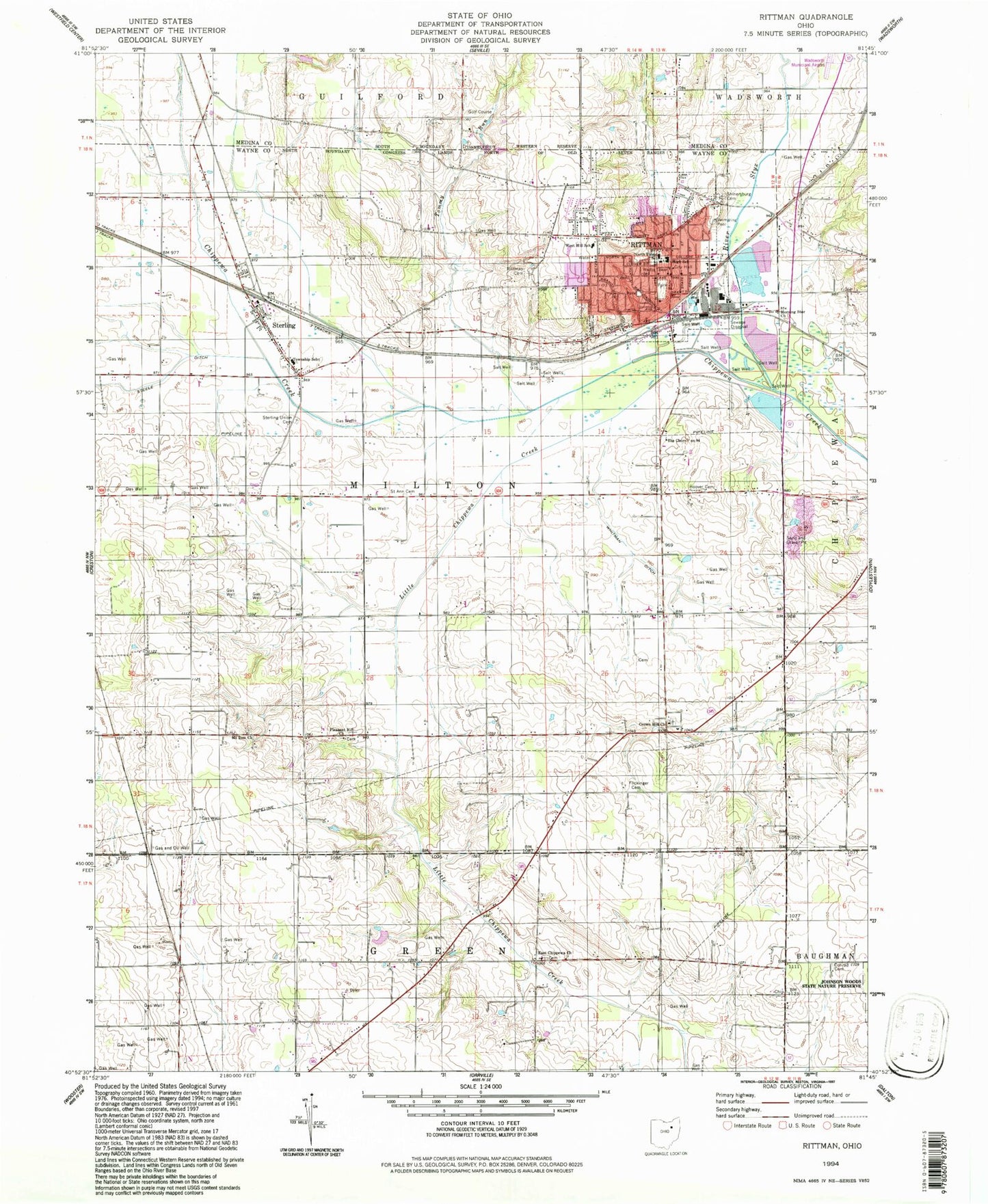
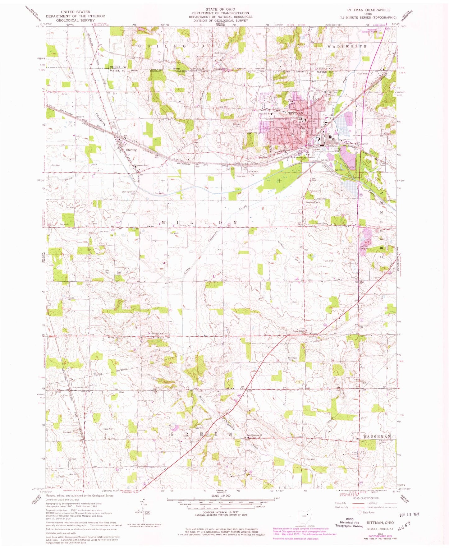
Classic USGS Rittman Ohio 7.5'x7.5' Topo Map
Couldn't load pickup availability
Historical USGS topographic quad map of Rittman in the state of Ohio. Map scale may vary for some years, but is generally around 1:24,000. Print size is approximately 24" x 27"
This quadrangle is in the following counties: Medina, Wayne.
The map contains contour lines, roads, rivers, towns, and lakes. Printed on high-quality waterproof paper with UV fade-resistant inks, and shipped rolled.
Contains the following named places: Acker Farms, Amwell Post Office, Apostolic Christian Cemetery, Bauman Orchards, Beech Grove Farm, Chippewa Conservation District Structure VII C Dam, Chippewa Creek Watershed 4a Reservoir, Chippewa Valley Angus Farm, Chippewa Watershed Conservation District Structure Reservoir, Church of Christ, City of Rittman, Clove Hill Farm, Conrad Cemetery, Crestland Farms, Crossroads Dairy, Crown Hill Mennonite Cemetery, Crown Hill Mennonite Church, Douglas, East Chippewa Church of the Brethren, Elindale Farms, Elm Farm, Enterprise Farm, Evergreen Farm, Excelsior Farm, Fairview Farm, First Baptist Church, Flickinger Cemetery, Fountain Spring Farm, Grace Brethren Church, Gresser Farm, Highland Farm, Hilty Field, Hoover Cemetery, Horst Farms, Johnsons Corners, L and R Dairy Farm, Little Chippewa Creek, Locas Lane Farm, Maple Grove Farm, Maple Hill Farm, Markley Farm Airport, Marty Farms, Milton Station, Morning Star Church, Mount Zion Cemetery, Mount Zion Church, North Street Elementary School, Oakland Farm, Old Dunkard Cemetery, Orange Lane Farm, Pleasant Hill Mennonite Cemetery, Pleasant Hill Mennonite Church, Pleasant Vale Dairy, Prospect Farm, Ramsier Farms, Rawiga Country Club Lake, Rawiga Country Club Lake Dam, Republican Farm, Riggenbach Farm, Rittman, Rittman Cemetery, Rittman City Hall, Rittman Community Church, Rittman Emergency Medical Services, Rittman Fire Department, Rittman High School, Rittman Middle School, Rittman Police Department, Rittman Post Office, Russell Station, Saint Ann Cemetery, Saint Anne Catholic Church, School Number 3, School Number 4, School Number 5, School Number 6, School Number 7, School Number 8, Shinersburg Cemetery, Smithville Church, Steele Ditch, Steiner Farm, Steinhurst Farm, Sterling, Sterling Census Designated Place, Sterling Elementary School, Sterling Fire District, Sterling Heights Dairy Farm, Sterling Union Cemetery, Stine View Dairy, Stoller's Organic Dairy, Styx River, Sugar Bridge Farms, Swan Meadow Farm, The Church on 94, Tommy Run, Township of Milton, Union Church, West Hill Elementary School, Wheatland Farm, Whitman Ditch, Zollinger Construction and Debris Landfill, Zuber Pond, Zuber Pond Dam, ZIP Codes: 44270, 44276