MyTopo
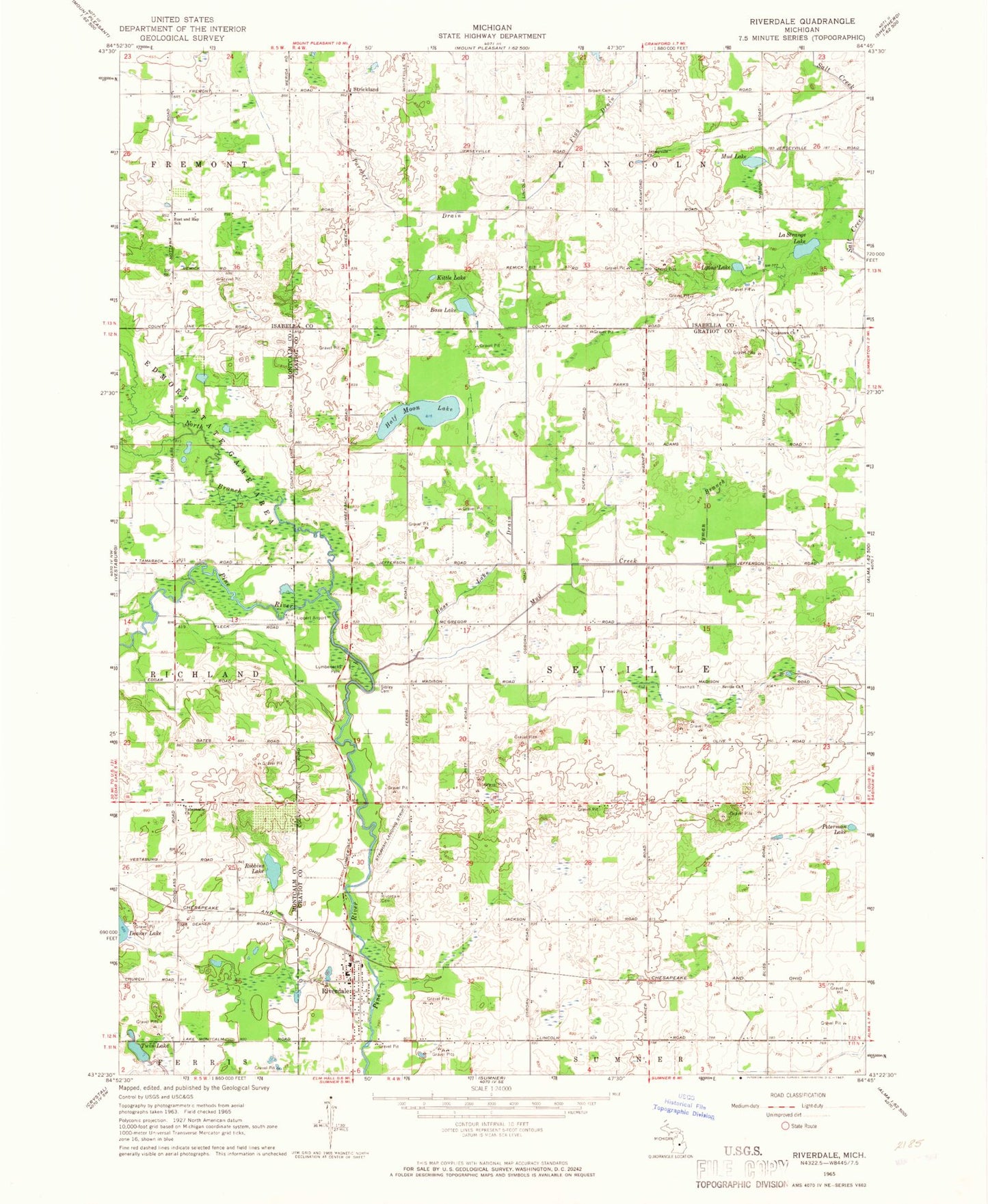
Classic USGS Riverdale Michigan 7.5'x7.5' Topo Map
Couldn't load pickup availability
Historical USGS topographic quad map of Riverdale in the state of Michigan. Map scale may vary for some years, but is generally around 1:24,000. Print size is approximately 24" x 27"
This quadrangle is in the following counties: Gratiot, Isabella, Montcalm.
The map contains contour lines, roads, rivers, towns, and lakes. Printed on high-quality waterproof paper with UV fade-resistant inks, and shipped rolled.
Contains the following named places: Bass Lake, Bass Lake Drain, Beaver Creek Post Office, Brown Cemetery, Half Moon Lake, Half Moon Lake Campground, Hamp Airport, Irishtown Cemetery, Irishtown Church, Jerseyville Church, Jerseyville Post Office, Kittle Lake, LaStrange Lake, Lighthouse Baptist Church, Lincoln Road United Methodist Church, Lumberjack Park, Lumberjack Park Historical Marker, Lyons Lake, Mud Creek, Mud Lake, North Branch Pine River, Parcher Drain, Peterman Lake, Riverdale, Riverdale Cemetery, Riverdale Census Designated Place, Riverdale Post Office, Riverdale Station, Robbins Lake, Rust and Hay School, Seville Cemetery, Seville Church, Sibley Cemetery, Strickland, Strickland Baptist Church, Strickland Post Office, Tabernacle Church, Timber Country Mobile Home Park, Township of Seville, Twin Lake, Tyman Branch, ZIP Codes: 48832, 48877