MyTopo
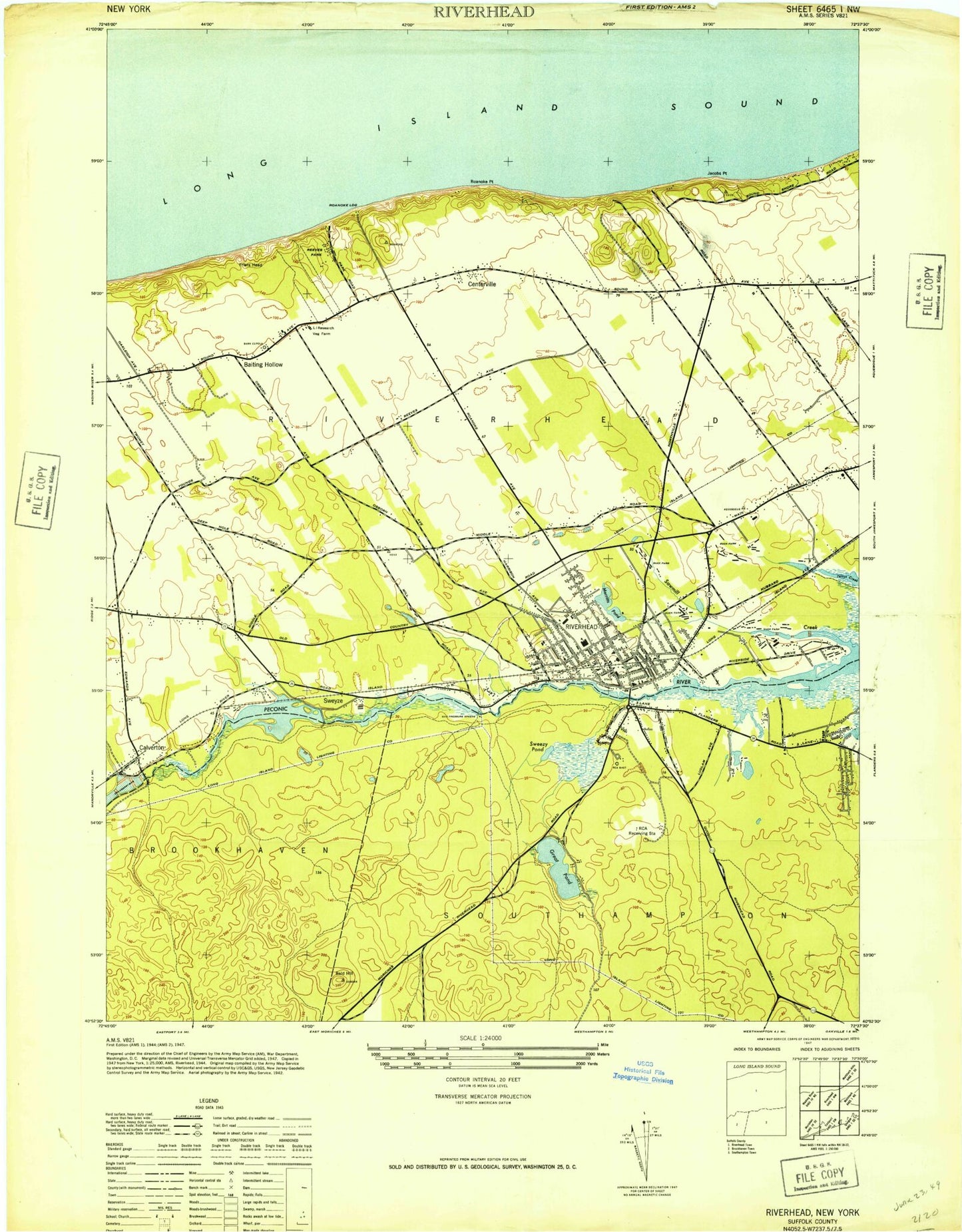
Classic USGS Riverhead New York 7.5'x7.5' Topo Map
Couldn't load pickup availability
Historical USGS topographic quad map of Riverhead in the state of New York. Typical map scale is 1:24,000, but may vary for certain years, if available. Print size: 24" x 27"
This quadrangle is in the following counties: Suffolk.
The map contains contour lines, roads, rivers, towns, and lakes. Printed on high-quality waterproof paper with UV fade-resistant inks, and shipped rolled.
Contains the following named places: Aquebogue, Baiting Hollow, Bald Hill, Calvary Baptist Church, Calverton, Calverton School (historical), Cedar Pond, Cedar Swamp, Centerville, Peconic Bay Medical Center, Cheney Pond, Colonels Island, Jacobs Point, Little River, Mercy High School, Merritts Pond, Peconic Lake, Reeves Park, Riverhead, Riverhead Cemetery, Roanoke Church, Roanoke Point, Roanoke School (historical), Saint Isidore's Roman Catholic Church, Saint John the Evangelist Cemetery, Sawmill Creek, Swan Pond, Sweezy Pond, Sweyze, Villa Immaculate, Wildwood Lake, Pine Valley, Roanoke Landing, WHRF, Roanoke Point Shoal, Suffolk County, Friars Head, Riverhead Raceway, WRIV-AM (Riverhead), WRIV-AM (Riverhead), WRHD-AM (Riverhead), Talmage Field, Northampton, Riverside, Indian Island County Park, Riley Avenue Elementary School, Cherry Creek Golf Links, Long Island National Golf Club, Aquebogue Elementary School, Indian Island Golf Course, New York State Research Farm, Baiting Hollow Cemetery, The Fox Hill Golf and Country Club, Riverhead High School, Riverhead Middle School, H B Ward Technical Center, Saint Isidore's School, Pulaski Street School, Saint David's Episcopal Day School, Roanoke Avenue School, Saint John The Evangelist School, Esat End Christian Academy, Galilee Church of God in Christ, Goodwill African Methodist Episcopal Zion Church, Riverhead United Methodist Church, Temple Israel of Riverhead, First Congregational Church, Saint John The Evangelist Roman Catholic Church, Grace Episcopal Church, The Church of Jesus Christ of Latter Day Saints, Saint John The Baptist Ukrainian Church, Emmanuel Baptist Church, Church of the Harvest, Tanger Factory Outlet Center, Riverhead Station, Sandy Pond Golf Course, Riverhead Post Office, Suffolk County Jail, Evan K Griffing Center, Riverhead Town Hall, Baiting Hollow Congregational Church, Baiting Hollow Census Designated Place, Northampton Census Designated Place, Riverhead Census Designated Place, Riverside Census Designated Place, Lakewood Park, Glenwood Village, Foxwood Village, Millbrook Mobile Home Park, Oakland Ridge Mobile Home Park, Church of Christ, First Assembly of God Church, First Baptist Church, First Fruit Church of God, Friendship Baptist Church, Iglesia La Nueva Jerusalem, Living Water Full Gospel Church, Seventh Day Adventist Church, Wells Farm, Anderson Farms, Briermere Farms, Edward Zilnicki Farms, Philip A Schmitt And Son Farms, Peace And Plenty Horse Farm, Fox Hollow Farm, Abbess Farm, Stakey's Pumpkin Farm, Helens Greenhouses And Flower Farm, Tanger Outlet Center Shopping Center, Roanoke Vineyards, Schneider Vineyards, Flanders Drive-In (historical), Calverton Pit, Calverton Post Office, Aquebogue Post Office, All Saints Greek Orthodox Church, Our Redeemer Lutheran Church, Salvation Army, Word of Life Ministries, Riverhead Sewage Treatment Plant, Baiting Hollow Free Library, Riverhead Free Library, Riverside Marina, Treasure Cove Resort Marina, Riverhead Armory, Riverhead Yacht Club, Riverhead Moose Lodge 1742 Marina and Yacht Club, Friar's Head Golf Course, Hampton Hills Golf and Country Club, Olde Vine Golf Club, The Woods at Cherry Creek, Riverhead Care Center, Riverhead Fire Department Headquarters, Flanders Northampton Volunteer Ambulance Service, Riverhead Fire Department Station 1, Riverhead Fire Department Station 3, Riverhead Fire Department Station 2, Riverhead Police Department


