MyTopo
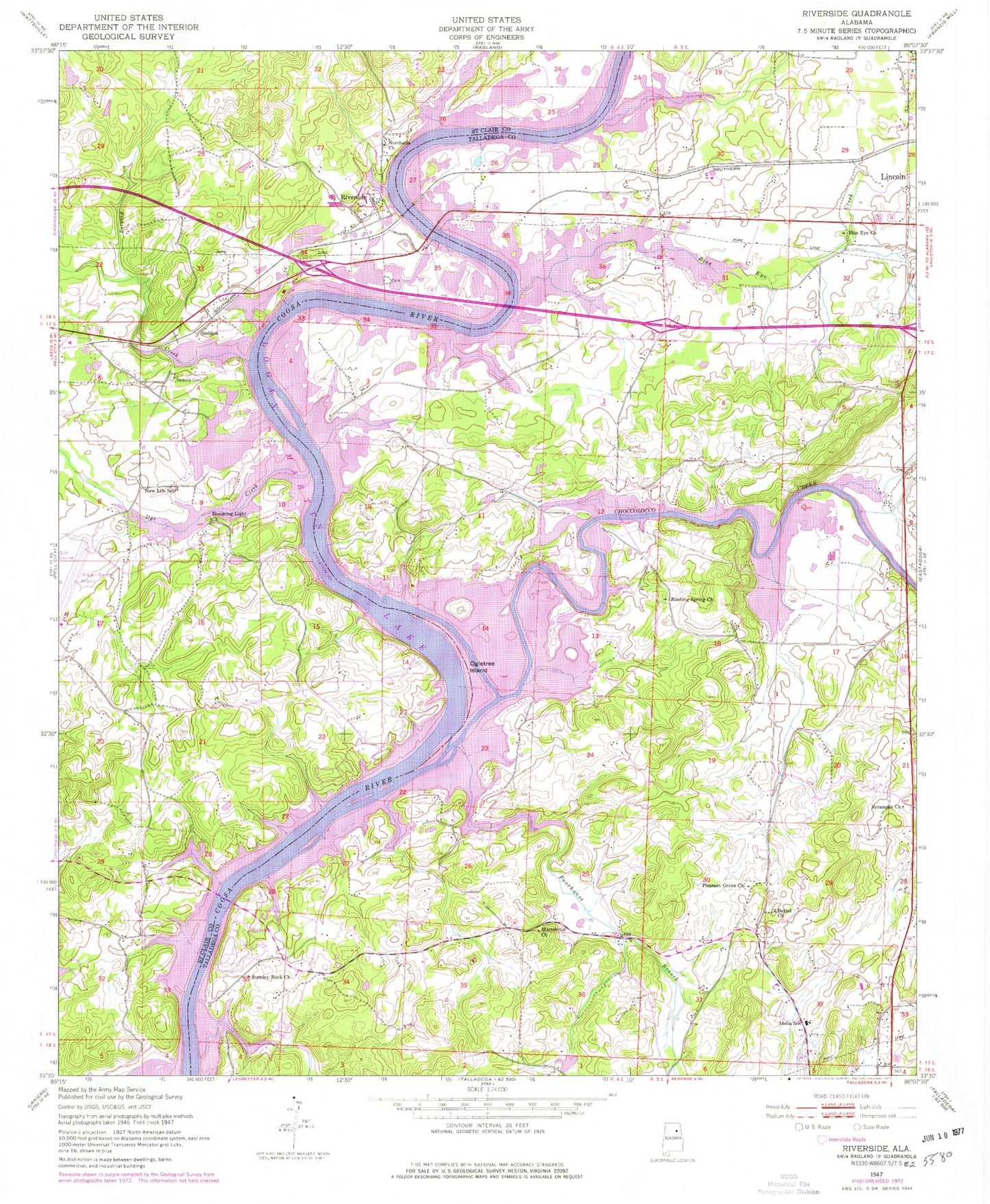
Classic USGS Riverside Alabama 7.5'x7.5' Topo Map
Couldn't load pickup availability
Historical USGS topographic quad map of Riverside in the state of Alabama. Map scale may vary for some years, but is generally around 1:24,000. Print size is approximately 24" x 27"
This quadrangle is in the following counties: St. Clair, Talladega.
The map contains contour lines, roads, rivers, towns, and lakes. Printed on high-quality waterproof paper with UV fade-resistant inks, and shipped rolled.
Contains the following named places: Averys Store, Bethel Church, Binghamtown, Blooming Light Church, Blue Eye, Blue Eye Baptist Church, Blue Eye Creek, Blue Eye Spring, Blue Spring Branch, Buchanan Ferry, Camelot Plateau, Camp Pleasure, Cape Choccolocco, Capri Islands, Charles R Drew Middle School, Choccolocco Creek, Choccolocco Estates, Choccolocco Shoals, City of Riverside, Clear Springs, Clear Springs Marina, Cogswell Avenue Industrial Park, Colemans Chapel, Collins Ferry, Colman Ferry, Colony, Crawfish Pond, Davis Acres, Dunrowin, Dye Creek, Embry Crossroads, Enchanted Hills, England Isle, Eureka, Eureka Bridge, Eureka Post Office, Eureka Shores, Eureka United Methodist Church, Fishermans Wharf Marina, Fishing Creek, Flynns Spring, Franklin Gin, Frog Bottom, Halls Ferry, Hamilton, Holy Hill Church of Our Lord Jesus Christ, Howells Cove, Idalia Elementary School, Ilamo, John Hollis Bankhead Bridge, Knoxs Landing, Lake Wancoole, Lincoln Fire and Rescue Department Station 2, Lincoln Fire and Rescue Honda Plant, Lock Five, Logan Martin Lake Estates, Macedonia Baptist Church, Mays Bend, Mays Cemetery, McCellan Cemetery, Morning Star School, New Life School, Northside Church, Ogletree Island, Pell City Fire Department, Pine Grove Missionary Baptist Church, Pleasant Grove, Pleasant Grove Baptist Church, Pleasant Hill Methodist Church, Poorhouse Branch, Poorhouse Junction, Ragland Mountain, River Terrace Estates, Riverside, Riverside Fire and Rescue, Riverside Police Department, Riverside Post Office, Robert Chapel Cemetery, Robertsons Island, Rogers Mill Station, Rushing Spring Church, Rushing Springs, Seddon, Seddon Cemetery, Sheep Island, Showboat Camp, St Clair County Airport, Stemley, Stemley Baptist Church, Stemley Bridge, Stemley Cove, Stemley United Methodist Church, Stemley Volunteer Fire Department Station 1, Stemley Volunteer Fire Department Station 2, Sycamore Baptist Church, Sycamore School, Truss Ferry, Truss Mill, Truss School, Walkers Family Cemetery, Wancoole Dam, Wendy Wood, West Branch Fishing Creek, Windsong Island, ZIP Code: 35135