MyTopo
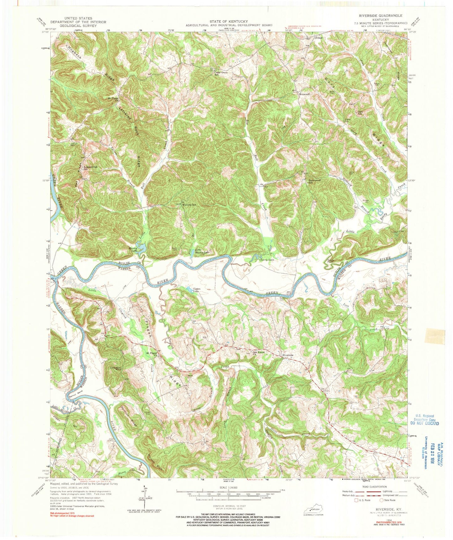
Classic USGS Riverside Kentucky 7.5'x7.5' Topo Map
Couldn't load pickup availability
Historical USGS topographic quad map of Riverside in the state of Kentucky. Map scale may vary for some years, but is generally around 1:24,000. Print size is approximately 24" x 27"
This quadrangle is in the following counties: Butler, Warren.
The map contains contour lines, roads, rivers, towns, and lakes. Printed on high-quality waterproof paper with UV fade-resistant inks, and shipped rolled.
Contains the following named places: Barren River, Betsy Branch, Big Bull Creek, Cedar Grove School, Cherry Lake, Clark Landing, Claylick Creek, Fanny Rone Cemetery, Finney Cemetery, Flat Branch, Flippo Hill, Fourth District Volunteer Fire Department Station 2, Gabbard Branch, Gary Creek, Gary Ridge, Gary School, Grant Phelps Cemetery, Greencastle Division, Greenwood, Greenwood School, Hogback Ridge, Horsemill, Jetson, Jetson Division, Jolertown Ridge, Jones Cemetery, Leonard Oak School, Lettered Rock Ridge, Little Barn Knob, Little Bull Creek, Little Claylick Creek, Little Martin Lake, Little Muddy Creek, Little Reedy Creek, Long Branch, Lost Creek, Marcum Bluff, Martin Lake, Martins Store, Maxey Creek, Millshed, Mount Pisgah, Mount Pisgah Church, Mount Union Church, Noah Johnson Cemetery, Nudger Cemetery, Oak Forest Church, Pea Ridge, Peyton Phelps Cemetery, Phelps Cemetery, Pisgah Ridge, Reedy Point, Riverside, Roan Family Cemetery, Roans Knob, Sproul Bend, Sprouse Ridge, Stone Creek, Threlkel Cemetery, Upton Lake, Waverly School, White Cemetery