MyTopo
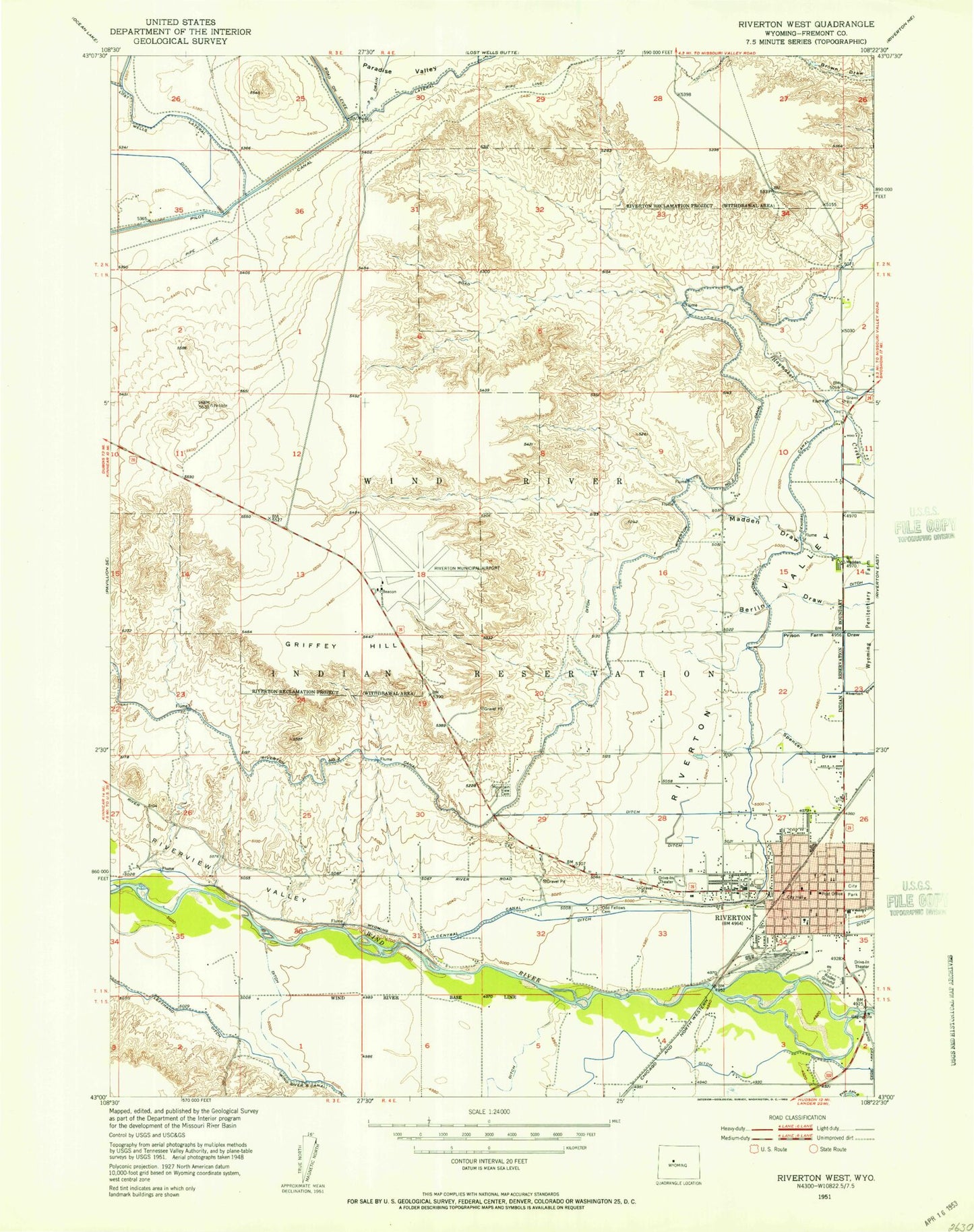
Classic USGS Riverton West Wyoming 7.5'x7.5' Topo Map
Couldn't load pickup availability
Historical USGS topographic quad map of Riverton West in the state of Wyoming. Map scale may vary for some years, but is generally around 1:24,000. Print size is approximately 24" x 27"
This quadrangle is in the following counties: Fremont.
The map contains contour lines, roads, rivers, towns, and lakes. Printed on high-quality waterproof paper with UV fade-resistant inks, and shipped rolled.
Contains the following named places: Ashgrove Elementary School, Ashgrove School, Berlin Draw, Career Center School, City of Riverton, Crusher Number 1-35 Mine, Fremont County Emergency Medical Services, Fremont County Fire Protection District, Fremont County Fire Protection District Battalion 8 Midvale Station 2, Fremont County Sheriff's Office - Riverton, Fremont Jade Quarry, Homestead Living Hospital, Jackson Elementary School, Jefferson School, Lincoln School, Mountain View Cemetery, Odd Fellows Cemetery, Riverton, Riverton Acid Plant Mine, Riverton Airport Pit, Riverton City Police Department, Riverton Country Club, Riverton Fire Department, Riverton High School, Riverton Memorial Hospital, Riverton Memorial Hospital Heliport, Riverton Middle School, Riverton Pit, Riverton Post Office, Riverton Regional Airport, Riverton Regional Airport Fire Station, Riverton Volunteer Fire Department, Riverview Valley, Wyoming Central Canal