MyTopo
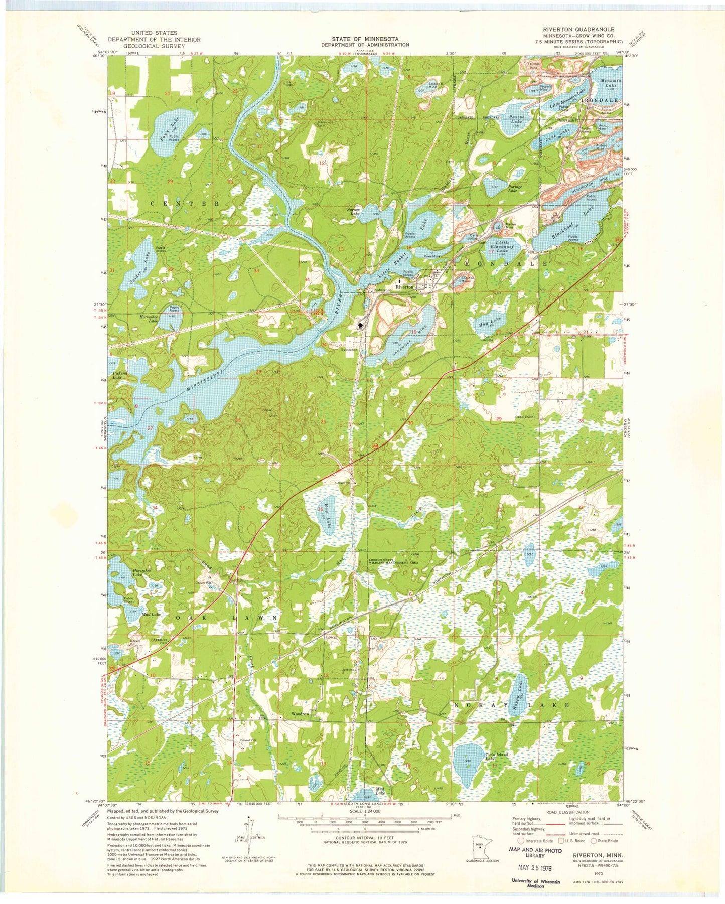
Classic USGS Riverton Minnesota 7.5'x7.5' Topo Map
Couldn't load pickup availability
Historical USGS topographic quad map of Riverton in the state of Minnesota. Map scale may vary for some years, but is generally around 1:24,000. Print size is approximately 24" x 27"
This quadrangle is in the following counties: Crow Wing.
The map contains contour lines, roads, rivers, towns, and lakes. Printed on high-quality waterproof paper with UV fade-resistant inks, and shipped rolled.
Contains the following named places: Alstead Mine, Arco Mine, Blackhoof Lake, Carlson Mine, City of Riverton, Crow Wing County, Fawn Lake, Hay Creek, Hay Lake, Homecroft, Hoppy Lake, Horseshoe Lake, Huntington Mine, Ironton Creek, June Lake, Little Blackhoof Lake, Little Menomin Lake, Little Rabbit Lake, Loerch, Loerch Post Office, Loerch State Wildlife Management Area, Mahnomen Number Two Mine, Mallen Mine, Mud Lake, Pascoe Lake, Pascoe Lake Dam, Portage Lake, Rabbit River, Riverton, Riverton Post Office, Rowe Mine, Sagamore Mine, Sand Creek, Section Six Mine, Silver Lake School, Snoshoe Mine, Spider Lake, Spruce Lake, Township of Center, Township of Irondale, Township of Oak Lawn, Twin Island Lake, Virginia Mine, Woodrow, Woodrow Post Office, Woods Post Office, ZIP Code: 56455