MyTopo
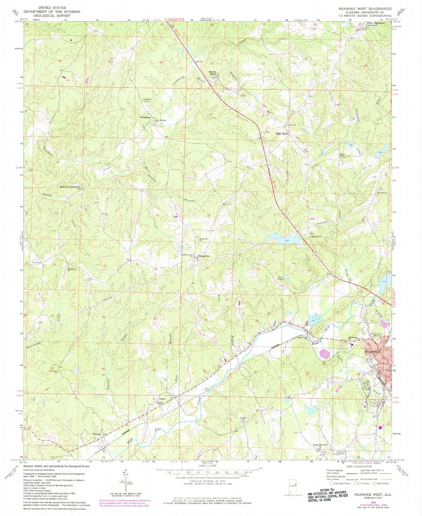
Classic USGS Roanoke West Alabama 7.5'x7.5' Topo Map
Couldn't load pickup availability
Historical USGS topographic quad map of Roanoke West in the state of Alabama. Map scale may vary for some years, but is generally around 1:24,000. Print size is approximately 24" x 27"
This quadrangle is in the following counties: Randolph.
The map contains contour lines, roads, rivers, towns, and lakes. Printed on high-quality waterproof paper with UV fade-resistant inks, and shipped rolled.
Contains the following named places: Acts Church, Boatner Creek, Broughton, Camp Heard, Canaan Missionary Baptist Church, Cornhouse, Crystal Lake, Dickert, El Bethel Church, First Christian Church, Friendship, Friendship Baptist Church, Friendship Cemetery, Gaston Branch, Graves Creek, Griswold Creek, Harmon Crossroads, High Pine Creek Lake Number 2, High Pine Creek Lake Number 4, High Pine Creek Lake Number 5, High Pine Creek Lake Number 6, High Pine Creek Watershed Dam Number 2, High Pine Creek Watershed Dam Number 4, High Pine Creek Watershed Dam Number 5, High Pine Creek Watershed Dam Number 6, Horton Shoal, Horton Shoal Branch, Jack Branch, Jones Creek, Liles Branch, Lookout Tower, McMurray Dam, McMurray Lake, Mission Mount Bethel Church, Mount Olive, Mount Olive Church, Mount Pisgah Baptist Church, Mount Zion, Mount Zion Church, Peavy, Pleasant Grove Baptist Church, Radney Chapel, Randolph Medical Center, Riverside Church, Roanoke Church of Christ, Roanoke City Lake, Roanoke City Reservoir Dam, Roanoke County Club, Roanoke Fire Department, Roanoke Sewage Disposal Plant, Rock Springs Church, Rock Stand, Rock Stand Christian Church, Rock Stand Volunteer Fire Department, Rocky Mount Primitive Baptist Church, Shady Creek Church, The Fire Baptizes Believers Church, Town Creek, Union Hill Cemetery, Union Hill Church, WELR-FM (Roanoke), White Signboard Crossroad, Whites Chapel, Zion Rest Church


