MyTopo
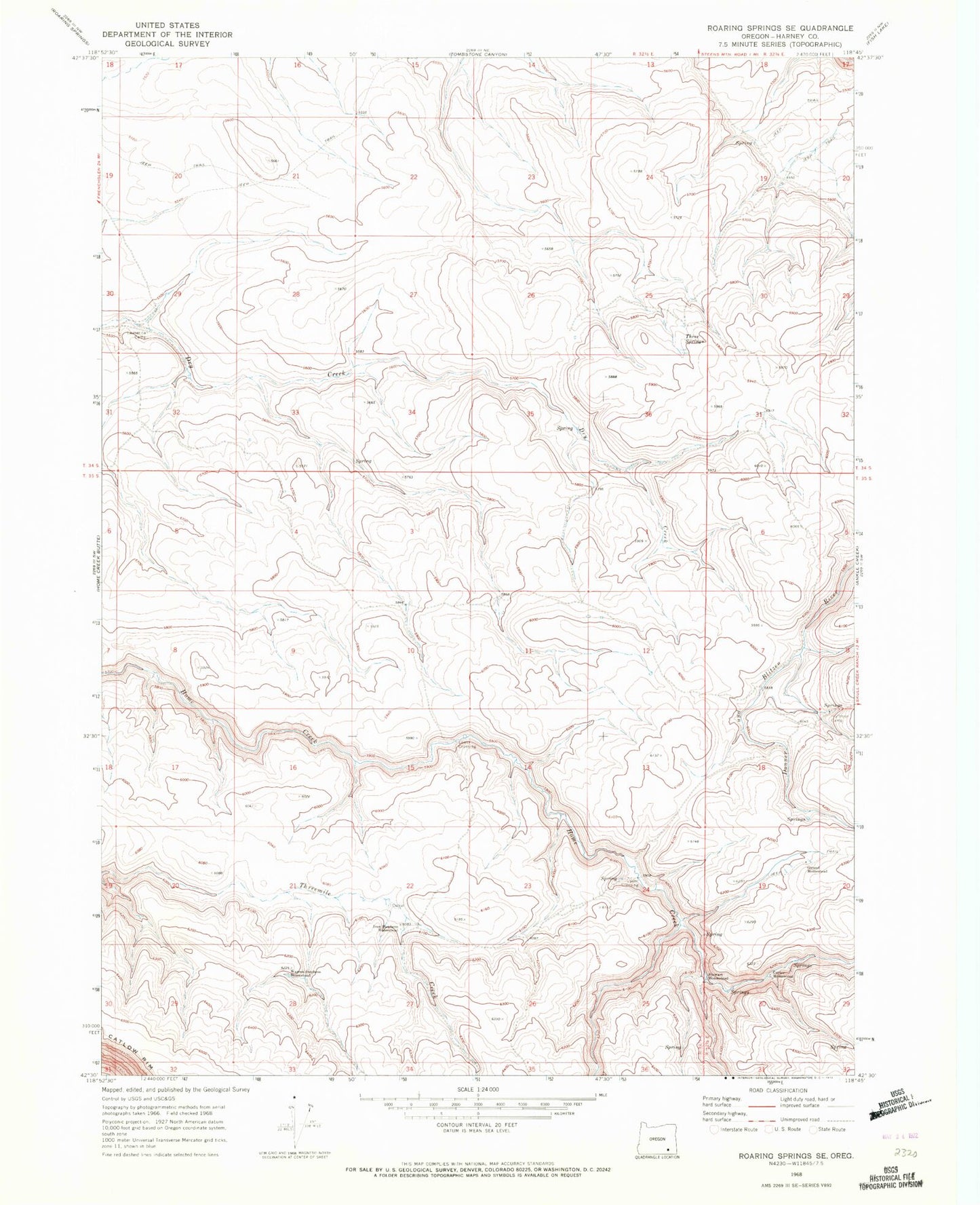
Classic USGS Roaring Springs SE Oregon 7.5'x7.5' Topo Map
Regular price
$16.95
Regular price
Sale price
$16.95
Unit price
per
Couldn't load pickup availability
Historical USGS topographic quad map of Roaring Springs SE in the state of Oregon. Map scale may vary for some years, but is generally around 1:24,000. Print size is approximately 24" x 27"
This quadrangle is in the following counties: Harney.
The map contains contour lines, roads, rivers, towns, and lakes. Printed on high-quality waterproof paper with UV fade-resistant inks, and shipped rolled.
Contains the following named places: Carter Homestead, Girand Homestead, Huffman Camp, Iven Stephens Homestead, Lauserica Camp, Lower Crossing, Stewart Homestead, Three Springs, Upper Crossing, Warren Stephens Homestead