MyTopo
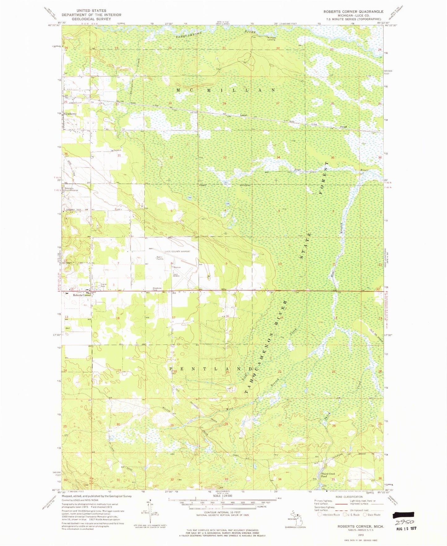
Classic USGS Roberts Corner Michigan 7.5'x7.5' Topo Map
Couldn't load pickup availability
Historical USGS topographic quad map of Roberts Corner in the state of Michigan. Map scale may vary for some years, but is generally around 1:24,000. Print size is approximately 24" x 27"
This quadrangle is in the following counties: Luce.
The map contains contour lines, roads, rivers, towns, and lakes. Printed on high-quality waterproof paper with UV fade-resistant inks, and shipped rolled.
Contains the following named places: Big Ditch, First Creek, Great Northern Trailer Court, Lencel, Lencel Station, Living Water Assembly of God Church, Luce County Airport, McPhees Landing, Roberts Corner, Sault Tribe Community Health Center, Third Creek, Third Creek Pond, Thirtynine Creek, Township of Pentland, West Branch Sage River