MyTopo
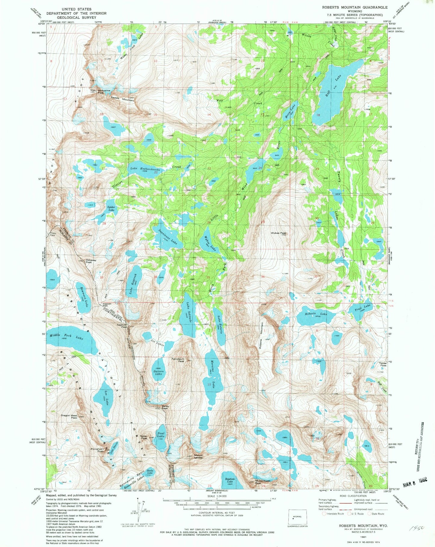
USGS Classic Roberts Mountain Wyoming 7.5'x7.5' Topo Map
Couldn't load pickup availability
Historical USGS topographic quad map of Roberts Mountain in the state of Wyoming. Scale: 1:24000. Print size: 24" x 27"
This quadrangle is in the following counties: Fremont, Sublette.
The map contains contour lines, roads, rivers, towns, lakes, and grids including latitude / longitude and UTM / MGRS. Printed on high-quality waterproof paper with UV fade-resistant inks.
Contains the following named places: Bewmark Lake, Dragon Head Peak, Entigo Creek, Fremont Trail, Glacier Creek, Lake Heebeecheeche, Ice Lakes, Kagevah Pass, Kagevah Peak, Lake Kagevah, Mount Lander, Lee Lake, Windy Ridge, Middle Fork Lake, Moraine Lake, Movo Lake, Nylon Peak, Musembeah Peak, Lake Polaris, Pronghorn Peak, Raft Lake, Roberts Lake, Roberts Mountain, Lake Solitude, Tepee Pass, Trail Lake, Twenty Lakes Creek, Baily Peak, Wilson Creek, Wolf Creek, Wolverine Peak, Wykee Lake, Wykee Peak, Petroleum Peak, Spider Lake, Darren Lake, Noel Lake, Lake Donna, Saddle Mountain, Shelia Lake, Wind River Roadless Area, Odyssey Peak, Sonnicant Lake