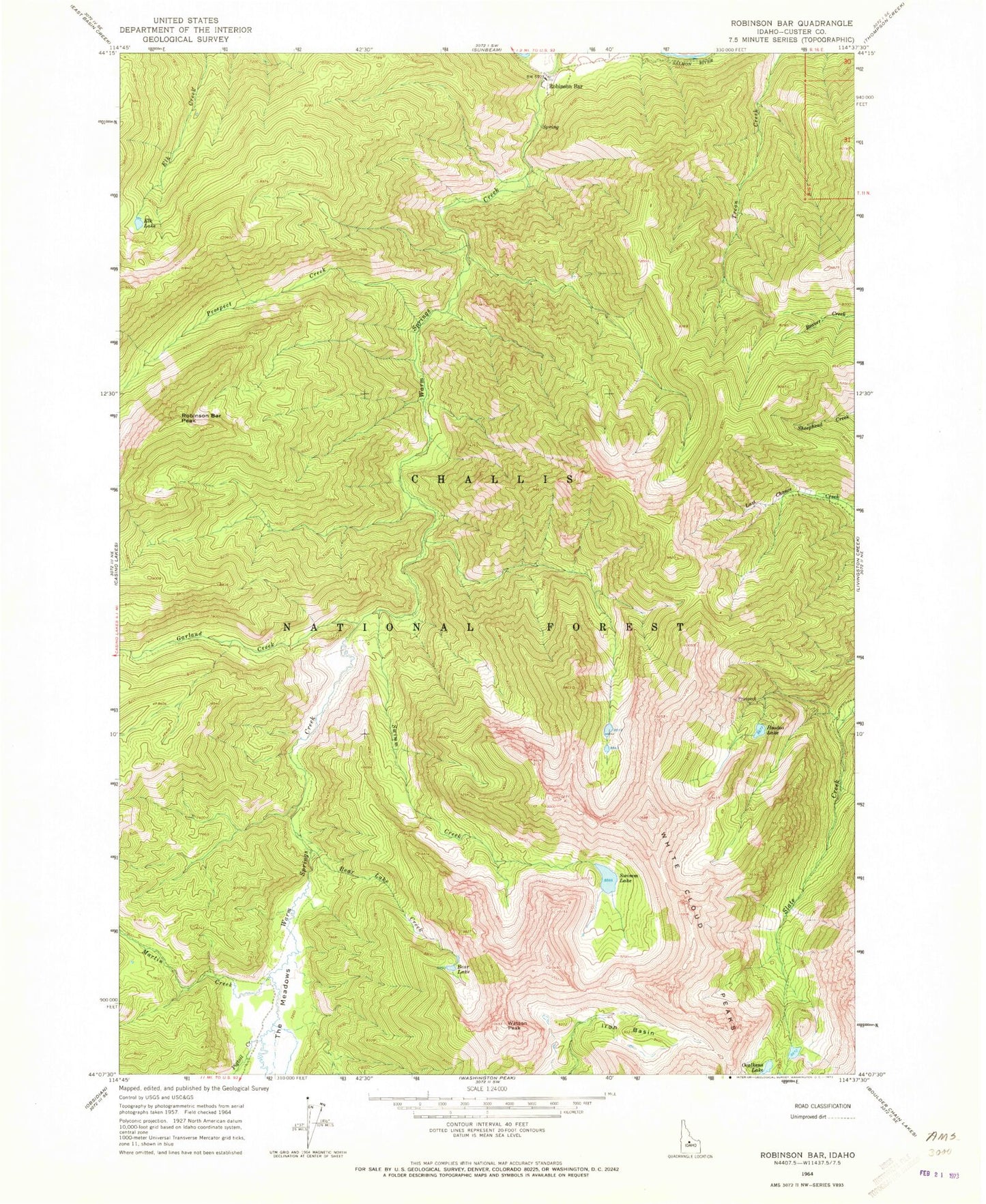
MyTopo
Classic USGS Robinson Bar Idaho 7.5'x7.5' Topo Map
Regular price
$16.95
Regular price
Sale price
$16.95
Unit price
per
Couldn't load pickup availability
Historical USGS topographic quad map of Robinson Bar in the state of Idaho. Typical map scale is 1:24,000, but may vary for certain years, if available. Print size: 24" x 27"
This quadrangle is in the following counties: Custer.
The map contains contour lines, roads, rivers, towns, and lakes. Printed on high-quality waterproof paper with UV fade-resistant inks, and shipped rolled.
Contains the following named places: Robinson Bar Peak, Bear Lake, Bear Lake Creek, Garland Creek, Hoodoo Lake, Iron Basin, Martin Creek, Pigtail Creek, Prospect Creek, Swim Lake, The Meadows, Watson Peak, Robinson Bar, Slate Creek Hot Spring, Swim Creek, White Clouds Wilderness