MyTopo
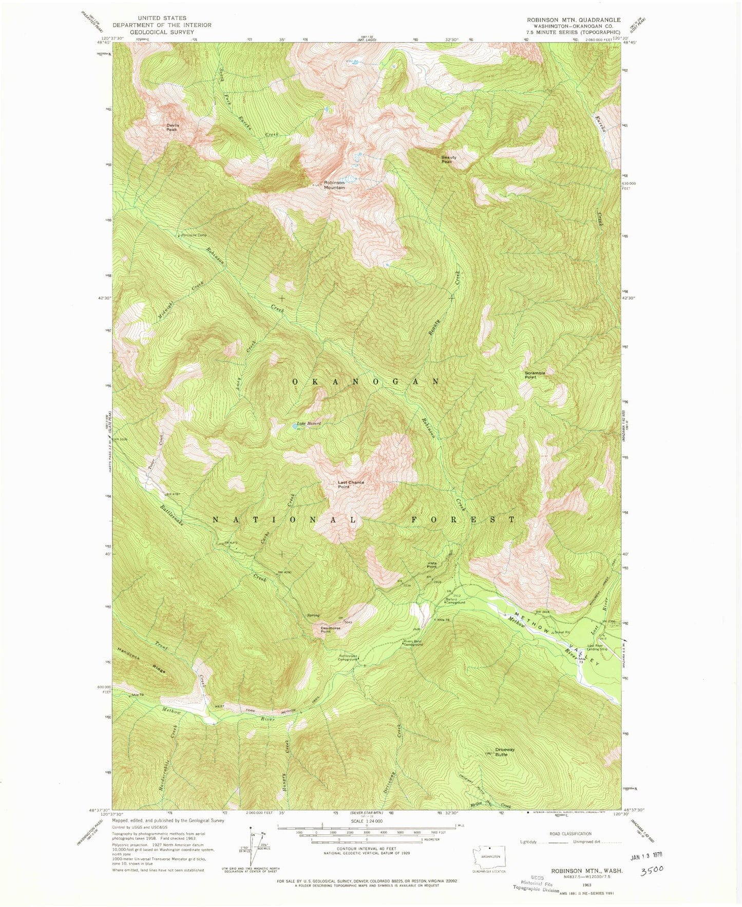
Classic USGS Robinson Mountain Washington 7.5'x7.5' Topo Map
Couldn't load pickup availability
Historical USGS topographic quad map of Robinson Mountain in the state of Washington. Typical map scale is 1:24,000, but may vary for certain years, if available. Print size: 24" x 27"
This quadrangle is in the following counties: Okanogan.
The map contains contour lines, roads, rivers, towns, and lakes. Printed on high-quality waterproof paper with UV fade-resistant inks, and shipped rolled.
Contains the following named places: Amey Creek, Ballard Campground, Beauty Creek, Beauty Peak, Cache Creek, Deadhorse Point, Devils Peak, Driveway Butte, Driveway Creek, Hard Scrabble Creek, Lake Hazard, Hungry Creek, Last Chance Point, Lost River, Midnight Creek, Porcupine Camp, Rattlesnake Campground, Rivers Bend Campground, Robinson Creek, Robinson Mountain, Scramble Point, Tozier Creek, Trout Creek, Vista Point, Monument Creek Trailhead, Robinson Creek Trailhead, Robinson Peak, Robinson (historical), Hardscrabble Creek, Lost River Resort Airport