MyTopo
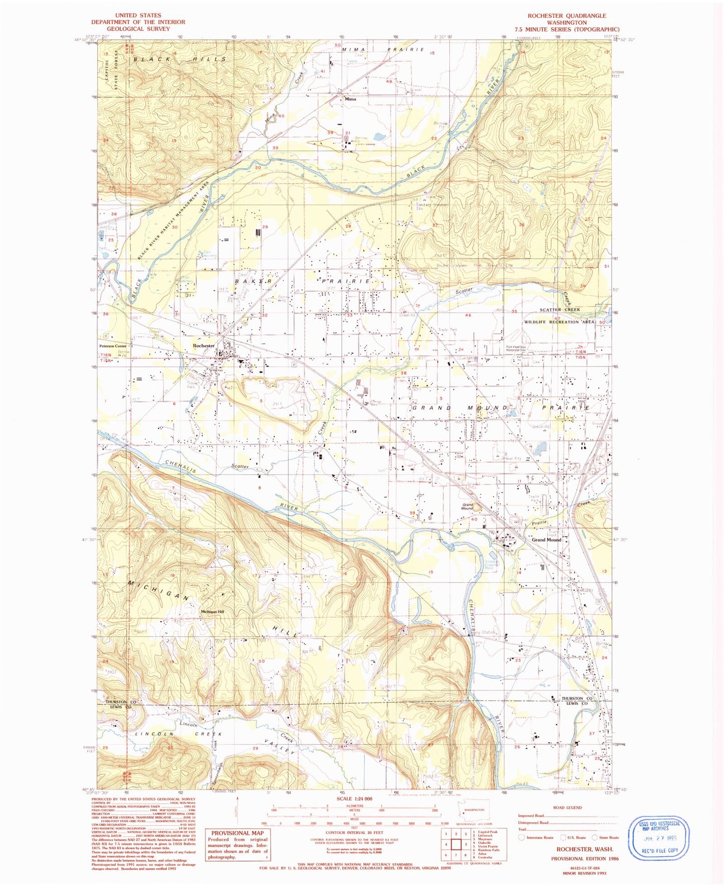
Classic USGS Rochester Washington 7.5'x7.5' Topo Map
Couldn't load pickup availability
Historical USGS topographic quad map of Rochester in the state of Washington. Typical map scale is 1:24,000, but may vary for certain years, if available. Print size: 24" x 27"
This quadrangle is in the following counties: Lewis, Thurston.
The map contains contour lines, roads, rivers, towns, and lakes. Printed on high-quality waterproof paper with UV fade-resistant inks, and shipped rolled.
Contains the following named places: Baker Prairie, Grand Mound Cemetery, Grand Mound State Game Reserve, Historical Marker Fort Henness Site, Prairie Creek, Scatter Creek, Sponenbergh Creek, Michigan Hill, Grand Mound, Black River Habitat Management Area, Essex, Helsing Junction, Michigan Hill, Mima, Peterson Corner, Mima Creek, Helsing Junction, Meadows, Grand Mound, Rochester, Dry Creek, Scatter Creek Wildlife Recreation Area, Rochester High School, Rochester Elementary School, Maple Lane High School, R & K Skyranch Airport, Grand Mound Elementary School, Ground Mound Middle School, Grand Mound Census Designated Place, Rochester Census Designated Place, Skatter Creek Airport (historical), Crossroads Foursquare Church, Rochester United Methodist Church, Rochester Life Assembly of God Church, The Church of Jesus Christ of Latter Day Saints, West Thurston Regional Fire Authority South Battalion Station 1 - 5 Michigan Hill, West Thurston Regional Fire Authority South Battalion Station 1 - 3 Rochester, West Thurston Regional Fire Authority South Battalion Station 1 - 1 Grand Mound, Rochester Post Office, Shaner Creek