MyTopo
Classic USGS Rochford South Dakota 7.5'x7.5' Topo Map
Couldn't load pickup availability
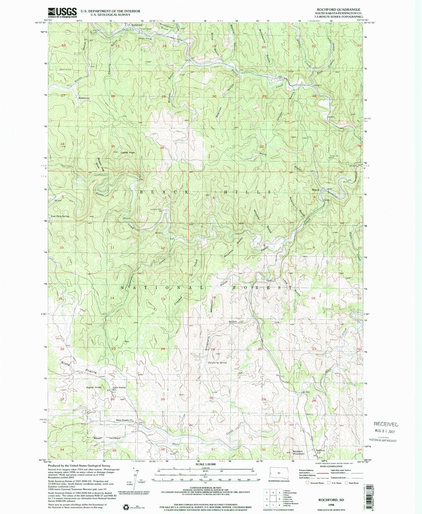
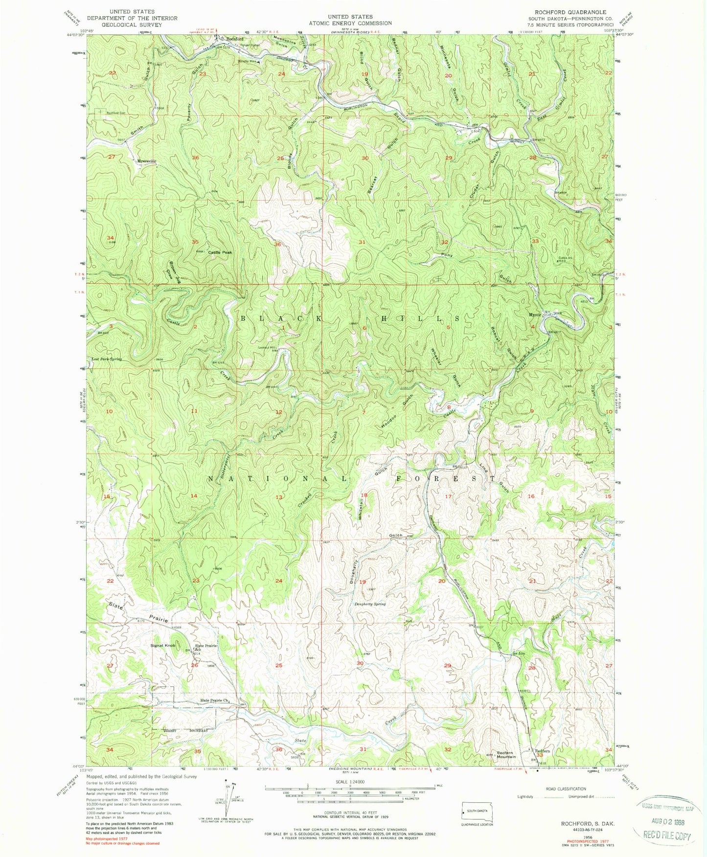
Historical USGS topographic quad map of Rochford in the state of South Dakota. Typical map scale is 1:24,000, but may vary for certain years, if available. Print size: 24" x 27"
This quadrangle is in the following counties: Pennington.
The map contains contour lines, roads, rivers, towns, and lakes. Printed on high-quality waterproof paper with UV fade-resistant inks, and shipped rolled.
Contains the following named places: Bearcat Gulch, Benner Gulch, Bittersweet Creek, Blind Gulch, Bloody Gulch, Bobcat Gulch, Brown Jug Draw, Castle Peak, Cluder Gulch, Crooked Creek, Cuttys Ark Mine, Dougherty Gulch, Dougherty Spring, East Gimlet Creek, Gimlet Creek, Hoodoo Gulch, Irish Gulch, Lind Gulch, Lost Park Spring, Minnesota Gulch, Moonshine Gulch, North Fork Castle Creek, Pony Gulch, Poverty Gulch, Redfern, Redfern Mountain, Rochford, Rochford Cemetery, Signal Knob, Silver Creek, Slate Prairie, Slate Prairie Church, Slate Prairie School, Smith Gulch, Standby Mine, Wheeler Gulch, Whitetail Gulch, Rimmer Ridge, Rockford Forest Service Facility, Castle Peak Campground, Fish and Hunter Siding (historical), Fairview (historical), Castleton (historical), Lookout Mill, Myersville, Mystic, Township of Rochford, Rochford Volunteer Fire Department