MyTopo
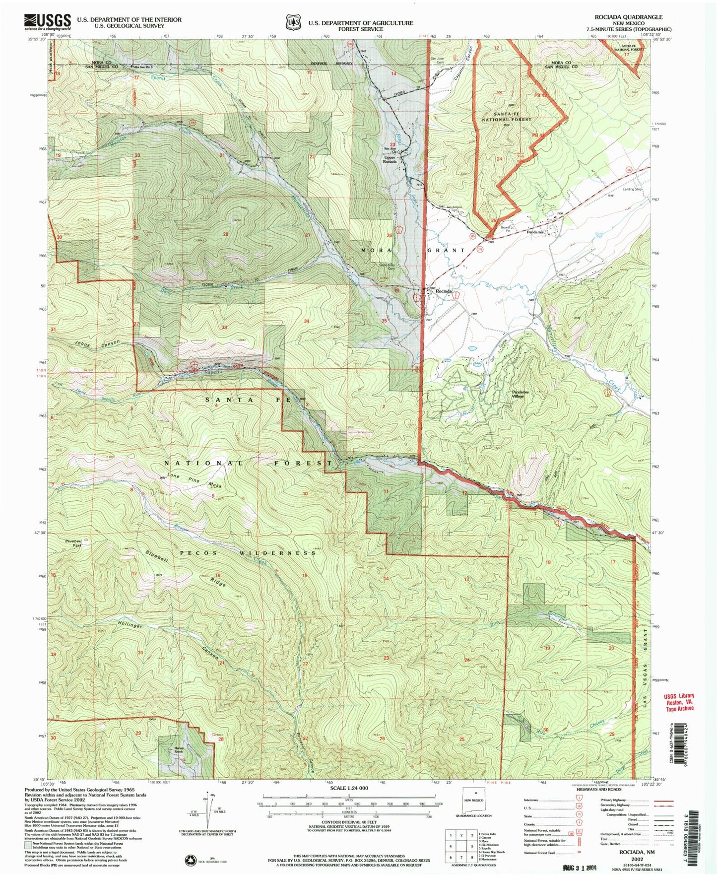
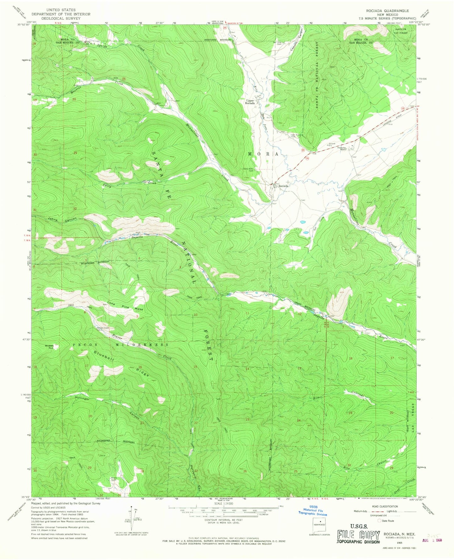
Classic USGS Rociada New Mexico 7.5'x7.5' Topo Map
Couldn't load pickup availability
Historical USGS topographic quad map of Rociada in the state of New Mexico. Typical map scale is 1:24,000, but may vary for certain years, if available. Print size: 24" x 27"
This quadrangle is in the following counties: Mora, San Miguel.
The map contains contour lines, roads, rivers, towns, and lakes. Printed on high-quality waterproof paper with UV fade-resistant inks, and shipped rolled.
Contains the following named places: Beaver Creek Cabin, Bluebell Park, Bluebell Ridge, Capulin Canyon, Cascade Canyon, Daily Creek, Harvey Ranch, Hollinger Canyon, Johns Canyon, Lone Pine Mesa, Maestas Creek, Pendaries Ranch (historical), Rito San Jose, Rociada, San Antonio Cemetery, San Jose Cemetery, Santo Nino Cemetery, Sparks Creek, Upper Rociada, Villa San Pio X, Left Hand Sapello River, Denton Canyon, Aspen Spring, San Jose Church, Pendaries Village, Refrigeration Springs, Loring Mine, Lepidolite Shaft, Pidlite Pegmatite, Rising Sun Mine, Smith Mine, Martinez Pit, Iron Hole Mine, Joe and Jenny Prospect, Joe Matt and Sam Adams Mine, Good Hope Mine, Azure Mine, Pendaries Grist Mill, Rociada Post Office, Las Vegas Ranger District, Sapello - Rociada Volunteer Fire Department Ambulance