MyTopo
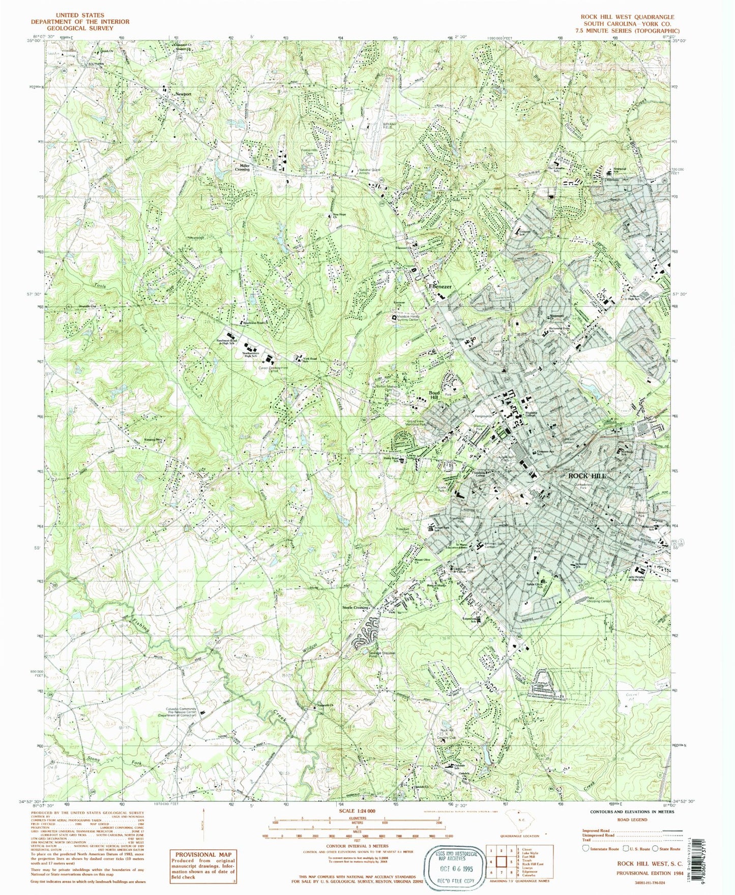
Classic USGS Rock Hill West South Carolina 7.5'x7.5' Topo Map
Couldn't load pickup availability
Historical USGS topographic quad map of Rock Hill West in the state of South Carolina. Map scale may vary for some years, but is generally around 1:24,000. Print size is approximately 24" x 27"
This quadrangle is in the following counties: York.
The map contains contour lines, roads, rivers, towns, and lakes. Printed on high-quality waterproof paper with UV fade-resistant inks, and shipped rolled.
Contains the following named places: Arcade Park, Armory Park, Avondale Terrace, Barber Memorial Cemetery, Beaty Estates, Beaty Shopping Center, Belair Acres, Belle Meade, Belleview Elementary School, Bethel United Methodist Church, Bethesda Fire Department Station 2, Botany Woods, Boyd Hill, Boyd Hill Baptist Church, Brookwood, Calvary Baptist Church, Camelot Woods, Carolina Surgical Center, Carroll Park, Castle Heights Junior High School, Catawba Community Pre-Release Center, Cato Estates, Cedar Forest Acres, Cedar Grove Park, Cedar Street Church of God, Cedarcrest Park, Center for Orthopaedic Surgery, Cherry Park, Cherry Park Centre Shopping Center, Cherry Plaza Shopping Center, Church Hill Heights, Church of Christ, Church of God, Church of God of Prophecy, Church of Our Lady and Saint Philip Neri, Church of Our Savior, City of Rock Hill, Clinton Junior College, Clinton Park, Clubside Estates, College Farms, College Park Baptist Church, Confederate Park, Country Club Estates, Country Oaks, Coventry Estates, Devonshire, East Side Shopping Center, Eastside Baptist Church, Ebenezer, Ebenezer Avenue Elementary School, Ebenezer Baptist Church, Ebenezer Church, Ebinport Elementary School, Edgewood Elementary School, Emmanuel Church, Emmanuel School, Emmett Scott Center, Emmett Scott Park, Emmett Scott School, Epworth United Methodist Church, Fairfield School, Fairlawn, Falls Landing, Fewell Park, Finley Road Elementary School, First Assembly of God Church, First Associate Reformed Presbyterian Church, First Baptist Church, First Calvary Baptist Church, First Church of the Nazarene, First Presbyterian Church, First Wesleyan Church, Flint Hill, Forest Hills, Forest Hills Cemetery, Freedom Cemetery, Friedman Park, Friendship College, Glencairn Garden, Glenwood Acres, Grace Lutheran Church, Grand View Memorial Park, Greenfield Acres, Grove Park, HealthSouth Rehabilitation Hospital of Rock Hill, Heatherwood, Hermon United Presbyterian Church, Ida Jane Dacus Library, Kenilworth Acres, Kimberly Woods, Lakeview Acres, Laney Terrace, Laurelwood Cemetery, Liberty Baptist Church, Lige Street Park, Little Dutchman Creek, Main Street United Methodist Church, Matthews Estates, Meadow Haven Nursing Center, Meadow Lakes, Mexico, Miller Crossing, Mirror Lake, Monterey Hills, Mount Olive United Methodist Church, Mount Prospect Baptist Church, Nazareth Church, Nazareth School, New Hope Church, New Mount Olivet African Methodist Episcopal Zion Church, Newport, Newport Census Designated Place, Newport Church, Newport Fire Department Newport, Northside Baptist Church, Northside Elementary School, Northside Park, Northwestern High School, Oak Ridge School, Oakdale, Oakdale Acres, Oakdale Baptist Church, Oakdale Church, Oakdale Elementary School, Oakdale Fire Department Station 1, Oakland Avenue Presbyterian Church, Oakland Baptist Church, Oakwood Acres, Oakwood Acres Park, Old Farm, Old Point Station, Oldwoods, Oratory School for Boys, Park Baptist Church, Pentecostal Holiness Church, Piedmont Medical Center, Piedmont Medical Center Emergency Medical Services, Pineridge, Pineville Church, Pineville School, Plaza Shopping Center, Quail Run, Quiet Acres, Ragin Estates, Rawlinson Acres, Rawlinson Road Baptist Church, Rawlinson Road Junior High School, Rawlinson Woods, Red Oaks, Richmond Drive Elementary School, Rock Hill, Rock Hill Alternative School, Rock Hill Career Development Center, Rock Hill City Hall, Rock Hill College of Commerce, Rock Hill Country Club, Rock Hill Division, Rock Hill Downtown Historic District, Rock Hill Fire Department Headquarters, Rock Hill Fire Department Station 1, Rock Hill Fire Department Station 2, Rock Hill Fire Department Station 4, Rock Hill Fire Department Station 6, Rock Hill Police Department, Rock Hill Post Office, Rock Hill Public Library, Rock Hill Quarry, Rock Hill Senior Citizens Center, Rock Hill/York County Airport/Bryant Field, Rogers Memorial Associate Reformed Presbyterian Church, Rose of Sharon Church, Rosewood Elementary School, Rowell Bates Campbell Cemetery, Saint Annes Catholic Church, Saint Annes School, Saint Johns United Methodist Church, Saint Marys Education Center, Saluda Shopping Center, Sedgefield, Shadowbrook, Shaw Brothers Shopping Center, Shiland Hills, Shiland Shopping Cneter, South Carolina Noname 46014 D-3671 Dam, South Carolina Noname 46027 D-3670 Dam, Southgate Shopping Center, Southland Park, Spencer Park, Spencer Pond Dam D-3669, Squire Estates, Stadium Park, Steele Crossing, Stoneybrook Estates, Sullivan Junior High School, Sullivan Park, Sunset Acres, Sunset Park Elementary School, Swan Meadows, Sylvia Circle Elementary School, The Catawba School, Tools Fork, Trexler Acres, Trinity Christian School, Triple Creek Farm, Victoria School, Village Square Shopping Center, WBZK-AM (York), Weeping Mary School, West End School, Westerwood Acres, Westminister Christian School, Whispering Hills, Wildcat Creek, Willis Pond, Willow Acres, Wintercrest, Winthrop Coliseum, Winthrop College, Winthrop College Farm, Winthrop College Historic District, Winthrop Golf COurse, Winthrop Heights, Winthrop Park, Wood Forest, Woodbridge, Woodwind, WRHI-AM (Rock Hill), WYRS-AM (Rock Hill), York County Endoscopy Center, York County Hospital, York Road Elementary School, ZIP Codes: 29730, 29732, 29733


