MyTopo
Classic USGS Rock Island Dam Washington 7.5'x7.5' Topo Map
Couldn't load pickup availability
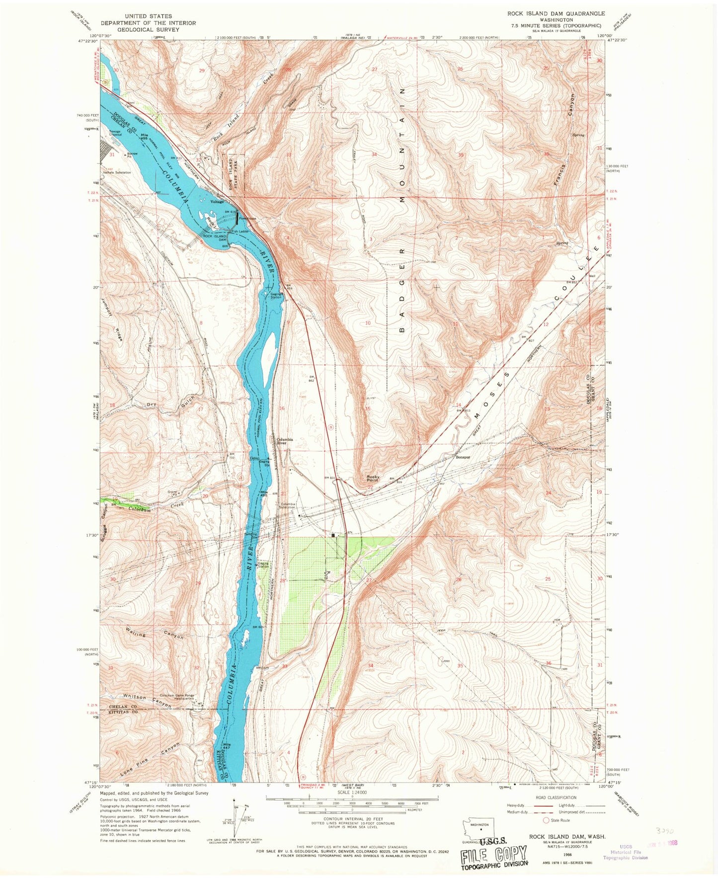
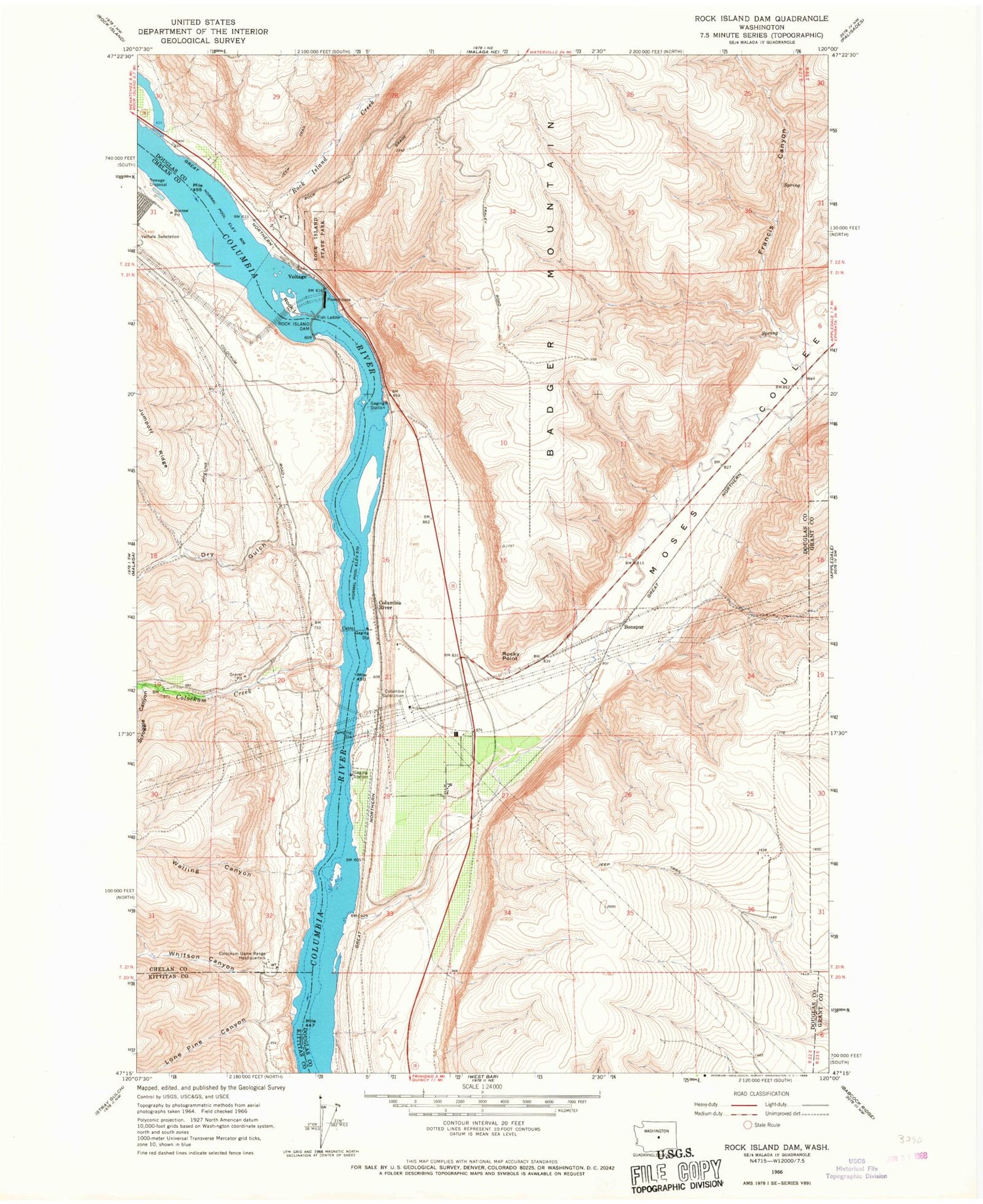
Historical USGS topographic quad map of Rock Island Dam in the state of Washington. Map scale may vary for some years, but is generally around 1:24,000. Print size is approximately 24" x 27"
This quadrangle is in the following counties: Chelan, Douglas, Grant, Kittitas.
The map contains contour lines, roads, rivers, towns, and lakes. Printed on high-quality waterproof paper with UV fade-resistant inks, and shipped rolled.
Contains the following named places: Bonspur, Cabinet Rapids, Colockum Creek, Colockum Game Range, Colockum Game Range Headquarters, Columbia River, Columbia Substation, Douglas Creek, Dry Gulch, Francis Canyon, Hammond Lake, Lone Pine Canyon, Lone Rock, Moses Coulee, Nixon Rapids, Rock Island, Rock Island Creek, Rock Island Dam, Rock Island State Park, Rocky Point, Scroggie Canyon, Voltage, Walling Canyon, Whitson Canyon, ZIP Code: 98850