MyTopo
Classic USGS Rock Lake Washington 7.5'x7.5' Topo Map
Regular price
$16.95
Regular price
Sale price
$16.95
Unit price
per
Couldn't load pickup availability
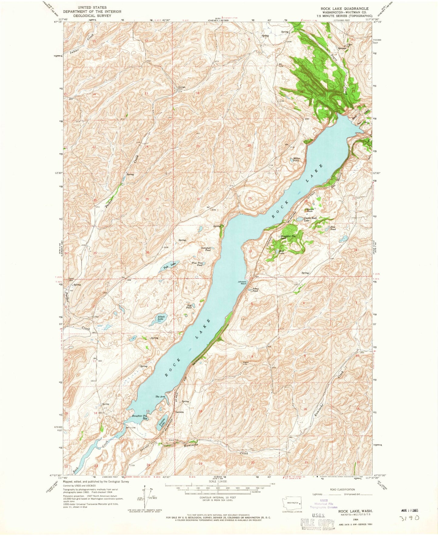
Historical USGS topographic quad map of Rock Lake in the state of Washington. Map scale may vary for some years, but is generally around 1:24,000. Print size is approximately 24" x 27"
This quadrangle is in the following counties: Whitman.
The map contains contour lines, roads, rivers, towns, and lakes. Printed on high-quality waterproof paper with UV fade-resistant inks, and shipped rolled.
Contains the following named places: Alkali Lake, Campbell Pond, Castle Rock, Castle Rock Lake, Egg Pond, Fire Pond, Johns Pond, Johnsons Beach, Lavista, Lavista Lake, Miller Pond, Mud Lake, Negro Creek, Pine Tree Pond, Rock Lake, Slaughter Pen Bay, Slaughter Pen Pond, The Arm, Tule Lake